


<< Our Photo Pages >> Pont Ddu - Stone Row / Alignment in Wales in Carmarthenshire
Submitted by vicky on Monday, 30 September 2002 Page Views: 6261
Neolithic and Bronze AgeSite Name: Pont DduCountry: Wales County: Carmarthenshire Type: Stone Row / Alignment
Map Ref: SN30791484 Landranger Map Number: 159
Latitude: 51.806522N Longitude: 4.455743W
Condition:
| 5 | Perfect |
| 4 | Almost Perfect |
| 3 | Reasonable but with some damage |
| 2 | Ruined but still recognisable as an ancient site |
| 1 | Pretty much destroyed, possibly visible as crop marks |
| 0 | No data. |
| -1 | Completely destroyed |
| 5 | Superb |
| 4 | Good |
| 3 | Ordinary |
| 2 | Not Good |
| 1 | Awful |
| 0 | No data. |
| 5 | Can be driven to, probably with disabled access |
| 4 | Short walk on a footpath |
| 3 | Requiring a bit more of a walk |
| 2 | A long walk |
| 1 | In the middle of nowhere, a nightmare to find |
| 0 | No data. |
| 5 | co-ordinates taken by GPS or official recorded co-ordinates |
| 4 | co-ordinates scaled from a detailed map |
| 3 | co-ordinates scaled from a bad map |
| 2 | co-ordinates of the nearest village |
| 1 | co-ordinates of the nearest town |
| 0 | no data |
Internal Links:
External Links:
")
You may be viewing yesterday's version of this page. To see the most up to date information please register for a free account.
")
")
Do not use the above information on other web sites or publications without permission of the contributor.
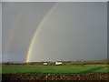
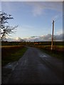
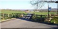
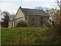
Nearby Images from Geograph Britain and Ireland:
©2008(licence)
©2008(licence)
©2008(licence)
©2008(licence)
©2009(licence)
The above images may not be of the site on this page, they are loaded from Geograph.
Please Submit an Image of this site or go out and take one for us!
Click here to see more info for this site
Nearby sites
Key: Red: member's photo, Blue: 3rd party photo, Yellow: other image, Green: no photo - please go there and take one, Grey: site destroyed
Download sites to:
KML (Google Earth)
GPX (GPS waypoints)
CSV (Garmin/Navman)
CSV (Excel)
To unlock full downloads you need to sign up as a Contributory Member. Otherwise downloads are limited to 50 sites.
![]()
Turn off the page maps and other distractions
Nearby sites listing. In the following links * = Image available
934m SSE 152° Gors Llangynog* Standing Stones (SN312140)
1.1km SE 141° Meini Llwydion, Llangynog* Standing Stones (SN3145513969)
3.3km NE 55° Bryn Cywyn* Ancient Village or Settlement (SN33551660)
3.3km ENE 64° Twlc y Filiast* Chambered Tomb (SN33811618)
3.4km WNW 286° Eithin Fach Mound* Round Barrow(s) (SN27521589)
3.9km S 187° St Martin's Church (Laugharne)* Ancient Cross (SN302110)
4.4km SSW 213° Llandawke Inscribed Stone* Early Christian Sculptured Stone (SN2827111214)
4.4km ESE 116° Maen Melyn, Llanybri* Standing Stone (Menhir) (SN34711279)
5.2km W 268° Llanddowror Standing stone* Standing Stone (Menhir) (SN25621487)
5.2km W 265° Cross Stones, Llanddowror* Early Christian Sculptured Stone (SN25531458)
5.6km SE 136° Fron Ucha* Chambered Tomb (SN3455510744)
5.6km SE 128° Waun y Felin Burial Chamber or Dolmen (SN351113)
5.7km SW 220° Holy Stones Llansadurnan Sculptured Stone
6.1km W 262° Vaynor Farm Henge* Henge (SN24701417)
6.2km SSW 200° Coygan Cave Cave or Rock Shelter (SN28480913)
6.2km N 0° Pen-Y-Gaer (Meidrim) Hillfort (SN31002102)
6.2km SE 140° St Anthony's Well (Llansteffan)* Holy Well or Sacred Spring (SN34600993)
6.3km SE 127° Maen Llwyd, St Ishmail* Standing Stone (Menhir) (SN3569610910)
6.4km SE 135° Llansteffan Castle* Hillfort (SN352102)
6.6km WSW 250° Castell Pen-Y-Coed Hillfort (SN24531278)
6.9km E 84° Meini Llwydion* Chambered Tomb (SN37721534)
7.0km WNW 303° Withybush Timber Circle (SN250188)
7.2km E 79° Myrddin's Quoits* Chambered Tomb (SN37911598)
7.5km E 91° Maenau Llwydion, Llangain* Standing Stones (SN38311450)
7.9km E 88° Quoit Stone, Parc-y-maen llwyd* Standing Stone (Menhir) (SN38691485)
View more nearby sites and additional images


 We would like to know more about this location. Please feel free to add a brief description and any relevant information in your own language.
 Wir möchten mehr über diese Stätte erfahren. Bitte zögern Sie nicht, eine kurze Beschreibung und relevante Informationen in Deutsch hinzuzufügen.
 Nous aimerions en savoir encore un peu sur les lieux. S'il vous plaît n'hesitez pas à ajouter une courte description et tous les renseignements pertinents dans votre propre langue.
 Quisieramos informarnos un poco más de las lugares. No dude en añadir una breve descripción y otros datos relevantes en su propio idioma.