


<< Our Photo Pages >> Mehatzeko Bizkarra Menhir - Standing Stone (Menhir) in Spain in Navarra
Submitted by irundarra on Thursday, 24 July 2008 Page Views: 2546
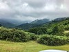
Neolithic and Bronze AgeSite Name: Mehatzeko Bizkarra Menhir Alternative Name: Mehatzeko Bizkarra, Meatseko, ArtzamendiCountry: Spain Region: Navarra Type: Standing Stone (Menhir)
Latitude: 43.272395N Longitude: 1.412045W
Condition:
| 5 | Perfect |
| 4 | Almost Perfect |
| 3 | Reasonable but with some damage |
| 2 | Ruined but still recognisable as an ancient site |
| 1 | Pretty much destroyed, possibly visible as crop marks |
| 0 | No data. |
| -1 | Completely destroyed |
| 5 | Superb |
| 4 | Good |
| 3 | Ordinary |
| 2 | Not Good |
| 1 | Awful |
| 0 | No data. |
| 5 | Can be driven to, probably with disabled access |
| 4 | Short walk on a footpath |
| 3 | Requiring a bit more of a walk |
| 2 | A long walk |
| 1 | In the middle of nowhere, a nightmare to find |
| 0 | No data. |
| 5 | co-ordinates taken by GPS or official recorded co-ordinates |
| 4 | co-ordinates scaled from a detailed map |
| 3 | co-ordinates scaled from a bad map |
| 2 | co-ordinates of the nearest village |
| 1 | co-ordinates of the nearest town |
| 0 | no data |
Internal Links:
External Links:
")
You may be viewing yesterday's version of this page. To see the most up to date information please register for a free account.
Do not use the above information on other web sites or publications without permission of the contributor.
Nearby Images from Flickr

The above images may not be of the site on this page, but were taken nearby. They are loaded from Flickr so please click on them for image credits.
Click here to see more info for this site
Nearby sites
Click here to view sites on an interactive map of the areaKey: Red: member's photo, Blue: 3rd party photo, Yellow: other image, Green: no photo - please go there and take one, Grey: site destroyed
Download sites to:
KML (Google Earth)
GPX (GPS waypoints)
CSV (Garmin/Navman)
CSV (Excel)
To unlock full downloads you need to sign up as a Contributory Member. Otherwise downloads are limited to 50 sites.
Turn off the page maps and other distractions
Nearby sites listing. In the following links * = Image available
109m NNW 340° Meatseko Bizkarra Menhir 2* Standing Stone (Menhir)
151m NW 324° Mehatzeko Bizkarra Cromlechs 1-5* Stone Circle
353m W 281° Meatseko Lepoa Cromlechs* Stone Circle
367m W 279° Mehatseko Lepoa Dolmen* Burial Chamber or Dolmen
463m S 189° Iguzki Illán Túmulo Round Barrow(s)
562m WSW 247° Iguzki Ipar Cromlech Stone Circle
624m NE 56° Zelai Dolmen Burial Chamber or Dolmen
666m ENE 62° Zelai Cista Cist
761m WSW 240° Iguzkiko Tontorra Dolmen Burial Chamber or Dolmen
771m WSW 242° Iguzkiko Tontorra Cromlechs 1+2 Stone Circle
787m NE 40° Mendittipiko Bizkarra Menhir* Standing Stone (Menhir)
829m NE 38° Mendittipiko Bizkarra Cromlech* Stone Circle
850m NE 50° Zelai Cromlech* Stone Circle
879m NE 54° Zelai Menhir* Standing Stone (Menhir)
1.1km SW 222° Iguzki Cromlechs Hegoalde 1-3 Stone Circle
1.3km WSW 253° Iguzki Menhir Standing Stone (Menhir)
1.5km WSW 258° Iguzki Mendebalde Cromlech Stone Circle
1.5km WSW 242° Iguzki Mendebalde Dolmen* Burial Chamber or Dolmen
1.5km WSW 257° Iguzki Mendebalde Tumulus Round Barrow(s)
1.6km WSW 250° Iguzkiko Lepoa Menhir Standing Stone (Menhir)
1.8km NE 52° Artzamendi Dolmen* Burial Chamber or Dolmen
2.0km NNE 30° Arluxeta Hego Cromlech Stone Circle
2.3km NNE 30° Arluxeta Chromlechs* Stone Circle
2.4km NNE 24° Arluxeta Barrow Cemetery Barrow Cemetery
2.6km NE 47° Eiheraldea Cromlech 1 Stone Circle
View more nearby sites and additional images


 We would like to know more about this location. Please feel free to add a brief description and any relevant information in your own language.
 Wir möchten mehr über diese Stätte erfahren. Bitte zögern Sie nicht, eine kurze Beschreibung und relevante Informationen in Deutsch hinzuzufügen.
 Nous aimerions en savoir encore un peu sur les lieux. S'il vous plaît n'hesitez pas à ajouter une courte description et tous les renseignements pertinents dans votre propre langue.
 Quisieramos informarnos un poco más de las lugares. No dude en añadir una breve descripción y otros datos relevantes en su propio idioma.