


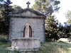
<< Our Photo Pages >> Alaric Dolmen - Burial Chamber or Dolmen in France in Languedoc:Aude (11)
Submitted by richardfrance on Friday, 25 January 2008 Page Views: 5059
Neolithic and Bronze AgeSite Name: Alaric DolmenCountry: France Département: Languedoc:Aude (11) Type: Burial Chamber or Dolmen
Nearest Town: Carcassonne Nearest Village: Moux
Latitude: 43.162500N Longitude: 2.634400E
Condition:
| 5 | Perfect |
| 4 | Almost Perfect |
| 3 | Reasonable but with some damage |
| 2 | Ruined but still recognisable as an ancient site |
| 1 | Pretty much destroyed, possibly visible as crop marks |
| 0 | No data. |
| -1 | Completely destroyed |
| 5 | Superb |
| 4 | Good |
| 3 | Ordinary |
| 2 | Not Good |
| 1 | Awful |
| 0 | No data. |
| 5 | Can be driven to, probably with disabled access |
| 4 | Short walk on a footpath |
| 3 | Requiring a bit more of a walk |
| 2 | A long walk |
| 1 | In the middle of nowhere, a nightmare to find |
| 0 | No data. |
| 5 | co-ordinates taken by GPS or official recorded co-ordinates |
| 4 | co-ordinates scaled from a detailed map |
| 3 | co-ordinates scaled from a bad map |
| 2 | co-ordinates of the nearest village |
| 1 | co-ordinates of the nearest town |
| 0 | no data |
Internal Links:
External Links:
")
The dolmen appears in no maps, nor in any publication that I have found so far. I am now a member of SESA. ( www.sesa-aude.com ) and have spent some hours searching the library, but as it is a voluntary organisation with no inter-library-loan facility and few funds, it is dependent on the generosity of its learned and illustrious members to provide copies of academic articles. The full account of this excavation is out there I am sure - but France as a whole has been slow to embrace the internet, and none more than the academic world, who demand E30 for access to such articles as have been digitized. Thus there is little to go on, apart from my interviews with Régis, and his file of memorabilia, which includes a photo of the excavation team including Jean Guilaine, and his copy of an issue of Cahiers Ligures (Ligurian Notebooks), an in-house SESA publication, in which I believe an account of the find is made. He is reluctant to part with these, but has assured me he will make copies this week.
I have set this down at length not only because this is a 'new' site - but also to draw attention to the problems encountered in this corner of France, when searching for the vestiges of protohistory. For more: see my blog www.dolmen.wordpress.com - its title is Dolmens Lost and Found.
You may be viewing yesterday's version of this page. To see the most up to date information please register for a free account.
")
")
")
")
Do not use the above information on other web sites or publications without permission of the contributor.
Nearby Images from Flickr
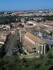
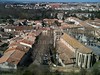
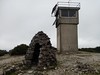
The above images may not be of the site on this page, but were taken nearby. They are loaded from Flickr so please click on them for image credits.
Click here to see more info for this site
Nearby sites
Click here to view sites on an interactive map of the areaKey: Red: member's photo, Blue: 3rd party photo, Yellow: other image, Green: no photo - please go there and take one, Grey: site destroyed
Download sites to:
KML (Google Earth)
GPX (GPS waypoints)
CSV (Garmin/Navman)
CSV (Excel)
To unlock full downloads you need to sign up as a Contributory Member. Otherwise downloads are limited to 50 sites.
Turn off the page maps and other distractions
Nearby sites listing. In the following links * = Image available
64m SSW 210° Camp Rolland* Hillfort
126m W 271° Dolmen du Roc Gris Burial Chamber or Dolmen
6.0km NE 55° Dolmen de Montbrun-des-Corbières Burial Chamber or Dolmen
8.5km NE 36° Allée Couverte d'Escales Passage Grave
9.4km SSE 166° Tournissan burial chamber Burial Chamber or Dolmen
9.5km SSE 162° La Pierre de Charlemagne Standing Stone (Menhir)
9.5km S 176° La Pèira Dreta (Tournissan)* Standing Stone (Menhir)
10.3km S 176° La Coumette* Standing Stone (Menhir)
11.8km SW 223° Menhir de la Pierre Droite (Rieux-en-Val)* Standing Stone (Menhir)
12.1km W 275° Les Bénitiers Rock Outcrop
12.3km NE 35° Tourouzelle burial chamber Burial Chamber or Dolmen
12.7km WNW 287° Le Mourral Millegrand* Hillfort
13.4km SSW 192° St-Pierre-des-Champs burial chamber Burial Chamber or Dolmen
13.9km S 177° Peira Dreta de Talairan Standing Stone (Menhir)
14.4km NE 43° Mourrel Ferrat oppidum* Hillfort
15.1km W 270° Dolmen de la Madeleine d’Albesse* Burial Chamber or Dolmen
15.4km NNE 12° Morrel das Fadas replica* Modern Stone Circle etc
15.6km NNE 29° Oppidum protohistorique Ancient Village or Settlement
16.9km SE 142° Dolmen de Bellongue Burial Chamber or Dolmen
17.1km NNE 12° Morrel das Fadas* Passage Grave
17.4km NNW 330° Allée Couverte de Saint-Eugène* Passage Grave
17.4km NE 44° La Pierre Plantee (Oupia)* Standing Stone (Menhir)
17.6km WNW 296° Bouilhonnac burial chamber Burial Chamber or Dolmen
17.8km SE 136° Fontjoncouse 3 burial chamber Burial Chamber or Dolmen
18.4km NW 316° Villarlong burial chamber Burial Chamber or Dolmen
View more nearby sites and additional images


 We would like to know more about this location. Please feel free to add a brief description and any relevant information in your own language.
 Wir möchten mehr über diese Stätte erfahren. Bitte zögern Sie nicht, eine kurze Beschreibung und relevante Informationen in Deutsch hinzuzufügen.
 Nous aimerions en savoir encore un peu sur les lieux. S'il vous plaît n'hesitez pas à ajouter une courte description et tous les renseignements pertinents dans votre propre langue.
 Quisieramos informarnos un poco más de las lugares. No dude en añadir una breve descripción y otros datos relevantes en su propio idioma.