


<< Our Photo Pages >> Ballymore Lower - Chambered Tomb in Ireland (Republic of) in Co. Donegal
Submitted by twentytrees on Thursday, 11 October 2007 Page Views: 4859
Neolithic and Bronze AgeSite Name: Ballymore LowerCountry: Ireland (Republic of) County: Co. Donegal Type: Chambered Tomb
Nearest Town: Letterkenny Nearest Village: Creeslough
Map Ref: C039345
Latitude: 55.157654N Longitude: 7.939572W
Condition:
| 5 | Perfect |
| 4 | Almost Perfect |
| 3 | Reasonable but with some damage |
| 2 | Ruined but still recognisable as an ancient site |
| 1 | Pretty much destroyed, possibly visible as crop marks |
| 0 | No data. |
| -1 | Completely destroyed |
| 5 | Superb |
| 4 | Good |
| 3 | Ordinary |
| 2 | Not Good |
| 1 | Awful |
| 0 | No data. |
| 5 | Can be driven to, probably with disabled access |
| 4 | Short walk on a footpath |
| 3 | Requiring a bit more of a walk |
| 2 | A long walk |
| 1 | In the middle of nowhere, a nightmare to find |
| 0 | No data. |
| 5 | co-ordinates taken by GPS or official recorded co-ordinates |
| 4 | co-ordinates scaled from a detailed map |
| 3 | co-ordinates scaled from a bad map |
| 2 | co-ordinates of the nearest village |
| 1 | co-ordinates of the nearest town |
| 0 | no data |
Internal Links:
External Links:
")
Two large slabs remain. Close to the school and church, and a large silage bale which, fortunately, won't be there for long. The views are long, into the broad valley of the Derryart River, and further to the Muckish Mountains.
For anyone who visits I recommend the Muck n' Muffin cafe in Dunfanaghy a few miles around the coast.
There are further stones in a field one hundred yards down the hill which are worth a look although not marked on the map.
You may be viewing yesterday's version of this page. To see the most up to date information please register for a free account.
")
")
Do not use the above information on other web sites or publications without permission of the contributor.
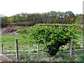
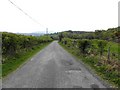
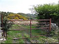
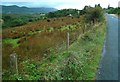
Nearby Images from Geograph Britain and Ireland:

©2011(licence)
©2011(licence)
©2011(licence)
©2011(licence)
©2009(licence)
The above images may not be of the site on this page, they are loaded from Geograph.
Please Submit an Image of this site or go out and take one for us!
Click here to see more info for this site
Nearby sites
Click here to view sites on an interactive map of the areaKey: Red: member's photo, Blue: 3rd party photo, Yellow: other image, Green: no photo - please go there and take one, Grey: site destroyed
Download sites to:
KML (Google Earth)
GPX (GPS waypoints)
CSV (Garmin/Navman)
CSV (Excel)
To unlock full downloads you need to sign up as a Contributory Member. Otherwise downloads are limited to 50 sites.
Turn off the page maps and other distractions
Nearby sites listing. In the following links * = Image available
100m S 180° Knocknafaugher Stone Row / Alignment (C039344)
3.4km W 275° Greenhill Donegal * Chambered Tomb (C005348)
4.8km NNW 334° Muntermellan* Portal Tomb (C0180138771)
7.6km SE 127° Carlan Upper Stone Row / Alignment (C100300)
9.7km ENE 58° Mevagh Rock Art* Rock Art (C121397)
11.6km SE 135° Barnes Lower NE Row Stone Row / Alignment (C122263)
12.2km SE 146° Barnes Lower Standing Stones* Standing Stones (C1077024449)
13.5km ESE 102° Carmoney* Chambered Tomb (C172318)
15.0km SE 127° Drumard* Chambered Tomb (C159255)
15.2km ENE 57° Cashel Glebe unclassified tomb* Burial Chamber or Dolmen (C16744274)
16.7km S 175° St. Colmcille's Stone* Wedge Tomb (C0535617857)
16.9km ENE 58° Ballyhiernan standing stone* Standing Stone (Menhir) (C18254350)
17.3km SE 130° Portleon Stone Row / Alignment (C172233)
18.3km ESE 103° Gortnavern* Portal Tomb (C218304)
21.9km NE 56° O'Donnell's stones* Marker Stone (C22084687)
21.9km WNW 303° Tory Island Ancient Cross (B854464)
24.1km ESE 116° Ballykenny Stone Circle (C257240)
24.2km E 93° Killycolman Stone Row / Alignment (C282334)
25.5km WSW 241° Cnoc a' Stolaire 1* Standing Stone (Menhir)
30.0km ESE 111° Carnaghan Portal Tomb (C320237)
30.5km ESE 104° St Mura's Cross (Fahan)* Early Christian Sculptured Stone (C3360426970)
31.8km SE 141° Labbadish Stone Row / Alignment (C238096)
33.5km S 177° Moonbeg* Chambered Tomb (C059010)
35.1km SSE 164° Magherayall* Chambered Tomb (C134007)
35.5km ENE 71° Clonmany Souterrain Souterrain (Fogou, Earth House)
View more nearby sites and additional images


 We would like to know more about this location. Please feel free to add a brief description and any relevant information in your own language.
 Wir möchten mehr über diese Stätte erfahren. Bitte zögern Sie nicht, eine kurze Beschreibung und relevante Informationen in Deutsch hinzuzufügen.
 Nous aimerions en savoir encore un peu sur les lieux. S'il vous plaît n'hesitez pas à ajouter une courte description et tous les renseignements pertinents dans votre propre langue.
 Quisieramos informarnos un poco más de las lugares. No dude en añadir una breve descripción y otros datos relevantes en su propio idioma.