


<< Our Photo Pages >> Bin Tepe Tumuli - Round Barrow(s) in Turkey
Submitted by AlexHunger on Tuesday, 27 March 2007 Page Views: 8960
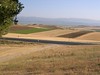
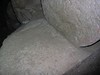
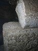
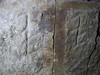
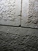
Neolithic and Bronze AgeSite Name: Bin Tepe Tumuli Alternative Name: Thousand HillsCountry: Turkey Type: Round Barrow(s)
Nearest Town: Manisa Nearest Village: Salihli
Latitude: 38.572465N Longitude: 28.007768E
Condition:
| 5 | Perfect |
| 4 | Almost Perfect |
| 3 | Reasonable but with some damage |
| 2 | Ruined but still recognisable as an ancient site |
| 1 | Pretty much destroyed, possibly visible as crop marks |
| 0 | No data. |
| -1 | Completely destroyed |
| 5 | Superb |
| 4 | Good |
| 3 | Ordinary |
| 2 | Not Good |
| 1 | Awful |
| 0 | No data. |
| 5 | Can be driven to, probably with disabled access |
| 4 | Short walk on a footpath |
| 3 | Requiring a bit more of a walk |
| 2 | A long walk |
| 1 | In the middle of nowhere, a nightmare to find |
| 0 | No data. |
| 5 | co-ordinates taken by GPS or official recorded co-ordinates |
| 4 | co-ordinates scaled from a detailed map |
| 3 | co-ordinates scaled from a bad map |
| 2 | co-ordinates of the nearest village |
| 1 | co-ordinates of the nearest town |
| 0 | no data |
Internal Links:
External Links:
I have visited· I would like to visit
davidmorgan has visited here
")
You may be viewing yesterday's version of this page. To see the most up to date information please register for a free account.
")
Do not use the above information on other web sites or publications without permission of the contributor.
Nearby Images from Flickr
The above images may not be of the site on this page, but were taken nearby. They are loaded from Flickr so please click on them for image credits.
Click here to see more info for this site
Nearby sites
Click here to view sites on an interactive map of the areaKey: Red: member's photo, Blue: 3rd party photo, Yellow: other image, Green: no photo - please go there and take one, Grey: site destroyed
Download sites to:
KML (Google Earth)
GPX (GPS waypoints)
CSV (Garmin/Navman)
CSV (Excel)
To unlock full downloads you need to sign up as a Contributory Member. Otherwise downloads are limited to 50 sites.
Turn off the page maps and other distractions
Nearby sites listing. In the following links * = Image available
3.3km E 90° Alyattes Tomb* Round Barrow(s)
8.8km NW 310° Kaymakci Hill Ancient Village or Settlement
9.7km SSE 164° Sardis* Ancient Village or Settlement
10.6km S 169° Sardis Temple of Artemis* Ancient Temple
28.4km NNW 341° Kulaksizlar* Ancient Mine, Quarry or other Industry
41.4km NNW 339° Thyateira* Ancient Village or Settlement
42.8km W 272° Yarik Kaya Rock Carvings Rock Art
43.7km W 273° Yarik Kaya Rock Cut Tomb* Rock Cut Tomb
44.2km W 274° Manisa Kybele Rock Relief Rock Art
51.6km ESE 120° Gavurtepe Ancient Village or Settlement
53.0km WSW 245° Karabel Rock Relief* Carving
70.6km WSW 258° Yesilova Tumulus* Round Barrow(s)
70.6km W 259° Yassitepe* Ancient Village or Settlement
73.8km W 261° Bayrakli Ancient Village or Settlement
75.4km S 171° Nysa* Ancient Village or Settlement
75.6km S 173° Acharaca Ancient Village or Settlement
76.6km WNW 292° Aigai.* Ancient Village or Settlement
77.5km WSW 258° Smyrna Agora* Ancient Village or Settlement
77.7km SW 230° Metropolis* Ancient Village or Settlement
77.7km SW 217° Belevi Mausoleum* Chambered Tomb
77.7km SW 217° Belevi tumulus* Chambered Tomb
78.6km WSW 257° Izmir Archaeological Museum* Museum
80.3km W 277° Neonteikhos* Ancient Village or Settlement
80.5km S 191° Tralleis Ancient Village or Settlement
81.7km S 189° Aydin Archaeological Museum* Museum
View more nearby sites and additional images


 We would like to know more about this location. Please feel free to add a brief description and any relevant information in your own language.
 Wir möchten mehr über diese Stätte erfahren. Bitte zögern Sie nicht, eine kurze Beschreibung und relevante Informationen in Deutsch hinzuzufügen.
 Nous aimerions en savoir encore un peu sur les lieux. S'il vous plaît n'hesitez pas à ajouter une courte description et tous les renseignements pertinents dans votre propre langue.
 Quisieramos informarnos un poco más de las lugares. No dude en añadir una breve descripción y otros datos relevantes en su propio idioma.