Featured: Ark of Secrets - Neolithic spirit alive in the Middle Ages

Ark of Secrets - Neolithic spirit alive in the Middle Ages

Random Image


Circle of Light

The Stone Circles of Britain, Ireland and Brittany, Aubrey Burl

The Stone Circles of Britain, Ireland and Brittany, Aubrey Burl

Who's Online

There are currently, 254 guests and 6 members online.

You are a guest. To join in, please register for free by clicking here

Sponsors

<< Our Photo Pages >> Windmill Tump - Long Barrow in England in Gloucestershire

Submitted by TheCaptain on Tuesday, 29 May 2012  Page Views: 15530

Neolithic and Bronze AgeSite Name: Windmill Tump Alternative Name: Rodmarton Long Barrow
Country: England County: Gloucestershire Type: Long Barrow
Nearest Town: Tetbury  Nearest Village: Rodmarton
Map Ref: ST93259731  Landranger Map Number: 163
Latitude: 51.674518N  Longitude: 2.099013W
Condition:
5Perfect
4Almost Perfect
3Reasonable but with some damage
2Ruined but still recognisable as an ancient site
1Pretty much destroyed, possibly visible as crop marks
0No data.
-1Completely destroyed
4 Ambience:
5Superb
4Good
3Ordinary
2Not Good
1Awful
0No data.
4 Access:
5Can be driven to, probably with disabled access
4Short walk on a footpath
3Requiring a bit more of a walk
2A long walk
1In the middle of nowhere, a nightmare to find
0No data.
4 Accuracy:
5co-ordinates taken by GPS or official recorded co-ordinates
4co-ordinates scaled from a detailed map
3co-ordinates scaled from a bad map
2co-ordinates of the nearest village
1co-ordinates of the nearest town
0no data
5

Internal Links:
External Links:

I have visited· I would like to visit

johnwhitehead would like to visit

paulinelen visited on 29th Feb 2012 - their rating: Cond: 3 Amb: 4 Access: 4 lovely in the February sunshine - beautifully kept site with good access.

4clydesdale7 visited on 27th May 2011 - their rating: Cond: 3 Amb: 4 Access: 3 Very tidy - almost too well manicured - quite peaceful

TheWhiteRider visited on 20th Jun 2010 - their rating: Cond: 3 Amb: 4 Access: 4

oldman TheCaptain hamish mdensham have visited here

Average ratings for this site from all visit loggers: Condition: 3 Ambience: 4 Access: 3.67

Windmill Tump
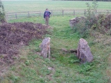
Windmill Tump submitted by TheCaptain : Rodmorton Longbarrow (Windmill Tump) viewed from the end of the footpath along the field edge, at the way into the barrow from the west, March 2009. (Vote or comment on this photo)
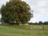
This lovely Long Barrow is found in a nicely fenced enclave within a cropping field about a mile to the southwest of the village of Rodmarton. For once, the fenced area is extended away from the barrow enough to allow a good look at it, and to leave the edges clear from the ploughed field.

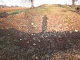
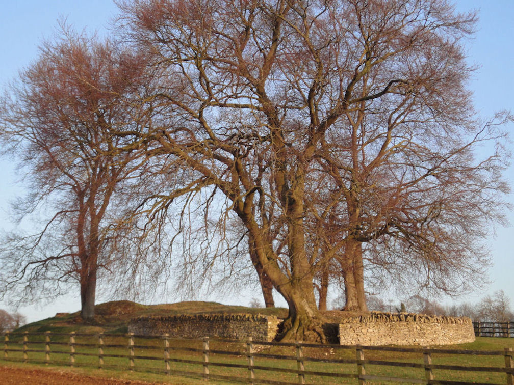
Much of the barrow has fairly modern walling surrounding it, particularly on the southern side and western end. The barrow is about 60 metres long and 20 metres wide, oriented approximately east to west, with its entrance forecourt and false portals facing east.

The false portal has its two sidestones standing in place, and also two smaller stones blocking the entrance. As well as the stone portal and forecourt, three chambers have been found by past excavations, two near the eastern end, one on the north, one on the south side, and also a further chamber on the norther side nearer to the western end.

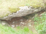
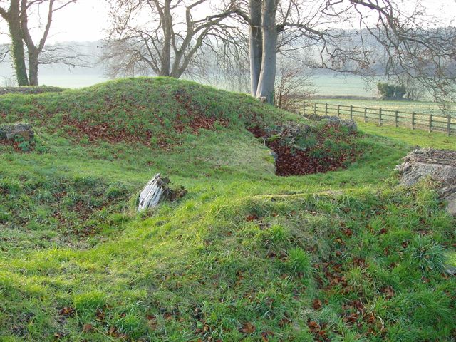
The north and south chambers are said to be unusual in that they are cut below the natural ground level with steps down into them in their passageways. They are/were slab lined and had a sort of port holed entrance into each chamber. However, these are not visible anymore, having been filled back in, but the position of these chambers is clear to be seen, in fact in the year 2009, the southern chamber coud be seen right into and indeed entered by a small person willing to wriggle in the leafy filling!

The western chamber was only found in 1987 after a big storm had brought down one of the large trees growing on the mound, its fallen roots opening up the chamber for all to see.

These days (as of May 2010) the top of the barrow has been cleared of the undergrowth and many of the large trees which used to grow on it. The surface is a very lumpy bumpy stony mess, with pits all over the surface, no doubt due to either antiquarian treasure hunters, or perhaps the holes made by fallen trees.

During past excavations, the northern chamber was found to contain the skeletons of ten adults and three children, whilst the southern chamber contained a jumble of many other individuals' bones.

In order to visit the barrow, a layby has been made beside the little lane which runs west from Rodmarton, and a signed footpath has been made from here along the western edge of the field to the barrow.

Note: Long Barrow damaged by vandals
You may be viewing yesterday's version of this page. To see the most up to date information please register for a free account.
Windmill Tump
Windmill Tump submitted by paulinelen : Beautiful in the low February sunshine, the bare trees and short scrubby grass enabled the true size and magnificence to be appreciated. (Vote or comment on this photo)

Windmill Tump
Windmill Tump submitted by jadewood : September 2007 (Vote or comment on this photo)

Windmill Tump
Windmill Tump submitted by TheCaptain : View towards where the southern chamber is. Rodmorton Longbarrow (Windmill Tump). 15 May 2010. (Vote or comment on this photo)

Windmill Tump
Windmill Tump submitted by TheCaptain : Approaching the tump along the signed path along the edge of the field on a cold March day 2009. (Vote or comment on this photo)

Windmill Tump
Windmill Tump submitted by oldlongdog : Dogs also welcome!

Windmill Tump
Windmill Tump submitted by paulinelen : This shows the many lumps and bumps that can be seen, lovely in the February sunshine.

Windmill Tump
Windmill Tump submitted by jadewood : September 2007

Windmill Tump
Windmill Tump submitted by jadewood (1 comment)

Windmill Tump
Windmill Tump submitted by jadewood

Windmill Tump
Windmill Tump submitted by jadewood

Windmill Tump
Windmill Tump submitted by TheCaptain : Rodmorton Longbarrow (Windmill Tump) viewed from the southwest. 15 May 2010.

Windmill Tump
Windmill Tump submitted by TheCaptain : Rodmorton Longbarrow (Windmill Tump) seen in its neatly fenced enclosure from the western end. 15 May 2010.

Windmill Tump
Windmill Tump submitted by TheCaptain : Rodmorton Longbarrow (Windmill Tump) viewed from the western end. 15 May 2010.

Windmill Tump
Windmill Tump submitted by TheCaptain : Looking east through the entrance portal stones of Rodmorton Longbarrow (Windmill Tump). No signs of any capstone/blocking stone these days. 15 May 2010.

Windmill Tump
Windmill Tump submitted by TheCaptain : View northwest from the top of Rodmorton Longbarrow (Windmill Tump) with what I believe is the depression of the fairly recently discovered western passage and chamber. 15 May 2010.

Windmill Tump
Windmill Tump submitted by TheCaptain : View eastwards along the top of the barrow. Unfortunately this newly tidied longbarrow, with much less woodland cover, is no longer much of a place for bluebells to grow, and I was disappointed to find most of the barrow green, and not blue! But there were a few patches still.

Windmill Tump
Windmill Tump submitted by TheCaptain : Rodmorton Longbarrow (Windmill Tump) viewed from the southwest, March 2009.

Windmill Tump
Windmill Tump submitted by TheCaptain : Inside the northern chamber, March 2009.

Windmill Tump
Windmill Tump submitted by TheCaptain : Looking into the northern chamber, March 2009.

Windmill Tump
Windmill Tump submitted by oldlongdog : Nice winter's day...!

Windmill Tump
Windmill Tump submitted by Humbucker : Rodmarton from the North. Lovely location & never anyone here when I've visited, except me & my mate.

Windmill Tump
Windmill Tump submitted by Humbucker : Rodmarton Longbarrow looking roughly from the Southwest. Excavation depressions & fallen tree pits showing across the surface.

Windmill Tump
Windmill Tump submitted by Humbucker : Rodmarton Longbarrow looking from the East. Forecourt & false portal visible without the summer grass.

Windmill Tump
Windmill Tump submitted by Bladup : Windmill Tump.

These are just the first 25 photos of Windmill Tump. If you log in with a free user account you will be able to see our entire collection.

Do not use the above information on other web sites or publications without permission of the contributor.
Click here to see more info for this site

Nearby sites

Click here to view sites on an interactive OS map

Key: Red: member's photo, Blue: 3rd party photo, Yellow: other image, Green: no photo - please go there and take one, Grey: site destroyed

Download sites to:
KML (Google Earth)
GPX (GPS waypoints)
CSV (Garmin/Navman)
CSV (Excel)

To unlock full downloads you need to sign up as a Contributory Member. Otherwise downloads are limited to 50 sites.


Turn off the page maps and other distractions

Nearby sites listing. In the following links * = Image available
 424m NW 313° Hasleden Barrow* Round Barrow(s) (ST92949760)
 2.2km E 88° Haresdown Barrow* Round Barrow(s) (ST95489737)
 2.8km WSW 237° Warren Tump (Gloucestershire)* Round Barrow(s) (ST90889577)
 3.8km W 278° Barrow Tumps* Long Barrow (ST89519783)
 4.3km SW 228° Tetbury Bowl Barrow* Round Barrow(s) (ST90039441)
 4.4km WNW 284° Norn's Tump* Chambered Tomb (ST88949839)
 4.6km SW 223° Worswell* Holy Well or Sacred Spring (ST90149395)
 5.3km NNE 22° Cassey Well* Holy Well or Sacred Spring (SO952022)
 5.3km WNW 288° The Tingle Stone* Long Barrow (ST88239899)
 5.4km SW 228° Magdalen Mead Well* Holy Well or Sacred Spring (ST89269371)
 5.4km WNW 296° Gatcombe Lodge* Long Barrow (ST88399972)
 5.4km ENE 63° Trewsbury Camp* Hillfort (ST98109980)
 5.4km W 281° Avening burial chambers* Burial Chamber or Dolmen (ST87899837)
 5.5km WNW 303° Crackstone Long Barrow* Long Barrow (SO88650030)
 5.5km ENE 72° King Athelstans Mounting Stone* Marker Stone (ST98549899)
 5.5km WNW 298° Long Stone (Minchinhampton)* Standing Stones (ST88359992)
 5.8km NW 314° Hyde Tumulus 2* Round Barrow(s) (SO89070130)
 5.8km ENE 78° Lyd Well (Kemble) Holy Well or Sacred Spring (ST98969847)
 5.9km NW 315° Hyde Tumulus 1* Round Barrow(s) (SO89060149)
 6.0km NNW 341° Ashmead Well* Holy Well or Sacred Spring (SO91270301)
 6.0km SW 224° Magdalen's spring* Holy Well or Sacred Spring (ST890930)
 6.3km WSW 258° Chavenage Sleight Round Barrows* Round Barrow(s) (ST87089601)
 6.4km WNW 296° Bubblewell* Standing Stone (Menhir) (SO875001)
 6.5km N 352° Litteridge Cross* Ancient Cross (SO92350373)
 6.6km W 279° The Oven* Round Barrow(s) (ST86769832)
View more nearby sites and additional images

<< Domu Beccia Nuraghe

Norton Wood Bowl Barrow >>

Please add your thoughts on this site

Long Barrows of the Cotswolds, Darvill

Long Barrows of the Cotswolds, Darvill

Sponsors

Auto-Translation (Google)

Translate from English into:

"Windmill Tump" | Login/Create an Account | 8 News and Comments
  
Go back to top of page    Comments are owned by the poster. We aren't responsible for their content.
Re: Windmill Tump by Zooks777 on Sunday, 15 August 2021
(User Info | Send a Message)
Clear E-W feature, facing E on the Environment Agency lidar (grey icon next to that for CamRA) but obviously very disturbed by excavators and tree-fall
[ Reply to This ]

Vandals who wrecked historic monument condemned by neolithique02 on Tuesday, 29 May 2012
(User Info | Send a Message)
A FORMER District Councillor has condemned drunken revellers who damaged a historic monument.

Former Tetbury mayor and Cotswold District Councillor Peter Martin, 50, discovered the damage to Windmill Tump – also known as Rodmarton Long Barrow – while out walking on Thursday May 10.

The damage to the Neolithic grave site which is more than 5,000-years-old, came just days after vandals pushed over graves at St Saviour’s church in Tetbury.

Mr Martin said he was shocked to find empty bottles and cans lying around as well as damage to the dry stone wall surrounding the monument.

"It’s very disrespectful," he said. "It’s a grave that’s been there for 5,000 years and it’s been destroyed in a drunken episode.

"Just because you can’t see that there’s anything buried there doesn’t mean you can go and vandalise the place. It’s unbelievable."

"It’s a grave that’s been there for 5,000 years and it’s been destroyed in a drunken episode"

Mr Martin added he was pleased officers from Gloucestershire County Council had already repaired a large amount of the damage to the site, which is owned by English Heritage.

"A lot of people don’t realise how rich this area is in archaeological remains," he said. "It’s as dense in remains as the area around Stonehenge.

"I hope whoever’s done it realises they’ve been caught and they shouldn’t do it again."

Police said they had seized of empty bottles and are appealing for any information to call them on 101, quoting incident number 270 of May 11.

Information can also be given anonymously to Crimestoppers on 0800 555 111 or via crimestoppers-uk.org

RODMARTON LONG BARROW FACT FILE - The site was built in the early Neolithic period, some time between 4000 and 3500 BC.

- There is evidence it was used well into the Roman period as coins and pottery dating from the reign of Emperor Claudius Gothicus (168-170 AD).

- It is around 60 meters long and 20 meters wide.

- There are at least three stone-lined burial chambers within the Long Barrow, within which animal bones and human remains have been found.

- Another chamber, along with the bones of a child, was discovered after a tree fell down at the site in the storms of 1987.

- It was excavated in the late 19th century, and again in 1939, when 13 skeletons and leaf-shaped arrowheads were found.

http://www.wiltsglosstandard.co.uk/news/9728058.Vandals_who_wrecked_historic_monument_condemned/
[ Reply to This ]
    Re: Vandals who wrecked historic monument condemned by 4clydesdale7 on Wednesday, 19 September 2012
    (User Info | Send a Message)
    Went on a 'flying visit' on 17/9/12 to this site - perhaps in my 'top 5' of sites in Gloucestershire - four months on from the above-mentioned incident and the Barrow seems to have recovered
    [ Reply to This ]
    Re: Vandals who wrecked historic monument condemned by oldlongdog on Wednesday, 16 October 2013
    (User Info | Send a Message)
    Wow, I didn't know someone had posted this! I'm very pleased to say that English Heritage and Glos County Council repaired the damaged walls very quickly and the Police - bless them - picked up all the rubbish!

    This is still one of my favourite places to visit at all times of the year and it was great to see it in the snow over the last couple of winters.
    [ Reply to This ]
    Re: Vandals who wrecked historic monument condemned by Anonymous on Monday, 04 June 2018
    I know this reply is years after the incident happened. But, as a practising research archaeologist stationed in Cirencester, this story is exaggerating a fair bit. Damage to the dry-stone wall is not damage to the monument. The dry-stone wall is there to protect the monument and was probably placed around 20 years ago. Whilst this is not okay, it is definitely not damage to the Barrow itself. And I disagree with there even being a dry-stone wall around the barrow. It interferes with interpretation of the long barrow and how it fits into the landscape. It is the same reason a road was not implemented closer to Stonehenge, it interferes with the landscape and can cause misconception within the public.

    Honestly the wall should just be taken down, as I adamantly disagree with any modern interference with monuments whether it be from bad or good intentions. The only time interference should be allowed is for research purposes and if a site is being used as a stress alleviation (Specific sites throughout the UK are developed and altered for use a tourist spots to make sure that more important nearby sites are not damaged) Stonehenge is again an example of this and is not the most important monument within the landscape, but is used to alleviate stress from other monuments. The Woodhenge nearby is more important historically.
    [ Reply to This ]

Re: Windmill Tump by TheCaptain on Sunday, 16 May 2010
(User Info | Send a Message)
Streetview

View Larger Map
[ Reply to This ]

Re: Windmill Tump by TheCaptain on Saturday, 15 May 2010
(User Info | Send a Message)
Despite the weather forecast, Saturday morning before the Cup Final was bright and sunny, so decided on a visit here, which I have been intending for a while now.

Having been to this barrow before in March and June, I saw that it would be covered in bluebells at the right time of year, so with that in mind, I visited this lovely barrow again today with the aim of getting some pictures of it in the sun all covered in bluebells.

Unfortunately, I was disappointed with what I found on the bluebell count, but I guess overall things have been changed for the better. I parked in the available lay-by, and took the signed park along the edge of the field, with a growing crop of broad beans this season. But as I walked towards the barrow, something looked different, which I soon figured to be some of the trees growing on the barrow have been chopped down and removed.

When I got to the barrow in its nicely fenced area, it was obvious that a lot of renovation work has been carried out, the fence mended where needed, the surrounding walls rebuilt where they had been tumbling, the edges of the previously untidy stony lump tidied up and re-turfed, lots of the old overgrowth cleared as well as many of the big old trees removed.

Unfortunately for me, this newly tidied longbarrow, with much less woodland cover, is no longer much of a place for bluebells to grow, and I was disappointed to find most of the barrow green, and not blue! But there were a few patches still including one lot in the entrance passage to the southeast chamber. There was also a few patches of other wildflowers, including some nice cowslips on the western part of the barrow.

From a megalithic stonehunters point of view, I think most of the recent changes have been good for this lovely longbarrow, with the exception of one thing. The previously open north-eastern chamber has been filled in with stones and earth, and the south-eastern chamber entrance also seems to have been partially filled in. I guess these are actually a good thing, as the chambers were becoming more and more open and decaying while they were open.
[ Reply to This ]

Re: Windmill Tump by oldlongdog on Tuesday, 05 January 2010
(User Info | Send a Message)
This is a site I regularly walk the dogs to! Also known as Rodmarton Longbarrow.

There is a signpost from the road, a notice board from English Heritage and the farmer seems to maintain access along the edge of the field and across his crops for the last 20 metres.

Well worth a, visit; very atmospheric and a beautiful place just to go and sit. There is a tumulus down in the valley just along the road to Cherington in a narrow strip of woods by the road. Interestingly, the tumulus and the longbarrow are aligned along the line of the midwinter sunrise and, extending it further to the northwest brings the line to a site marked on the map as The Devil's Churchyard... Nothing there now but there is some evidence that stones were removed in the 19th century by a local vicar, and two of these may be the Lammas Stones by the gate of Lammas House in Minchinhampton (where this vicar was said to live).
[ Reply to This ]

Your Name: Anonymous [ Register Now ]
Subject:


Add your comment or contribution to this page. Spam or offensive posts are deleted immediately, don't even bother

<<< What is five plus one as a number? (Please type the answer to this question in the little box on the left)
You can also embed videos and other things. For Youtube please copy and paste the 'embed code'.
For Google Street View please include Street View in the text.
Create a web link like this: <a href="https://www.megalithic.co.uk">This is a link</a>  

Allowed HTML is:
<p> <b> <i> <a> <img> <em> <br> <strong> <blockquote> <tt> <li> <ol> <ul> <object> <param> <embed> <iframe>

We would like to know more about this location. Please feel free to add a brief description and any relevant information in your own language.
Wir möchten mehr über diese Stätte erfahren. Bitte zögern Sie nicht, eine kurze Beschreibung und relevante Informationen in Deutsch hinzuzufügen.
Nous aimerions en savoir encore un peu sur les lieux. S'il vous plaît n'hesitez pas à ajouter une courte description et tous les renseignements pertinents dans votre propre langue.
Quisieramos informarnos un poco más de las lugares. No dude en añadir una breve descripción y otros datos relevantes en su propio idioma.