


<< Our Photo Pages >> Wadi Rum Massebah (1) - Cairn in Jordan
Submitted by Motist on Friday, 30 June 2006 Page Views: 4635
Neolithic and Bronze AgeSite Name: Wadi Rum Massebah (1)Country: Jordan Type: Cairn
Latitude: 29.558819N Longitude: 35.414873E
Condition:
| 5 | Perfect |
| 4 | Almost Perfect |
| 3 | Reasonable but with some damage |
| 2 | Ruined but still recognisable as an ancient site |
| 1 | Pretty much destroyed, possibly visible as crop marks |
| 0 | No data. |
| -1 | Completely destroyed |
| 5 | Superb |
| 4 | Good |
| 3 | Ordinary |
| 2 | Not Good |
| 1 | Awful |
| 0 | No data. |
| 5 | Can be driven to, probably with disabled access |
| 4 | Short walk on a footpath |
| 3 | Requiring a bit more of a walk |
| 2 | A long walk |
| 1 | In the middle of nowhere, a nightmare to find |
| 0 | No data. |
| 5 | co-ordinates taken by GPS or official recorded co-ordinates |
| 4 | co-ordinates scaled from a detailed map |
| 3 | co-ordinates scaled from a bad map |
| 2 | co-ordinates of the nearest village |
| 1 | co-ordinates of the nearest town |
| 0 | no data |
Be the first person to rate this site - see the 'Contribute!' box in the right hand menu.
Internal Links:
External Links:
 (PID:21375)")
Coordinates converted from old Israel datum: 189933 E, 885851 N.
You may be viewing yesterday's version of this page. To see the most up to date information please register for a free account.
 (PID:21423)")
 (PID:21422)")
 (PID:21389)")
Do not use the above information on other web sites or publications without permission of the contributor.
Nearby Images from Flickr
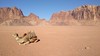
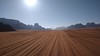
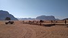
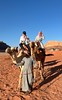
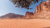
The above images may not be of the site on this page, but were taken nearby. They are loaded from Flickr so please click on them for image credits.
Click here to see more info for this site
Nearby sites
Click here to view sites on an interactive map of the areaKey: Red: member's photo, Blue: 3rd party photo, Yellow: other image, Green: no photo - please go there and take one, Grey: site destroyed
Download sites to:
KML (Google Earth)
GPX (GPS waypoints)
CSV (Garmin/Navman)
CSV (Excel)
To unlock full downloads you need to sign up as a Contributory Member. Otherwise downloads are limited to 50 sites.
Turn off the page maps and other distractions
Nearby sites listing. In the following links * = Image available
834m E 82° Wadi Rum Chambered Tomb* Chambered Tomb
1.1km ENE 67° Wadi Rum Ritual Structures* Ancient Temple
1.1km SW 216° Wadi Rum Masseboth* Standing Stones
1.1km SSE 149° Wadi Rum Massebah (2)* Burial Chamber or Dolmen
5.3km SSE 153° Wadi Kahkashea* Carving
5.3km SSE 153° Jabel Kashkash Statue* Sculptured Stone
13.9km SW 215° Wadi Rum Engravings* Carving
15.3km SW 231° Wadi Dhaika Engravings* Carving
20.7km SSW 198° Khirbet Rizqeh* Standing Stone (Menhir)
23.6km NNE 19° Wadi Rum Petroglyphs* Rock Art
44.2km W 277° Arround Shchoret hills* Ancient Village or Settlement
44.3km N 352° Humeima* Ancient Village or Settlement
44.7km W 278° Shchoret hills Open Air Mosque* Ancient Temple
44.9km W 277° Shehoret Hills Desert Kite* Misc. Earthwork
45.0km WNW 288° Nitsots hill open air sanctuary* Ancient Temple
45.3km W 274° Shahmon Desert Kite* Misc. Earthwork
45.6km W 278° Shchoret habitation site* Ancient Village or Settlement
45.8km WNW 283° Mt. 'Amram Tumulus* Burial Chamber or Dolmen
45.9km WNW 292° Beer-Ora N* Ancient Temple
46.4km WNW 291° E' of wadi Racham * Ancient Temple
47.7km W 277° Yedidyah pass Roded type cult site* Ancient Village or Settlement
47.8km W 275° Wadi Tawahin* Ancient Mine, Quarry or other Industry
48.2km W 276° Wadi Roded Open Air Sanctuaries* Ancient Temple
48.5km WNW 302° Sasgon valley* Standing Stones
48.6km WNW 286° Wadi Racham Matsebah* Standing Stones
View more nearby sites and additional images


 We would like to know more about this location. Please feel free to add a brief description and any relevant information in your own language.
 Wir möchten mehr über diese Stätte erfahren. Bitte zögern Sie nicht, eine kurze Beschreibung und relevante Informationen in Deutsch hinzuzufügen.
 Nous aimerions en savoir encore un peu sur les lieux. S'il vous plaît n'hesitez pas à ajouter une courte description et tous les renseignements pertinents dans votre propre langue.
 Quisieramos informarnos un poco más de las lugares. No dude en añadir una breve descripción y otros datos relevantes en su propio idioma.