

<< Our Photo Pages >> Timna Valley Slave Hill Massebah - Standing Stone (Menhir) in Israel
Submitted by AlexHunger on Wednesday, 14 June 2006 Page Views: 4788
Neolithic and Bronze AgeSite Name: Timna Valley Slave Hill MassebahCountry: Israel Type: Standing Stone (Menhir)
Nearest Town: Eilat Nearest Village: Timna Valley
Latitude: 29.772514N Longitude: 34.946118E
Condition:
| 5 | Perfect |
| 4 | Almost Perfect |
| 3 | Reasonable but with some damage |
| 2 | Ruined but still recognisable as an ancient site |
| 1 | Pretty much destroyed, possibly visible as crop marks |
| 0 | No data. |
| -1 | Completely destroyed |
| 5 | Superb |
| 4 | Good |
| 3 | Ordinary |
| 2 | Not Good |
| 1 | Awful |
| 0 | No data. |
| 5 | Can be driven to, probably with disabled access |
| 4 | Short walk on a footpath |
| 3 | Requiring a bit more of a walk |
| 2 | A long walk |
| 1 | In the middle of nowhere, a nightmare to find |
| 0 | No data. |
| 5 | co-ordinates taken by GPS or official recorded co-ordinates |
| 4 | co-ordinates scaled from a detailed map |
| 3 | co-ordinates scaled from a bad map |
| 2 | co-ordinates of the nearest village |
| 1 | co-ordinates of the nearest town |
| 0 | no data |
Internal Links:
External Links:
")
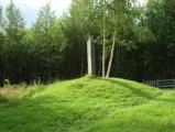
Standing stone, or massebah, at sites of ancient copper smelting.
You may be viewing yesterday's version of this page. To see the most up to date information please register for a free account.
Do not use the above information on other web sites or publications without permission of the contributor.
Nearby Images from Flickr
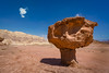

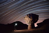
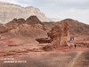
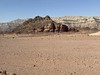
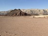
The above images may not be of the site on this page, but were taken nearby. They are loaded from Flickr so please click on them for image credits.
Click here to see more info for this site
Nearby sites
Click here to view sites on an interactive map of the areaKey: Red: member's photo, Blue: 3rd party photo, Yellow: other image, Green: no photo - please go there and take one, Grey: site destroyed
Download sites to:
KML (Google Earth)
GPX (GPS waypoints)
CSV (Garmin/Navman)
CSV (Excel)
To unlock full downloads you need to sign up as a Contributory Member. Otherwise downloads are limited to 50 sites.
Turn off the page maps and other distractions
Nearby sites listing. In the following links * = Image available
249m SE 131° Timna Valley Slave Hill Smelting Site* Ancient Village or Settlement
1.1km ESE 116° Timna Valley Temple of Hathor* Ancient Temple
1.4km N 11° Timna Valley Mushroom Site* Natural Stone / Erratic / Other Natural Feature
2.6km NNW 329° Timna Valley Copper Mines* Ancient Mine, Quarry or other Industry
4.5km ENE 66° Sasgon valley* Standing Stones
4.9km NE 45° Mount. Michrot* Ancient Temple
5.1km NE 39° N' W' Timna valley ancient copper industry* Ancient Mine, Quarry or other Industry
5.1km N 355° Timn'a cliffs Roded type open air sanctuaries* Ancient Temple
5.2km SSW 192° S' of wadi Gadna'a* Ancient Temple
6.1km NE 47° Ancient Copper Strip-mine north of Mt. Michrot* Ancient Mine, Quarry or other Industry
7.0km NW 307° North of Wadi Botem Massebah* Standing Stone (Menhir)
7.3km SSE 158° Beer-Ora N* Ancient Temple
7.3km WNW 290° Wadi Botem Predator's Trap* Ancient Village or Settlement
7.3km SSE 164° E' of wadi Racham * Ancient Temple
7.6km WNW 289° Wadi Botem Sites* Ancient Village or Settlement
7.6km WSW 245° Upper Wadi Eteq Masseboth* Standing Stones
8.5km NNW 337° Wadi Milhan Ancient Farm* Ancient Village or Settlement
8.7km SW 224° North Se'ipim Valley Predator Trap* Ancient Mine, Quarry or other Industry
8.8km SSW 199° Wadi 'Eteq Villas* Ancient Temple
8.9km S 189° S' of wadi 'Eteq* Ancient Temple
8.9km S 190° Flint workshop west of wadi Racham* Ancient Mine, Quarry or other Industry
9.0km SW 225° Se'ipim Valley North Predators Trap* Misc. Earthwork
9.3km NNW 331° North Sayarim Valley Tumulus* Barrow Cemetery
9.4km SSW 214° E' Se'ipim valley* Ancient Village or Settlement
9.7km WNW 285° Wadi Betamim Matseboth* Standing Stones
View more nearby sites and additional images


 We would like to know more about this location. Please feel free to add a brief description and any relevant information in your own language.
 Wir möchten mehr über diese Stätte erfahren. Bitte zögern Sie nicht, eine kurze Beschreibung und relevante Informationen in Deutsch hinzuzufügen.
 Nous aimerions en savoir encore un peu sur les lieux. S'il vous plaît n'hesitez pas à ajouter une courte description et tous les renseignements pertinents dans votre propre langue.
 Quisieramos informarnos un poco más de las lugares. No dude en añadir una breve descripción y otros datos relevantes en su propio idioma.