


<< Our Photo Pages >> Anta da Herdade da Candieira - Burial Chamber or Dolmen in Portugal in Évora
Submitted by AlexHunger on Tuesday, 30 May 2006 Page Views: 7806
Neolithic and Bronze AgeSite Name: Anta da Herdade da Candieira Alternative Name: Anta da Candeeira, Anta da SerraCountry: Portugal Distrito: Évora Type: Burial Chamber or Dolmen
Nearest Town: Redondo Nearest Village: Redondo
Latitude: 38.704158N Longitude: 7.553537W
Condition:
| 5 | Perfect |
| 4 | Almost Perfect |
| 3 | Reasonable but with some damage |
| 2 | Ruined but still recognisable as an ancient site |
| 1 | Pretty much destroyed, possibly visible as crop marks |
| 0 | No data. |
| -1 | Completely destroyed |
| 5 | Superb |
| 4 | Good |
| 3 | Ordinary |
| 2 | Not Good |
| 1 | Awful |
| 0 | No data. |
| 5 | Can be driven to, probably with disabled access |
| 4 | Short walk on a footpath |
| 3 | Requiring a bit more of a walk |
| 2 | A long walk |
| 1 | In the middle of nowhere, a nightmare to find |
| 0 | No data. |
| 5 | co-ordinates taken by GPS or official recorded co-ordinates |
| 4 | co-ordinates scaled from a detailed map |
| 3 | co-ordinates scaled from a bad map |
| 2 | co-ordinates of the nearest village |
| 1 | co-ordinates of the nearest town |
| 0 | no data |
Internal Links:
External Links:
I have visited· I would like to visit
BrunoG would like to visit
rrmoser visited on 12th Jun 2018 - their rating: Cond: 4 Amb: 5 Access: 4 Great site.
Bak_teria visited on 16th May 2015 - their rating: Cond: 5 Amb: 4 Access: 4
Average ratings for this site from all visit loggers: Condition: 4.5 Ambience: 4.5 Access: 4
")
The Anta da Candieira is a dolmen that features a polygonal chamber and the top cap remains in its original place. The enigmatic hole in the head pillar, usually referred by the locals as buraco da Alma (hole of the Soul), it was certainly related to other unknown later uses of this monument that have nothing to do with its original purpose. This site was made known by Gabriel Pereira, at the end of the XIX century and was classified as a Portuguese National Monument at the 23rd of June of 1910. Chronologically can be set in the Neo-Chalcolithic period.
About the architecture
This is a dolmen with polygonal chamber made of 7 pillars, all of them remain in situ. It has 3m in length and the cover slab is also in its original place. The huge head pillar has got an oval opening 26cm from the top, whose ritual functions are still unknown. This is the only monument in the Alentejo region with this feature. From the original corridor there are only 2 pillar fragments left. There are still traces of the mound, originally it had five meters in diameter although it's not very visible nowadays.
Links and information sources (all texts written in Portuguese)
- IGESPAR
- Page from the county of Redondo with info about the site.
- Portal do Arqueólogo
Aditional information:
- Follow the signs of the megalithic route, they will lead you to the exact spot of the site.
- You can buy a Portuguese wine from the Redondo region that uses the image of this Anta as its front cover. Check it out here.
You may be viewing yesterday's version of this page. To see the most up to date information please register for a free account.
")
")
")
")
Do not use the above information on other web sites or publications without permission of the contributor.
Nearby Images from Flickr
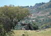
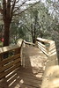


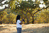
The above images may not be of the site on this page, but were taken nearby. They are loaded from Flickr so please click on them for image credits.
Click here to see more info for this site
Nearby sites
Click here to view sites on an interactive map of the areaKey: Red: member's photo, Blue: 3rd party photo, Yellow: other image, Green: no photo - please go there and take one, Grey: site destroyed
Download sites to:
KML (Google Earth)
GPX (GPS waypoints)
CSV (Garmin/Navman)
CSV (Excel)
To unlock full downloads you need to sign up as a Contributory Member. Otherwise downloads are limited to 50 sites.
Turn off the page maps and other distractions
Nearby sites listing. In the following links * = Image available
3.4km S 174° Anta do Vale de Anta* Burial Chamber or Dolmen
4.2km S 188° Anta do Monte Branco* Burial Chamber or Dolmen
5.5km SSE 152° Tholos do Caladinho* Burial Chamber or Dolmen
6.8km WSW 257° Anta 4 do Colmeeiro* Burial Chamber or Dolmen
7.1km NNW 329° Anta da Cerca* Burial Chamber or Dolmen
7.1km NNW 343° Anta do Vale do Milho Burial Chamber or Dolmen
7.2km W 260° Anta 1 do Colmeeiro Burial Chamber or Dolmen
7.2km WSW 252° Anta da Herdade das Casas Novas Burial Chamber or Dolmen
7.5km NW 322° Anta da Corticeira* Burial Chamber or Dolmen
7.8km NW 324° Anta da Talisca* Burial Chamber or Dolmen
8.2km SE 124° Rocha da Mina* Ancient Temple
8.3km NNW 330° Anta da Figueira* Burial Chamber or Dolmen
8.4km WSW 258° Anta das Dessouras* Burial Chamber or Dolmen
8.8km NW 320° Anta do Alto do Seixo* Burial Chamber or Dolmen
8.8km NNW 329° Anta 1 das Casas do Canal* Burial Chamber or Dolmen
9.2km NNW 330° Anta 2 das Casas do Canal* Burial Chamber or Dolmen
9.5km NW 325° Anta 3 das Casas do Canal* Burial Chamber or Dolmen
9.7km WSW 252° Anta da Vidigueira* Burial Chamber or Dolmen
10.3km SSE 163° Anta da Vinha* Burial Chamber or Dolmen
11.3km NW 323° Anta das Entre Águas* Burial Chamber or Dolmen
11.7km SE 125° Sanctuáry a Endovélico Barrow Cemetery
14.6km E 83° Anta da Azenha dos Apóstolos* Burial Chamber or Dolmen
16.1km SSE 165° Pedra do Galo* Natural Stone / Erratic / Other Natural Feature
17.2km W 262° Anta da Herdade da Azarujinha Burial Chamber or Dolmen
17.3km NNW 342° Anta de Nossa Senhora da Conceição dos Olivais* Burial Chamber or Dolmen
View more nearby sites and additional images


 We would like to know more about this location. Please feel free to add a brief description and any relevant information in your own language.
 Wir möchten mehr über diese Stätte erfahren. Bitte zögern Sie nicht, eine kurze Beschreibung und relevante Informationen in Deutsch hinzuzufügen.
 Nous aimerions en savoir encore un peu sur les lieux. S'il vous plaît n'hesitez pas à ajouter une courte description et tous les renseignements pertinents dans votre propre langue.
 Quisieramos informarnos un poco más de las lugares. No dude en añadir una breve descripción y otros datos relevantes en su propio idioma.