

, Aubrey Burl")
<< Our Photo Pages >> Beacharra - Standing Stone (Menhir) in Scotland in Argyll
Submitted by Anonymous on Thursday, 15 February 2001 Page Views: 7521
Neolithic and Bronze AgeSite Name: Beacharra Alternative Name: BeacharrCountry: Scotland County: Argyll Type: Standing Stone (Menhir)
Map Ref: NR69264332 Landranger Map Number: 62
Latitude: 55.628540N Longitude: 5.666954W
Condition:
| 5 | Perfect |
| 4 | Almost Perfect |
| 3 | Reasonable but with some damage |
| 2 | Ruined but still recognisable as an ancient site |
| 1 | Pretty much destroyed, possibly visible as crop marks |
| 0 | No data. |
| -1 | Completely destroyed |
| 5 | Superb |
| 4 | Good |
| 3 | Ordinary |
| 2 | Not Good |
| 1 | Awful |
| 0 | No data. |
| 5 | Can be driven to, probably with disabled access |
| 4 | Short walk on a footpath |
| 3 | Requiring a bit more of a walk |
| 2 | A long walk |
| 1 | In the middle of nowhere, a nightmare to find |
| 0 | No data. |
| 5 | co-ordinates taken by GPS or official recorded co-ordinates |
| 4 | co-ordinates scaled from a detailed map |
| 3 | co-ordinates scaled from a bad map |
| 2 | co-ordinates of the nearest village |
| 1 | co-ordinates of the nearest town |
| 0 | no data |
Be the first person to rate this site - see the 'Contribute!' box in the right hand menu.
Internal Links:
External Links:
")
Canmore site no. 38566.
You may be viewing yesterday's version of this page. To see the most up to date information please register for a free account.
")
")
Do not use the above information on other web sites or publications without permission of the contributor.
davidmorgan has found this location on Google Street View:
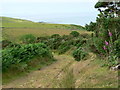
Nearby Images from Geograph Britain and Ireland:
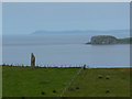
©2010(licence)
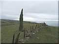
©2006(licence)
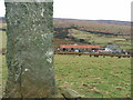
©2006(licence)
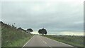
©2021(licence)
©2010(licence)
The above images may not be of the site on this page, they are loaded from Geograph.
Please Submit an Image of this site or go out and take one for us!
Click here to see more info for this site
Nearby sites
Key: Red: member's photo, Blue: 3rd party photo, Yellow: other image, Green: no photo - please go there and take one, Grey: site destroyed
Download sites to:
KML (Google Earth)
GPX (GPS waypoints)
CSV (Garmin/Navman)
CSV (Excel)
To unlock full downloads you need to sign up as a Contributory Member. Otherwise downloads are limited to 50 sites.
![]()
![]()
Turn off the page maps and other distractions
Nearby sites listing. In the following links * = Image available
1.5km S 176° North Beachmore (Muasdale) Standing Stone (Menhir) (NR69284184)
4.4km SSW 195° South Muasdale Standing Stone (Menhir) (NR6792239154)
5.5km SSW 203° Glencreggan (Glenbarr) Cairn (NR668384)
6.7km WNW 303° Bodach and Cailleach* Standing Stones (NR638473)
6.9km NW 310° Cnoc na Carraigh (Gigha) Standing Stone (Menhir) (NR64204806)
6.9km NW 313° Cnoc na Croise (Gigha) Cairn (NR64394828)
6.9km NW 311° Cnoc na Carraigh Ogham Stone* Sculptured Stone (NR6426548173)
7.0km NW 319° Ardminish Cist (NR64954890)
7.1km SSW 203° Barlea Standing Stone (Menhir) (NR661370)
7.8km NW 321° Druimyeonbeg (Isle of Gigha) Cairn (NR64634958)
7.9km NW 306° Ardlamey Cairn (NR63094825)
9.1km SE 146° Ballynacloghy Portal tomb* Portal Tomb (D52348198)
9.3km SSE 149° Beinn an Tuirc Standing Stone (Menhir) (NR73563507)
9.3km SE 137° Beinn an Tuirc Stone Circle (NR753362)
9.7km NNW 335° Tarbert (Gigha)* Standing Stone (Menhir) (NR6554952292)
9.8km NNW 335° Old Wife's Grave, The (Gigha, Isle of) Cairn (NR655524)
9.9km NNE 20° Ballochroy* Stone Row / Alignment (NR7309352426)
10.2km E 95° Brackley* Chambered Cairn (NR79374187)
10.5km NNW 337° Kinerarach (Gigha)* Standing Stone (Menhir) (NR6568453210)
11.2km NNW 340° Cnoc nan Gobhar Stone* Standing Stone (Menhir) (NR6607454042)
11.6km NNE 20° Correchrevie Cairn* Cairn (NR738540)
12.8km ESE 120° Dippen Bay* Carving (NR801364)
13.1km S 191° Killocraw Cup Marked Stone Standing Stone (Menhir) (NR6603630613)
14.0km ESE 116° Carradale Point Hillfort* Hillfort (NR81513649)
14.4km NE 34° Loch Ciaran* Standing Stone (Menhir) (NR78035479)
View more nearby sites and additional images


 We would like to know more about this location. Please feel free to add a brief description and any relevant information in your own language.
 Wir möchten mehr über diese Stätte erfahren. Bitte zögern Sie nicht, eine kurze Beschreibung und relevante Informationen in Deutsch hinzuzufügen.
 Nous aimerions en savoir encore un peu sur les lieux. S'il vous plaît n'hesitez pas à ajouter une courte description et tous les renseignements pertinents dans votre propre langue.
 Quisieramos informarnos un poco más de las lugares. No dude en añadir una breve descripción y otros datos relevantes en su propio idioma.