

<< Our Photo Pages >> Copley Hill - Round Barrow(s) in England in Cambridgeshire
Submitted by Thorgrim on Wednesday, 16 November 2005 Page Views: 10340
Neolithic and Bronze AgeSite Name: Copley HillCountry: England County: Cambridgeshire Type: Round Barrow(s)
Nearest Town: Cambridge Nearest Village: Babraham
Map Ref: TL509530
Latitude: 52.154663N Longitude: 0.204351E
Condition:
| 5 | Perfect |
| 4 | Almost Perfect |
| 3 | Reasonable but with some damage |
| 2 | Ruined but still recognisable as an ancient site |
| 1 | Pretty much destroyed, possibly visible as crop marks |
| 0 | No data. |
| -1 | Completely destroyed |
| 5 | Superb |
| 4 | Good |
| 3 | Ordinary |
| 2 | Not Good |
| 1 | Awful |
| 0 | No data. |
| 5 | Can be driven to, probably with disabled access |
| 4 | Short walk on a footpath |
| 3 | Requiring a bit more of a walk |
| 2 | A long walk |
| 1 | In the middle of nowhere, a nightmare to find |
| 0 | No data. |
| 5 | co-ordinates taken by GPS or official recorded co-ordinates |
| 4 | co-ordinates scaled from a detailed map |
| 3 | co-ordinates scaled from a bad map |
| 2 | co-ordinates of the nearest village |
| 1 | co-ordinates of the nearest town |
| 0 | no data |
Internal Links:
External Links:
")
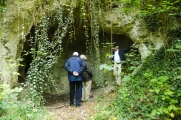
Bronze Age round barrow
You may be viewing yesterday's version of this page. To see the most up to date information please register for a free account.
")
Do not use the above information on other web sites or publications without permission of the contributor.
Nearby Images from Geograph Britain and Ireland:
©2019(licence)
©2008(licence)
©2012(licence)
©2012(licence)
©2021(licence)
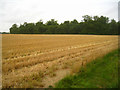
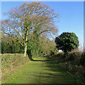
The above images may not be of the site on this page, they are loaded from Geograph.
Please Submit an Image of this site or go out and take one for us!
Click here to see more info for this site
Nearby sites
Key: Red: member's photo, Blue: 3rd party photo, Yellow: other image, Green: no photo - please go there and take one, Grey: site destroyed
Download sites to:
KML (Google Earth)
GPX (GPS waypoints)
CSV (Garmin/Navman)
CSV (Excel)
To unlock full downloads you need to sign up as a Contributory Member. Otherwise downloads are limited to 50 sites.
Turn off the page maps and other distractions
Nearby sites listing. In the following links * = Image available
412m SSE 168° Babraham* Long Barrow (TL510526)
1.2km W 262° Wormwood Hill* Round Barrow(s) (TL497528)
1.6km WNW 286° Wandlebury* Hillfort (TL493534)
1.7km WNW 285° Gog and Magog Giants Hill Figures* Hill Figure or Geoglyph (TL492534)
3.5km NW 318° East Pit Nature Reserve* Ancient Village or Settlement (TL485555)
3.9km NW 326° The Kingship Stone, Cherry Hinton Natural Stone / Erratic / Other Natural Feature (TL486562)
4.0km ENE 72° Mutlow Hill* Round Barrow(s) (TL5466354380)
4.7km WNW 286° Nine wells* Holy Well or Sacred Spring (TL46305420)
5.8km WSW 258° Little Shelford Crosses* Ancient Cross (TL453516)
7.7km NW 311° Cambridge Fitzwilliam Museum* Museum (TL44955790)
7.8km NW 313° Cambridge Museum of Archaeology & Anthropology* Museum (TL450581)
7.9km SW 228° Chronicle Hills Barrow Cemetery (TL452475)
9.0km SW 229° Thriplow Round Barrow(s) (TL4431646901)
9.6km SSE 151° St. Botolph's Well (Hadstock)* Holy Well or Sacred Spring (TL55864478)
9.7km NNE 25° Bottisham Cursus Cursus (TL547619)
9.8km SW 220° Thriplow Ring Ditch Misc. Earthwork (TL44784537)
10.2km SW 218° Thriplow Heath 1 Round Barrow(s) (TL4479044782)
11.2km SE 138° Bartlow Hills* Barrow Cemetery (TL586449)
11.5km SSW 195° Valance Farm Round Barrow(s) (TL4823241818)
11.9km SW 219° Thrplow Heath 2 Round Barrow(s) (TL4362943549)
13.0km WSW 245° Shepreth Cursus (TL393471)
13.1km SE 146° Lady Well (Ashdon) Holy Well or Sacred Spring (TL586424)
13.5km WNW 284° The Mazles Turf Maze (TL377559)
13.6km NNE 33° Devil's Dyke, Cambridgeshire* Misc. Earthwork (TL580646)
13.6km WSW 245° Shepreth Cursus (TL387468)
View more nearby sites and additional images


 We would like to know more about this location. Please feel free to add a brief description and any relevant information in your own language.
 Wir möchten mehr über diese Stätte erfahren. Bitte zögern Sie nicht, eine kurze Beschreibung und relevante Informationen in Deutsch hinzuzufügen.
 Nous aimerions en savoir encore un peu sur les lieux. S'il vous plaît n'hesitez pas à ajouter une courte description et tous les renseignements pertinents dans votre propre langue.
 Quisieramos informarnos un poco más de las lugares. No dude en añadir una breve descripción y otros datos relevantes en su propio idioma.