


<< Our Photo Pages >> Hilgenstein (Werkel) - Standing Stone (Menhir) in Germany in Hesse
Submitted by AlexHunger on Wednesday, 12 October 2005 Page Views: 3448
Neolithic and Bronze AgeSite Name: Hilgenstein (Werkel)Country: Germany Land: Hesse Type: Standing Stone (Menhir)
Nearest Town: Kassel Nearest Village: Werkel
Latitude: 51.152470N Longitude: 9.306570E
Condition:
| 5 | Perfect |
| 4 | Almost Perfect |
| 3 | Reasonable but with some damage |
| 2 | Ruined but still recognisable as an ancient site |
| 1 | Pretty much destroyed, possibly visible as crop marks |
| 0 | No data. |
| -1 | Completely destroyed |
| 5 | Superb |
| 4 | Good |
| 3 | Ordinary |
| 2 | Not Good |
| 1 | Awful |
| 0 | No data. |
| 5 | Can be driven to, probably with disabled access |
| 4 | Short walk on a footpath |
| 3 | Requiring a bit more of a walk |
| 2 | A long walk |
| 1 | In the middle of nowhere, a nightmare to find |
| 0 | No data. |
| 5 | co-ordinates taken by GPS or official recorded co-ordinates |
| 4 | co-ordinates scaled from a detailed map |
| 3 | co-ordinates scaled from a bad map |
| 2 | co-ordinates of the nearest village |
| 1 | co-ordinates of the nearest town |
| 0 | no data |
Internal Links:
External Links:
 (PID:21198)")
About 1.2 Meter tall menhir in housing development on corner of "am Hilgenstein" street. This area was made into a pleasant park with a Bench. 205 Meters Altitude. Exact GPS position from handheld device.
You may be viewing yesterday's version of this page. To see the most up to date information please register for a free account.
 (PID:21195)")
Do not use the above information on other web sites or publications without permission of the contributor.
Nearby Images from Flickr
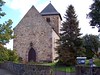
The above images may not be of the site on this page, but were taken nearby. They are loaded from Flickr so please click on them for image credits.
Click here to see more info for this site
Nearby sites
Click here to view sites on an interactive map of the areaKey: Red: member's photo, Blue: 3rd party photo, Yellow: other image, Green: no photo - please go there and take one, Grey: site destroyed
Download sites to:
KML (Google Earth)
GPX (GPS waypoints)
CSV (Garmin/Navman)
CSV (Excel)
To unlock full downloads you need to sign up as a Contributory Member. Otherwise downloads are limited to 50 sites.
Turn off the page maps and other distractions
Nearby sites listing. In the following links * = Image available
3.2km NW 319° Flur Wehrengrab Passage Grave
3.8km N 4° Gleichen Passage Grave
4.4km N 358° Wartberg Hillfort
4.6km ENE 75° Wodanstein in Maden* Standing Stone (Menhir)
5.2km WNW 297° Züschen Galeriegrab* Chambered Tomb
5.4km WNW 298° Züschen (2) Passage Grave
6.5km NW 315° Ringwall Hinterberg* Hillfort
7.1km NNE 27° Lautariusgrab* Chambered Tomb
8.2km NW 307° Riesenstein (Heiligenberg)* Rock Outcrop
9.5km ENE 65° Haldorf Hügelgräber Barrow Cemetery
9.6km NW 312° Altendorf Passage Grave
10.1km ENE 59° Haldorf Menhir* Standing Stone (Menhir)
10.6km ENE 65° Riesenstein von Wolfershausen* Standing Stone (Menhir)
10.6km N 354° Grüne Platte Hillfort
11.3km NNE 19° Burgberg Hillfort Hillfort
11.5km NE 38° Hertingshausen Menhir* Standing Stone (Menhir)
12.6km NNE 30° Hünstein Grossenritte* Standing Stone (Menhir)
13.4km NE 50° Guntershausen Riesenstein Standing Stone (Menhir)
13.7km SSW 209° Ringwall Altenburg Römersberg* Hillfort
18.8km NNW 343° Bilstein Istha Rock Outcrop
19.9km NE 36° Summstein Schönfeld Modern Stone Circle etc
21.3km NE 53° Summstein Grüne Mitte Modern Stone Circle etc
21.7km NE 36° Hessisches Landesmuseum Kassel* Museum
21.9km W 276° Wellen Menhir* Standing Stone (Menhir)
22.5km N 7° Hoher Dörnberg* Hillfort
View more nearby sites and additional images


 We would like to know more about this location. Please feel free to add a brief description and any relevant information in your own language.
 Wir möchten mehr über diese Stätte erfahren. Bitte zögern Sie nicht, eine kurze Beschreibung und relevante Informationen in Deutsch hinzuzufügen.
 Nous aimerions en savoir encore un peu sur les lieux. S'il vous plaît n'hesitez pas à ajouter une courte description et tous les renseignements pertinents dans votre propre langue.
 Quisieramos informarnos un poco más de las lugares. No dude en añadir una breve descripción y otros datos relevantes en su propio idioma.