

<< Our Photo Pages >> Butzbach Menhir - Standing Stone (Menhir) in Germany in Hesse
Submitted by AlexHunger on Wednesday, 12 October 2005 Page Views: 6268
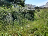
Neolithic and Bronze AgeSite Name: Butzbach MenhirCountry: Germany Land: Hesse Type: Standing Stone (Menhir)
Nearest Town: Frankfurt Nearest Village: Butzbach
Latitude: 50.442760N Longitude: 8.664390E
Condition:
| 5 | Perfect |
| 4 | Almost Perfect |
| 3 | Reasonable but with some damage |
| 2 | Ruined but still recognisable as an ancient site |
| 1 | Pretty much destroyed, possibly visible as crop marks |
| 0 | No data. |
| -1 | Completely destroyed |
| 5 | Superb |
| 4 | Good |
| 3 | Ordinary |
| 2 | Not Good |
| 1 | Awful |
| 0 | No data. |
| 5 | Can be driven to, probably with disabled access |
| 4 | Short walk on a footpath |
| 3 | Requiring a bit more of a walk |
| 2 | A long walk |
| 1 | In the middle of nowhere, a nightmare to find |
| 0 | No data. |
| 5 | co-ordinates taken by GPS or official recorded co-ordinates |
| 4 | co-ordinates scaled from a detailed map |
| 3 | co-ordinates scaled from a bad map |
| 2 | co-ordinates of the nearest village |
| 1 | co-ordinates of the nearest town |
| 0 | no data |
Internal Links:
External Links:
I have visited· I would like to visit
Klingon visited on 24th Sep 2011 - their rating: Cond: 5 Amb: 2 Access: 4
Klingon visited on 10th Apr 2006 - their rating: Cond: 5 Amb: 2 Access: 4
Average ratings for this site from all visit loggers: Condition: 5 Ambience: 2 Access: 4
")
You may be viewing yesterday's version of this page. To see the most up to date information please register for a free account.
")
")
")
")
")
")
")
")
")
")
")
")
Do not use the above information on other web sites or publications without permission of the contributor.
Click here to see more info for this site
Nearby sites
Click here to view sites on an interactive map of the areaKey: Red: member's photo, Blue: 3rd party photo, Yellow: other image, Green: no photo - please go there and take one, Grey: site destroyed
Download sites to:
KML (Google Earth)
GPX (GPS waypoints)
CSV (Garmin/Navman)
CSV (Excel)
To unlock full downloads you need to sign up as a Contributory Member. Otherwise downloads are limited to 50 sites.
Turn off the page maps and other distractions
Nearby sites listing. In the following links * = Image available
4.9km SW 225° Hausberg Hillfort* Hillfort
5.8km SSE 164° Menhir Ober-Moerlen* Standing Stone (Menhir)
7.3km WNW 300° Grauer Stein Oberkleen* Marker Stone
8.3km NW 318° Opferstein Dornholzhausen Rock Art
8.6km ENE 76° Kräppelstein* Standing Stone (Menhir)
10.1km ENE 71° Hügelgrab Heiliger Stein* Round Barrow(s)
10.3km ENE 72° Heiliger Stein* Passage Grave
11.0km ENE 69° Vorderwald Muschenheim* Barrow Cemetery
17.8km S 178° Hünengrab Köppern Round Barrow(s)
18.1km E 95° Kindstein* Standing Stone (Menhir)
18.3km SSE 151° Friedberg Siedlung Ancient Village or Settlement
20.3km SSW 200° Saalburg* Hillfort
20.6km NNW 346° Archaeological Museum Gleiberger Land Museum
23.0km SSW 192° Gluckenstein* Standing Stone (Menhir)
23.9km NNW 346° Duensberg* Hillfort
27.4km SSW 193° Vortaunusmuseum Oberursel Museum
27.7km ESE 121° Glauberg Museum* Museum
28.3km SW 226° Ringwall Waldems Hillfort
28.3km E 88° Dicker Stein Eichelsdorf Standing Stone (Menhir)
28.6km ESE 121° Glauberg Siedlung* Hillfort
28.7km ESE 122° Keltenwelt am Glauberg* Museum
28.7km SSW 207° Altkönig Oppidum* Hillfort
28.8km ESE 122° Glauberg Fürstengrabhügel* Round Barrow(s)
29.0km SSW 196° Heidetränk Oppidum* Hillfort
29.6km SSE 153° Schöneck-Kilianstädten* Ancient Village or Settlement
View more nearby sites and additional images


 We would like to know more about this location. Please feel free to add a brief description and any relevant information in your own language.
 Wir möchten mehr über diese Stätte erfahren. Bitte zögern Sie nicht, eine kurze Beschreibung und relevante Informationen in Deutsch hinzuzufügen.
 Nous aimerions en savoir encore un peu sur les lieux. S'il vous plaît n'hesitez pas à ajouter une courte description et tous les renseignements pertinents dans votre propre langue.
 Quisieramos informarnos un poco más de las lugares. No dude en añadir una breve descripción y otros datos relevantes en su propio idioma.