


<< Our Photo Pages >> Matakana Modern Stone Circle - Modern Stone Circle etc in New Zealand
Submitted by Klingon on Friday, 03 June 2005 Page Views: 7976
Modern SitesSite Name: Matakana Modern Stone CircleCountry: New Zealand Type: Modern Stone Circle etc
Nearest Town: Warkworth Nearest Village: Matakana
Latitude: 36.33752S Longitude: 174.735650E
Condition:
| 5 | Perfect |
| 4 | Almost Perfect |
| 3 | Reasonable but with some damage |
| 2 | Ruined but still recognisable as an ancient site |
| 1 | Pretty much destroyed, possibly visible as crop marks |
| 0 | No data. |
| -1 | Completely destroyed |
| 5 | Superb |
| 4 | Good |
| 3 | Ordinary |
| 2 | Not Good |
| 1 | Awful |
| 0 | No data. |
| 5 | Can be driven to, probably with disabled access |
| 4 | Short walk on a footpath |
| 3 | Requiring a bit more of a walk |
| 2 | A long walk |
| 1 | In the middle of nowhere, a nightmare to find |
| 0 | No data. |
| 5 | co-ordinates taken by GPS or official recorded co-ordinates |
| 4 | co-ordinates scaled from a detailed map |
| 3 | co-ordinates scaled from a bad map |
| 2 | co-ordinates of the nearest village |
| 1 | co-ordinates of the nearest town |
| 0 | no data |
Internal Links:
External Links:
I have visited· I would like to visit
Klingon visited - their rating: Cond: 5 Amb: 3 Access: 5
DrewParsons have visited here
")
You may be viewing yesterday's version of this page. To see the most up to date information please register for a free account.
")
Do not use the above information on other web sites or publications without permission of the contributor.
Klingon has found this location on Google Street View:
Nearby Images from Flickr


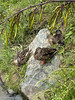


The above images may not be of the site on this page, but were taken nearby. They are loaded from Flickr so please click on them for image credits.
Click here to see more info for this site
Nearby sites
Click here to view sites on an interactive map of the areaKey: Red: member's photo, Blue: 3rd party photo, Yellow: other image, Green: no photo - please go there and take one, Grey: site destroyed
Download sites to:
KML (Google Earth)
GPX (GPS waypoints)
CSV (Garmin/Navman)
CSV (Excel)
To unlock full downloads you need to sign up as a Contributory Member. Otherwise downloads are limited to 50 sites.
Turn off the page maps and other distractions
Nearby sites listing. In the following links * = Image available
1.1km WNW 291° Pukematakeo Pa* Hillfort
8.8km N 3° Te Kiri's Pa* Hillfort
9.0km NNE 19° Okakari Point Pa* Hillfort
9.7km ESE 111° Papahi Headland Pa* Hillfort
18.8km S 184° R09-928* Ancient Village or Settlement
19.9km S 182° R10-335* Hillfort
21.1km NNW 338° Te Arai o Tahuhu Pa* Hillfort
22.5km S 185° Kakaha Pa* Hillfort
26.5km S 189° Nukuhau Pa* Hillfort
29.6km S 187° Orewa South Bridge Pa* Hill Figure or Geoglyph
30.1km S 173° Coal Mine Bay Headland Pa* Hillfort
30.4km S 173° Whangaparaoa Stone Folly* Modern Stone Circle etc
31.2km SSE 156° Papakura Pa* Hillfort
31.4km S 189° Silverdale Pioneer Village* Museum
31.5km SSE 166° Shakespear Homestead Pa* Hillfort
31.6km SSE 166° Te Haruhi Bay Kainga* Ancient Village or Settlement
32.1km SSE 156° Tiritiri Matangi Pa* Hillfort
32.3km S 177° West Manly Pa* Hillfort
32.8km S 171° Rakauananga Pa* Hillfort
33.4km S 175° Little Manly East Point Pa* Hillfort
34.5km S 179° Rarowhara Pa* Hillfort
36.1km S 181° Dacre Point Pa* Hillfort
36.7km S 180° Okura 784 Settlement & Midden* Artificial Mound
44.5km WSW 250° Muriwai Headland Pa* Hillfort
44.9km WSW 249° Ihawhanui Ridge Pa* Hillfort
View more nearby sites and additional images


 We would like to know more about this location. Please feel free to add a brief description and any relevant information in your own language.
 Wir möchten mehr über diese Stätte erfahren. Bitte zögern Sie nicht, eine kurze Beschreibung und relevante Informationen in Deutsch hinzuzufügen.
 Nous aimerions en savoir encore un peu sur les lieux. S'il vous plaît n'hesitez pas à ajouter une courte description et tous les renseignements pertinents dans votre propre langue.
 Quisieramos informarnos un poco más de las lugares. No dude en añadir una breve descripción y otros datos relevantes en su propio idioma.