Featured: Hare and Tabor T Shirts for discerning antiquarians

Hare and Tabor T Shirts for discerning antiquarians

The Illustrated Encyclopedia of Native American Indian Mounds

The Illustrated Encyclopedia of Native American Indian Mounds

Who's Online

There are currently, 215 guests and 0 members online.

You are a guest. To join in, please register for free by clicking here

Sponsors

<< Our Photo Pages >> Cahokia - Ancient Village or Settlement in United States in Great Lakes Midwest

Submitted by bat400 on Saturday, 01 February 2020  Page Views: 38950

Multi-periodSite Name: Cahokia Alternative Name: Cahokia Mounds
Country: United States Region: Great Lakes Midwest Type: Ancient Village or Settlement
Nearest Town: Collinsville
Latitude: 38.658472N  Longitude: 90.05867W
Condition:
5Perfect
4Almost Perfect
3Reasonable but with some damage
2Ruined but still recognisable as an ancient site
1Pretty much destroyed, possibly visible as crop marks
0No data.
-1Completely destroyed
3 Ambience:
5Superb
4Good
3Ordinary
2Not Good
1Awful
0No data.
4 Access:
5Can be driven to, probably with disabled access
4Short walk on a footpath
3Requiring a bit more of a walk
2A long walk
1In the middle of nowhere, a nightmare to find
0No data.
5 Accuracy:
5co-ordinates taken by GPS or official recorded co-ordinates
4co-ordinates scaled from a detailed map
3co-ordinates scaled from a bad map
2co-ordinates of the nearest village
1co-ordinates of the nearest town
0no data
4

Internal Links:
External Links:

I have visited· I would like to visit

DrewParsons would like to visit

bat400 visited on 1st Jan 2017 - their rating: Cond: 2 Amb: 4 Access: 5 A huge, sprawling site that gives you more and more if you spend some time at both the museum and walking the huge expanse. I've visited many times starting in the mid 1990's. The earthen mounds are so large and so many in number that it's easy to become overwhelmed and a bit numb ("... oh, there's another mound ...") Walking around the site and climbing to the top of the largest earthwork in the US, Monk's Mound, gives you an idea of the size of the site. This is a truncated pyramid with several terraces. The footprint is larger than that of the stone pyramids of Giza.

davidmorgan have visited here

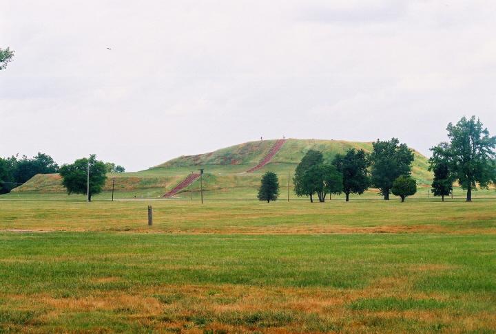
Cahokia - Monk's Mound
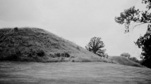
Cahokia - Monk's Mound submitted by bat400 : Monk's Mound taken from the SE. bat 400. 23 June 2007. (Vote or comment on this photo)
Ancient City in Madison and St. Clair Counties, Illinois. A few miles west of Collinsville are the remains of a Mississippian city now called Cahokia. The site was inhabited between 700-1400AD, with its peak being around 1050-1200AD. The city is famous for its 120 plus mounds constructed and enlarged on several occasions during the city’s habitation.

At its most populous Cahokia is believed to have had as many as 10000-20000 people living there and its central area covered six square miles. In addition to the mounds, a bastioned stockade around a central mound and plaza area, and the remains of rows of houses and other plazas have been found. The site has produced many finds, including copper items, fine pottery & carved tablets of stone. Burials of individuals with funeral goods and human sacrifices support the concept of a society focused on individual leaders or hierarchical lineages.

Some researchers (including Timothy Pauketat, Joeseph Galloy, Thomas Emerson, and John Kelly) believe that Cahokia, along with two other Mound Centers, the East Saint Louis" and Saint Louis Mound groups, were joined and served as a central ceremonial and administrative center to a much larger area of smaller settlements, farmsteads, and craft centers, In others words, they functioned as a city, producing an influx of peoples of multiple ethnic and language groups, spurring trade, and having a large influence on religious and technological culture up and down the Mississippi River and its regional watershed. Other researches (whom Galloy refers to as "minimalists') concede the size of each center, but doubt that the society was as complex as to be considered as as a city.

What happened to Cahokia’s inhabitants is not completely understood, but archaeology seems to point in the direction of a decline in the population starting in the 1200s, leading to it being abandoned by 1400AD.

The name ‘Cahokia’, comes from a tribe who inhabited the surrounding area some 200 yrs after the city was abandoned.

See individual site listings for major structures within the Cahokia complex, including Monk's Mound and Woodhenge.
For more, see the Cahokia Mounds State Historic Site, and the UNESCO World Heritage site.

The location given is for the park's museum entrance.

Note: First Notice for The Mississippian Conference at Cahokia Mounds on July 8, 2020. See Comments. More information as it is available.
You may be viewing yesterday's version of this page. To see the most up to date information please register for a free account.
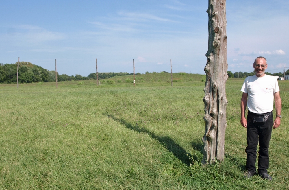
David Morgan at Cahokia - Woodhenge
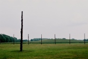
David Morgan at Cahokia - Woodhenge submitted by bat400 : Cahokia mini-meetup, 20 Aug 2017. davidmorgan at Cahokia's Woodhenge reconstruction. Monk's Mound in the far background and Mound 42 in the near background. Taken by bat400. (2 comments - Vote or comment on this photo)

Cahokia - Monk's Mound
Cahokia - Monk's Mound submitted by bat400 : Cahokia - Monk's Mound. The largest earthen mound in North America. The base is larger than that of the Great Pyramid of Giza. Photo by bat400, June 2007. (1 comment - Vote or comment on this photo)

Cahokia - Monk's Mound
Cahokia - Monk's Mound submitted by bat400 : The view to the West from Monk's Mound. St. Louis Missouri appears on the far horizon - the Arch is to the left. Mound 42 is to the right. bat400. 23 June 2007. (Vote or comment on this photo)

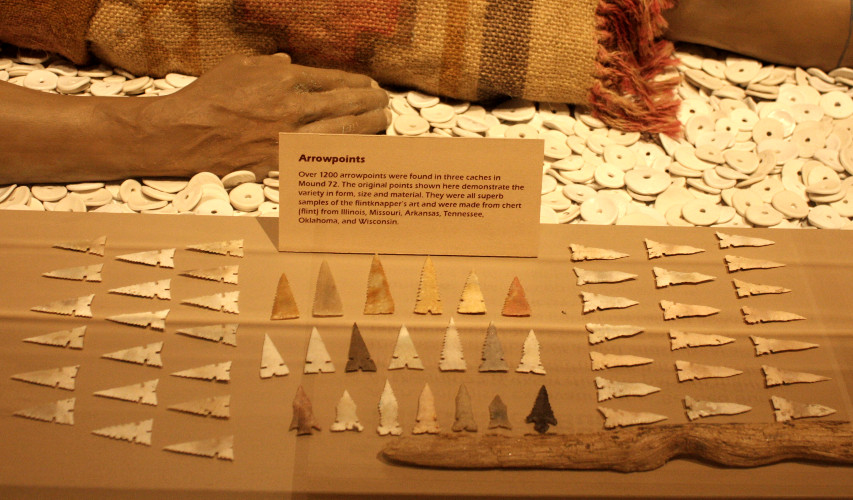
Cahokia - Mound 72
Cahokia - Mound 72 submitted by davidmorgan : Beautiful arrowheads found in Mound 72, on display in Cahokia Museum. (Vote or comment on this photo)

Cahokia - Museum
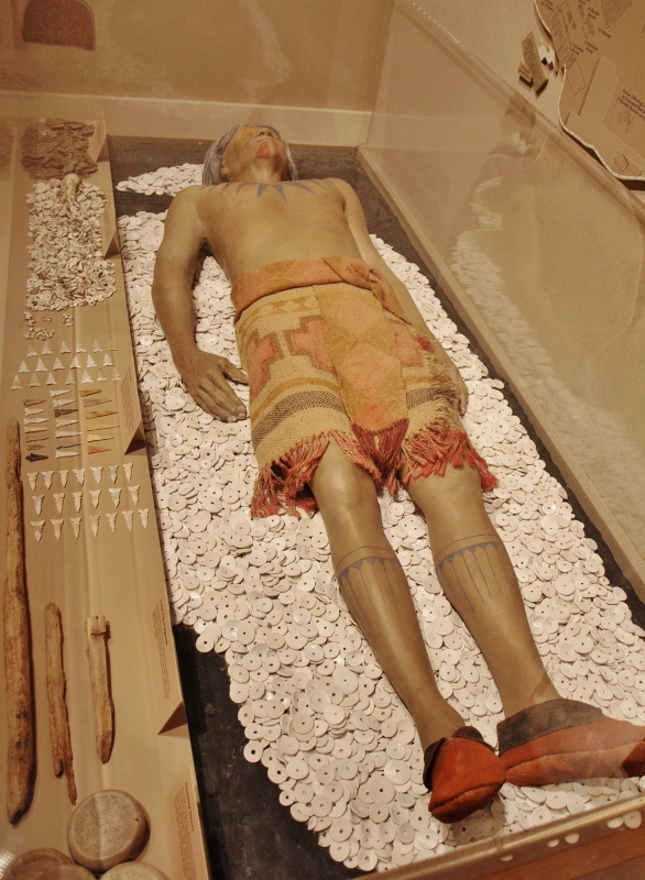
Cahokia - Museum submitted by bat400 : A recreation in the museum of the "Falcon" burial in Mound 72. Actual artifacts (mica sheets, shell beads, stone points) join a manikin decked in clothing of a weave similar to charred cloth and clay impressions found on site. The manikin's tattoo or body paint copies depictions found on period artifacts. Photo: bat400, 20Aug2017. (Vote or comment on this photo)

Cahokia - Museum
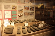
Cahokia - Museum submitted by davidmorgan : Many stone axeheads on display in Cahokia Museum.

Cahokia - Museum
Cahokia - Museum submitted by davidmorgan : A good display of the stone axes found in various caches at the Grossmann site, 18km east of Cahokia. In the Cahokia Museum.

Cahokia
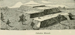
Cahokia submitted by durhamnature : Drawing, from "Prehistoric America" via archive.org

Cahokia - Kunnemann Group
Cahokia - Kunnemann Group submitted by durhamnature : Section of Kunnemann Mound, one of 6-11, from "Cahokia Mounds" via archive.org

Cahokia
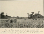
Cahokia submitted by durhamnature : Old photo of smaller mounds, from "Mound Builders..." via archive.org

Cahokia
Cahokia submitted by durhamnature : The Great Cahokia Mound. Old, imaginative drawing from "Records of Ancient Races" via archive.org

Cahokia - Mound 60
Cahokia - Mound 60 submitted by bat400 : The Twin Mounds (59 and 60) at the south end of the Great Plaza of Cahokia. This type of grouping of a flat topped mound and a conical mound occurs in other places at Cahokia, but these are the largest "set." Photo by bat400, June 2007.

Cahokia - Woodhenge
Cahokia - Woodhenge submitted by bat400 : Cahokia - Woodhenge, Illinois. Looking to the east from the center of the woodhenge, one can see the much reduced Mound 44, the larger Mound 42 beyond it, and the shape of the massive Monk's Mound. Photo by bat400, June 2007.

Cahokia - Museum
Cahokia - Museum submitted by bat400 : Cahokia - Visitor's Center and Museum, Illinois. When the center was built the post holes and building footprints of multiple small houses were revealed and completely excavated. The size and orientation of these homes has been recorded in a painted image on the paved areas around the building. Inside the museum several buildings' footprints have been incorporated into the museum displays. Phot...

Cahokia 1150
Cahokia 1150 submitted by bat400 : Cahokia, 1150 AD, Main Plaza. Cahokia Mounds State Historic Site. Photograph of museum mural. Image copywrite L.K. Townsend and Cahokia Mounds State Historic Site. (Used in accordance with State Historic Site policy.) City Center within Stockade. Monk's Mound, the main structure at the right near the horizon, is a structural mound and originally held a wooden structure at the top level, su...

Cahokia - Monk's Mound
Cahokia - Monk's Mound submitted by AKFisher : In the 1800s illustrations of mounds were often exaggerated & distorted. This is an 1887 depiction of Monk's Mound showing how it got its name. A monk once did live on the summit. Image courtesy Dr Greg Little, author of the Illustrated Encyclopedia of Native American Indian Mounds & Earthworks (2016). 

Cahokia
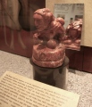
Cahokia submitted by AKFisher : The "Birger Figurine" (replica) excavated from Cahokia Mounds. It is thought to represent the Earth Mother. Photo courtesy Dr Greg Little, author of the Illustrated Encyclopedia of Native American Indian Mounds & Earthworks (2016). 

Cahokia
Cahokia submitted by AKFisher : The "Keller Figurine" (replica) excavated from a pit at Cahokia mounds in Illinois with other goods indicating it is related to pumpkins, squash, and corn. It is thought to represent the Corn Mother. Photo courtesy Dr Greg Little, author of the Illustrated Encyclopedia of Native American Indian Mounds & Earthworks (2016). 

Cahokia
Cahokia submitted by AKFisher : Herb Roe's astonishing archaeological recreation of the central core of the Cahokia, Illinois mound complex at its height ca. AD 1200. Monk's Mound, 100 ft tall with a base larger than the Great Pyramid is top center. Woodhenge is at the lower left. From the mound encyclopedia. Photo courtesy Dr Greg Little, author of the Illustrated Encyclopedia of Native American Indian Mounds & Earthworks (201...

Cahokia - Monk's Mound
Cahokia - Monk's Mound submitted by AKFisher : Depiction of Monk's Mound at Cahokia, Illinois (1909). The mound is 100 ft tall and its base covers about 14 acres, an acre larger than the Great Pyramid at Giza. Photo courtesy Dr Greg Little, author of the Illustrated Encyclopedia of Native American Indian Mounds & Earthworks (2016).

Cahokia - Museum
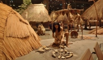
Cahokia - Museum submitted by bat400 : A life size diorama in the museum of a residential area of Cahokia at the height of its occupation. Photo: bat400, 20Aug2017.

Cahokia - Museum
Cahokia - Museum submitted by bat400 : A recreation in the museum of the "Falcon" burial in Mound 72. Actual artifacts (shell beads, stone points) join a manikin decked in clothing of a weave similar to charred cloth and clay impressions found on site. The manikin's tattoo or body paint copies depictions found on period artifacts. Photo: bat400, 20Aug2017. (1 comment)

Cahokia - Kunnemann Group
Cahokia - Kunnemann Group submitted by bat400 : The Area of the Kunnemann group of mounds. This photo was taken from Bishoff Road, looking south. Photo by bat400, 20Aug2017.

Cahokia - Monk's Mound
Cahokia - Monk's Mound submitted by davidmorgan : Monk's Mound under a looming sky.

Cahokia
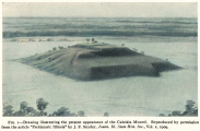
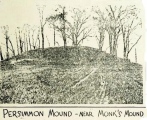
Cahokia submitted by durhamnature : Old picture of Mound 51, Persimmon Mound, from "Mound Builders..." via archive.org

These are just the first 25 photos of Cahokia. If you log in with a free user account you will be able to see our entire collection.

Do not use the above information on other web sites or publications without permission of the contributor.
Click here to see more info for this site

Nearby sites

Click here to view sites on an interactive map of the area

Key: Red: member's photo, Blue: 3rd party photo, Yellow: other image, Green: no photo - please go there and take one, Grey: site destroyed

Download sites to:
KML (Google Earth)
GPX (GPS waypoints)
CSV (Garmin/Navman)
CSV (Excel)

To unlock full downloads you need to sign up as a Contributory Member. Otherwise downloads are limited to 50 sites.


Turn off the page maps and other distractions

Nearby sites listing. In the following links * = Image available
 230m ENE 63° Cahokia - Mounds 30 and 31 Artificial Mound
 239m NNW 341° Cahokia - Mound 36 Artificial Mound
 270m SSW 204° Cahokia - Mound 55* Artificial Mound
 337m N 358° Cahokia - Stockade* Misc. Earthwork
 359m NNE 24° Cahokia - Ramey Group* Ancient Village or Settlement
 388m NW 306° Cahokia - Monk's Mound* Pyramid / Mastaba
 398m S 187° Cahokia - Museum* Museum
 591m SW 220° Cahokia - Mound 60* Artificial Mound
 604m N 352° Cahokia - Mound 5.* Artificial Mound
 606m W 264° Cahokia - Mound 48 Artificial Mound
 672m SW 228° Cahokia - Mound 59* Artificial Mound
 889m W 281° Cahokia - Mound 42* Artificial Mound
 920m SSW 208° Cahokia - Mound 72* Artificial Mound
 1.3km W 277° Cahokia - Mound 44* Artificial Mound
 1.3km NNW 341° Cahokia - Kunnemann Group* Ancient Temple
 1.5km W 276° Cahokia - Woodhenge* Timber Circle
 1.6km SSW 195° Cahokia - Mound 66 Artificial Mound
 2.7km W 276° Cahokia - Powell Mound Artificial Mound
 2.8km W 264° Fingerhut tract* Ancient Village or Settlement
 5.1km N 350° Horseshoe Lake Mound* Artificial Mound
 5.3km WSW 252° Sam Chucalo Mound* Artificial Mound
 8.3km WSW 257° East Saint Louis Mound Center* Ancient Village or Settlement
 11.2km W 261° Big Mound (St Louis)* Artificial Mound
 17.6km WSW 238° Sugarloaf Mound, Missouri* Artificial Mound
 24.0km E 97° Emerald Mound, Illinois* Artificial Mound
View more nearby sites and additional images

<< Stiogha Chnap Propped Stone SC1

Dunmail Raise >>

Please add your thoughts on this site

Prehistoric Avebury

Prehistoric Avebury

Sponsors

Auto-Translation (Google)

Translate from English into:

"Cahokia" | Login/Create an Account | 40 News and Comments
  
Go back to top of page    Comments are owned by the poster. We aren't responsible for their content.
New paper: Following The Milky Way Path of Souls by Andy B on Saturday, 18 December 2021
(User Info | Send a Message)
A new paper in the Journal of Skyscape Archaeology:

Following The Milky Way Path of Souls - An Archaeoastronomic Assessment of Cahokia’s Main Site Axis and Rattlesnake Causeway
William F. Romain, Indiana University
DOI: https://doi.org/10.1558/jsa.18926

Cahokia was a major Native American city on the east side of the Mississippi River, across from the modern-day city of St. Louis, Missouri. Cahokia flourished from c.1050 AD to c.1250. In this paper archaeoastronomic and ethnohistoric data along with computer simulations are used to explore the idea that the Cahokia site axis and the Rattlesnake Causeway were intentionally aligned to the Milky Way. It is proposed that this alignment accounts for the peculiar 5° offset of the site from the cardinal directions. Following Sarah Baires, it is suggested that Rattlesnake Causeway was a terrestrial metaphor for the Milky Way Path of Souls used by the deceased to cross to the Land of the Dead. Rattlesnake Mound at the end of the Causeway is suggested as a portal to the Path of Souls. According to ethnohistoric accounts, the Land of the Dead was guarded by a Great Serpent – suggested here as visible in the night sky as either the constellation Serpens or that of Scorpius.
[ Reply to This ]

First Notice for The Mississippian Conference at Cahokia Mounds on July 8, 2020 by bat400 on Saturday, 14 March 2020
(User Info | Send a Message)
"This is the first notice for The Mississippian Conference, which returns to Cahokia Mounds this summer and is scheduled for Saturday, July 18. As usual, we hope to have 16 20-minute presentations on current Mississippian research in the Midwest/Southeast. More notices will go out in future months as reminders." - from the News Items at the Midwest Archaeological Conference, Inc. website.

Researchers wishing to give a presentation are now invited to submit abstracts: "Submitters should include their name and how they wish to be listed; title of the presentation; and a short abstract. These should be sent to Lori Belknap (the new site superintendent) Cahokia Mounds State Historic Site, 30 Ramey Street, Collinsville, IL 62234, or emailed to her at lori.belknap@illinois.gov

In previous years this conference has invited the public to attend the presentations. Watch for more information here.
[ Reply to This ]
    Re: First Notice for The Mississippian Conference at Cahokia Mounds on July 8, 2020 by Andy B on Tuesday, 31 March 2020
    (User Info | Send a Message)
    Hello, is this likely to be going ahead do you know?
    [ Reply to This ]
    Re: First Notice for The Mississippian Conference at Cahokia Mounds on July 8, 2020 by NatalieLovelandStone on Sunday, 14 June 2020
    (User Info | Send a Message)
    May i share this noting the conference and contributors if this is still being held?
    [ Reply to This ]
      Re: First Notice for The Mississippian Conference at Cahokia Mounds on July 8, 2020 by Andy B on Tuesday, 16 June 2020
      (User Info | Send a Message)
      Yes but I'd think it's most likely been cancelled, could you let us know if you find out - thanks
      [ Reply to This ]
        Re: First Notice for The Mississippian Conference at Cahokia Mounds on July 8, 2020 by NatalieLovelandStone on Saturday, 20 June 2020
        (User Info | Send a Message)
        Sure! I left a message but im not even sure i called the correct place and cant make it but ill let you know if i do hear !
        [ Reply to This ]

Cahokia Depopulation - Repopulation Investigated by bat400 on Friday, 31 January 2020
(User Info | Send a Message)
Graduate Student AJ White, UC, Berkley, has published papers showing data that supports not only a population spike associated specific Mississippian archaeological artifacts, but also a lower density but noticeable repopulation of peoples with a different subsistence pattern than the Mississippian culture.

"White and fellow researchers at California State University, Long Beach, the University of Wisconsin-Madison and Northeastern University analyzed fossil pollen, the remnants of ancient feces, charcoal and other clues to reconstruct a post-Mississippian lifestyle.

"[Their] findings, just published in the journal American Antiquity, make the case that a fresh wave of Native Americans repopulated the region in the 1500s and kept a steady presence there through the 1700s, when migrations, warfare, disease and environmental change led to a reduction in the local population.

"Their evidence paints a picture of communities built around maize farming, bison hunting and possibly even controlled burning in the grasslands, which is consistent with the practices of a network of tribes known as the Illinois Confederation.

"Unlike the Mississippians who were firmly rooted in the Cahokia metropolis, the Illinois Confederation tribe members roamed further afield, tending small farms and gardens, hunting game and breaking off into smaller groups when resources became scarce.

"The linchpin holding together the evidence of their presence in the region were “fecal stanols” derived from human waste preserved deep in the sediment under Horseshoe Lake, Cahokia’s main catchment area.

"Fecal stanols are microscopic organic molecules produced in our gut when we digest food, especially meat. They are excreted in our feces and can be preserved in layers of sediment for hundreds, if not thousands, of years."

Unfortunately UC Berkeley News has published a story (repeated in other media) with headline that implies a somewhat sensational narrative of White's research debunking "myths" associated with a lost civilization narrative. The research itself is more complex. See the links below.

"After Cahokia: Indigenous Repopulation and Depopulation of the Horseshoe Lake Watershed AD 1400–1900", Published online by Cambridge University Press: 24 January 2020.
"Fecal stanols show simultaneous flooding and seasonal precipitation change correlate with Cahokia’s population decline", Proceedings of the National Academy of Sciences, PNAS March 19, 2019 116 (12) 5461-5466; first published February 25, 2019.

UC Berkeley Archaeological Research Facility Brown Bag talk on YouTube.
and the two UC Berkeley News items:

"New study debunks myth of Cahokia’s Native American lost civilization", 27 Jan 2020.
"What ancient poop reveals about the rise and fall of civilizations", 14 March 2019.

[ Reply to This ]

Native American Tribes Support National Park Status For Cahokia Mounds by bat400 on Thursday, 03 October 2019
(User Info | Send a Message)
In July, Republican U.S. Rep. Mike Bost of Murphysboro and Democratic U.S. Sen. Dick Durbin introduced companion bills in both houses to create the Cahokia Mounds and Mississippian Culture National Historic Park.

In addition to the 2,200-acre Cahokia Mounds, the park would include ancient mounds in St. Clair, Monroe and Madison counties in Illinois and Sugarloaf Mound in St. Louis. Sugarloaf is the only mound left in the city.

The legislation would create a partnership between the National Park Service and state and local entities to manage the park. Illinois would retain ownership of Cahokia Mounds.

The Osage Nation is one of 11 Native American tribes with ancestral links to Cahokia Mounds that have worked with researchers studying the feasibility of making the ancient mounds a national park. In 2009, the Osage Nation bought Sugarloaf Mound. The tribe has been raising money for its preservation.

“I want my grandchildren and their children to be able to go up there,’’ said Scott BigHorse, 63, a spokesman for the tribe in Pawhuska, Oklahoma. “And when they go back and they read some of the things that I have written down throughout my lifetime, I want them to be able to go to that spot and see what I see.”

The federal protections that come with national park status would better ensure the future of the surviving mounds, BigHorse said. They would also be a deterrent for souvenir hunters who desecrate his tribe’s sacred lands.

The tribes no longer live near the ancient mounds. Starting in 1830, the federal government forced them to relocate to the Indian Territory — now Oklahoma.

But they have been involved in the national park discussion — something that doesn’t always happen, said Logan Pappenfort, second chief of the Peoria Tribe of Indians of Oklahoma. He directs the tribe’s historic preservation efforts.

Pappenfort has worked for several years with the HeartLands Conservancy, the Belleville nonprofit that produced the national parks study. He credits HeartLands for reaching out to Native American tribes.
“We have had a voice, which is something that you cannot always say as a tribe, unfortunately,” he said.

For Pappenfort, visiting Cahokia Mounds is a spiritual experience — especially climbing to the top of the 100-foot-tall Monks Mound, the largest of the ancient mounds.
“It is a little bit of a coming home journey for myself when you take that walk up Monks Mound, and you are on top where the chieftain would have been,’’ he said. “You get a full idea and breadth of the scope of this Mississippian civilization.’’

For more, see St. Louis Public Radio.
[ Reply to This ]

Exploring New Cahokian Neighborhoods: Structure Density Estimates by Andy B on Monday, 04 September 2017
(User Info | Send a Message)
Exploring New Cahokian Neighborhoods: Structure Density Estimates from the Spring Lake Tract, Cahokia, Sarah E. Baires, Melissa R. Baltus, and Elizabeth Watts Malouchos

The recent results of a magnetometry survey of the Spring Lake Tract conducted during the summer of 2015 at Cahokia Mounds State Historic Site located along the Mississippi River Floodplain in southern Illinois. This tract, located southeast of Woodhenge and west of the Grand Plaza, is situated north of two known borrow pits and includes an additional, previously unidentified borrow pit.

Through comparing our gradiometer results with our subsequent test excavations, we argue that this area of Cahokia potentially demonstrates an increase in building density at the Spring Lake Tract during the transition between the Terminal Late Woodland and Lohmann phases.

In addition, our survey and exaction results demonstrate that this area was densely occupied between the Lohmann and Stirling phases. During the Moorehead phase, we identify a possible increase in habitation based on hypothesized structure density using statistical analyses of length and width ratios (m) and structure area (m 2). Our preliminary results suggest that the Spring Lake Tract saw an increase in habitation during the Moorehead phase, a new perspective on the density and use of domestic space during Cahokia's late occupational history.

https://www.academia.edu/34411420/
[ Reply to This ]

America's Hidden Pyramid City: Ancient Mysteries Channel 5 UK by Andy B on Monday, 01 February 2016
(User Info | Send a Message)
Cahokia: A team of experts uses cutting-edge technology to examine the history of a Native American people who built a thriving metropolis in what is now Illinois, tracing the rise and fall of a civilisation that came into existence in 900AD, but vanished 400 years later. Much of the site is covered by forest, but archaeologist John Kelly obtains a view of what lies beneath and exposes the true scale of the city, while Bill Iseminger hunts down the engineering secrets behind the 10-storey pyramid that stood at its centre.

A Smithsonian Channel co-production which doesn't appear to have aired in the US yet. Now available to watch on-demand (possibly UK only)
http://www.channel5.com/shows/ancient-mysteries/episodes/americas-hidden-pyramid-city
[ Reply to This ]
    Re: America's Hidden Pyramid City: Ancient Mysteries Channel 5 UK by bat400 on Friday, 31 January 2020
    (User Info | Send a Message)
    This show is also available on streaming services in the US that include the Smithsonian Channel such as YouTubeTV and Hulu.
    [ Reply to This ]

Cahokia Mounds LiDAR model by Andy B on Monday, 01 February 2016
(User Info | Send a Message)
Animation of Quantum Spatial dataset of Cahokia Mounds, which was featured on the History Channel's America Unearthed, "Mystery of the Serpents" Season 2, Episode 9.

https://vimeopro.com/quantumspatial/quantum-spatial-blog-videos
[ Reply to This ]

Refortifying Cahokia: More Efficient Palisade Construction through Redesigned Bastion by Andy B on Monday, 01 February 2016
(User Info | Send a Message)
By Tony Krus. The number of posts in the initial and subsequent construction of Cahokia’s Central Palisade was recalculated using new measurements of the postholes, bastions, and changes in the perimeter of the palisade that resulted from its reconstructions. Application of this recalculation indicates that constructions of the palisade may have used fewer posts than previously estimated. These data also suggest that both the number of posts needed for construction and the number of person-hours needed for construction decreased between 22.5 to 27.5 percent from its second to its final construction episodes, and that the Central Palisade always used wood more efficiently after it was reconstructed. This may reflect a conscious attempt by Cahokians to conserve wood resources through changing the Central Palisade’s architecture.

Publication Date: 2011
Publication Name: Midcontinental Journal of Archaeology

https://www.academia.edu/1507028/Refortifying_Cahokia_More_Efficient_Palisade_Construction_through_Redesigned_Bastions
[ Reply to This ]

The role of water in the emergence of the pre-Columbian Native American City Cahokia by Andy B on Monday, 01 February 2016
(User Info | Send a Message)
The role of water in the emergence of the pre-Columbian Native American City Cahokia

https://www.academia.edu/12921854/The_role_of_water_in_the_emergence_of_the_pre-Columbian_Native_American_City_Cahokia
[ Reply to This ]

An American Indian City by Andy B on Monday, 01 February 2016
(User Info | Send a Message)
This looks to be an excellent introduction to the latest research on Cahokia, by Timothy R. Pauketat, Thomas E. Emerson, Michael G. Farkas, and Sarah E. Baires

An American Indian City, chapter 3 in Medieval Mississippians
https://www.academia.edu/19633787/An_American_Indian_City
[ Reply to This ]

Re: Cahokia by Anonymous on Saturday, 19 July 2014
I have walk on monks mound visit museum enjoyed greatly sir. I purchaes 4 frames of points From Norman Willmore old farmer and artifact hunter pass away few years ago. I think he hunted around the mounds in 1920s and 1930s He wrote on back of frame carpet with point glued on Cahokia points several. I can send pictures if you are interested in the fine sir. lonewolf.jim@gmail.com thank you Jim/////
[ Reply to This ]

Ceremonial ‘Axis’ Road Discovered in Heart of Ancient City of Cahokia by davidmorgan on Sunday, 01 June 2014
(User Info | Send a Message)
After more than 85 years of study and speculation, recent digs have confirmed the presence of a ceremonial road running through the heart of Cahokia, the largest prehistoric city north of Mexico, archaeologists report.

The broad, elevated road, known as a causeway, extends for at least a kilometer through the center of the ancient city, which is situated just east of modern-day St. Louis.

While the existence of such a road had been the subject of debate and conjecture since the 1920s, the excavations finally confirm its presence, potentially changing our understanding of the Mississippian metropolis, said Dr. Sarah Baires of the University of Illinois.

“This is very exciting research, because I have documented and confirmed the existence of a 1 kilometer-long earthen feature that has never been confirmed before,” Baires said in an interview.

“It is a new monument at Cahokia, and one that oriented the rest of the city’s urban plan.”
Cahokia Rattlesnake CausewayA map of Cahokia made in 2011 using Light Detection and Ranging, or LiDAR, reveals traces of a causeway leading north from the midpoint of Rattlesnake Mound (LiDAR imaging courtesy of the Illinois State Archaeological Survey)

The road, dubbed the Rattlesnake Causeway, is an elevated embankment about 18 meters wide that stretches from Cahokia’s Grand Plaza south through the center of the city, where it dead-ends in the middle of the burial feature known as Rattlesnake Mound.

Archaeologists had first detected traces of the feature in 1927, but subsequent investigations raised questions about whether it was human-made or natural. Some experts later thought it might have been the bed of an early railroad.

But in the summer of 2011, a University of Illinois field school, under the direction of Baires and Dr. Timothy Pauketat, resumed study of the feature, and the following year, Baires began digging, excavating sections more than 8 meters wide and 2 meters deep at its northern and southern ends.

The excavations at the southern end revealed distinct layers of fill dirt, deposited with a technique seen in many of Cahokia’s famous monumental earthworks, Baires said.

“This method of construction is seen in the ways Cahokians built other mounds,” she said.

“They used many different methods for moving earth, but one in particular consisted of taking baskets, filling them up with the prepared soils and then dumping those fills out on top of one another to create the feature.”

The digs also turned up a few crucial fragments of datable material: pottery and charcoal.

The pottery sherds bore signs of a tempering technique that was common from the mid-11th century until about 11oo CE, Baires said, and a sample of the charcoal yielded dates from an almost identical range.

This places the construction of the Rattlesnake Causeway at about the same time as the culture’s so-called Big Bang — a period beginning around 1050 when Cahokia underwent remarkable and rapid development, transforming from a mere village into a burgeoning metropolis of up to 10,000 people in a matter of decades.

“Based on the context of the earthen feature and the presence of shell-tempered, early forms of pottery, I argue that [the construction date of] this feature is earlier rather than later,” Baires said of the causeway.

“Why would Cahokians have built this 1 kilometer-long earthen feature after they constructed everything else?

“To me, it makes much more sense that this was one of the foundational pieces of the Cahokian landscape.”

Adding to the evidence that the road may have been a literal and symbolic centerpiece of the city, Baires noted that it is aligned 5 degrees east of north, forming a central “axis” around which the community seems to have been built.
Cahokia paintingAn artist’s rendering dep

Read the rest of this post...
[ Reply to This ]

Did a Mega-Flood Doom Ancient American City of Cahokia? by Andy B on Monday, 04 November 2013
(User Info | Send a Message)
Sediments reveal evidence of massive Mississippian flood around 1200 C.E.

One thousand years ago, on a floodplain of the Mississippi River near modern-day St. Louis, the massive Native American city known today as Cahokia sprang suddenly into existence. Three hundred years later it was virtually deserted.

The reasons for Cahokia's quick emergence and precipitous decline have been among the greatest mysteries in American prehistory, but new research suggests a possible cause of the city's demise: a catastrophic flood.

A team led by Samuel E. Munoz, a doctoral student at the University of Wisconsin, Madison, reported at the 2013 conference of the Geological Society of America that their study of sediment cores from a lake adjacent to the site of Cahokia reveals calamitous flooding of the area around 1200 C.E., just as the city was reaching its apex of population and power.

More at National Geo
http://news.nationalgeographic.com/news/2013/13/131030-cahokia-native-american-flood-mystery-archaeology-pollen/
and
http://gsa.confex.com/gsa/2013AM/webprogram/Paper227023.html
[ Reply to This ]
    Floods, and a Great City Disappears... Link? by bat400 on Tuesday, 29 April 2014
    (User Info | Send a Message)
    More on this study from livescienc.com.

    "The city wasn't completely abandoned until A.D. 1350, but the catastrophic flood could have shaken the confidence of the town, sited near modern-day St. Louis, Munoz said.

    " 'I think the relationships between flooding and the decision to abandon the settlement are pretty complicated, but it's surprising and exciting to discover this flood happened right in the middle of a key turning point in Cahokia's history,' Munoz said.

    "At its height, Cahokia sprawled over an area of about 6 square miles (16 square kilometers). Similar to modern-day New York City, Cahokia was an artistic and cultural center, where people brought in raw materials from across North America, and residents transformed them into exquisite goods.

    "Vast agricultural fields — where farmers grew crops such as corn, squash, sunflower, little barley and lambs quarters — surrounded the city. More than 200 earthen mounds rose from the city, many of which still loom over the landscape today."
    [ Reply to This ]
    As the river rises: Cahokia’s emergence and decline linked to Mississippi River flood by bat400 on Thursday, 07 May 2015
    (User Info | Send a Message)
    At Cahokia, the largest prehistoric settlement in the Americas north of Mexico, new evidence suggests that major flood events in the Mississippi River valley are tied to the cultural center’s emergence and ultimately, to its decline.

    Publishing May 4 in the Proceedings of the National Academy of Sciences, a research team led by UW-Madison geographers Samuel Munoz and Jack Williams provides this evidence, hidden beneath two lakes in the Mississippi floodplain. Sediment cores from these lakes, dating back nearly 2,000 years, provide evidence of at least eight major flood events in the central Mississippi River valley that could help explain the enigmatic rise and fall of Cahokia, near present-day St. Louis.

    While the region saw frequent flood events before A.D. 600 and after A.D. 1200, Cahokia rose to prominence during a relatively arid and flood-free period and flourished in the years before a major flood in 1200, the study reveals. That was also a time of political instability and population decline. Two hundred years later, Cahokia was completely abandoned.

    While drought has traditionally been implicated as one of several factors leading to the decline of many early agricultural societies in North America and around the world, the findings of this study present new ideas and avenues for archaeologists and anthropologists to explore.

    “We are not arguing against the role of drought in Cahokia’s decline but this presents another piece of information,” says Munoz, a Ph.D. candidate in geography and the study’s lead author.

    “It also provides new information about the flood history of the Mississippi River, which may be useful to agencies and townships interested in reducing the exposure of current landowners and townships to flood risk,” says Williams, a professor of geography and director of the Nelson Institute for Environmental Studies Center for Climatic Research.

    Originally, Munoz was looking for the signals of prehistoric land use on ancient forests. He chose to study Cahokia because it was such a large site and is famous for its large earthen mounds. At one point, tens of thousands of people lived in and around Cahokia. If there was anywhere that ancient peoples would have altered the landscapes of the past, it was Cahokia.

    The team went to Horseshoe Lake, near the six-square-mile city’s center, and collected cores of lake mud — all the stuff that settles to the bottom — to look for pollen and other fossils that document environmental change. Lakes are “sediment traps” that can capture and record past environmental changes, much like the rings of a tree.

    “We had these really strange layers in the core that didn’t have any pollen and they had a really odd texture,” Munoz says. “In fact, one of the students working with us called it ‘lake butter.’”

    They asked around, talked to colleagues, and checked the published literature. The late Jim Knox, who spent his 43-year career as a geography professor at UW-Madison, suggested to Munoz that he think about flooding, which can disrupt the normal deposition of material on lake bottoms and leave a distinct signature.

    The team used radiocarbon dating of plant remains and charcoal within the core to create a timeline extending back nearly two millennia. In so doing, they established a record of eight major flood events at Horseshoe Lake during this time, including the fingerprint left by a known major flood in 1844.

    To validate the findings, the team also collected sediments from Grassy Lake, roughly 120 miles downstream from Cahokia, and found the same flood signatures (Grassy Lake is younger than Horseshoe Lake, so its sediments captured only the five most recent flood events).

    The new findings show that floods were common in the region between A.D. 300 and 600. Meanwhile, the earliest evidence of more agricultural settlement appears along the higher e

    Read the rest of this post...
    [ Reply to This ]
    Mississippi floods shaped the rise and fall of the prehistoric metropolis Cahokia by Andy B on Friday, 22 May 2015
    (User Info | Send a Message)

    Researchers have long debated the reasons behind the rapid rise and swift disappearance of Cahokia, a sprawling, ancient city-state near the modern city of St. Louis. Now an analysis of sediment cores reveals that the city’s ups and downs correspond to the timing of Mississippi River megafloods, according to a recent study.

    Archaeological data show that agricultural settlements first appeared in the area around A.D. 400. Around A.D. 1050 there was a veritable boom at Cahokia, which became a major political and cultural center with a population in the tens of thousands. But by 1350—a span of only three centuries—Cahokia was gone.

    To uncover clues to the city’s fate, a research team led by University of Wisconsin-Madison geographers Samuel Munoz and Jack Williams performed laser diffraction particle size analysis on sediment samples from Horseshoe Lake, an oxbow lake near Cahokia. The samples yielded evidence of eight separate flood events over the past 2,000 years.

    More at National Geographic
    http://news.nationalgeographic.com/2015/05/150518-cahokia-ancient-America-prehistoric-floods-mystery-Mississippi/
    [ Reply to This ]
    Re: Did a Mega-Flood Doom Ancient American City of Cahokia? by Andy B on Monday, 01 February 2016
    (User Info | Send a Message)
    A record of sustained prehistoric and historic land use from the Cahokia region, Illinois, USA
    Samuel E. Munoz et al., Dept. of Geography, University of Wisconsin–Madison, 550 North Park Street, Madison, Wisconsin 53706, USA. Published online 10 Apr. 2014, http://dx.doi.org/10.1130/G35541.1.

    The downfall of Cahokia, the largest Native American settlement north of Mexico, likely coincided with a large flood of the Mississippi River. Researchers had previously believed that flooding may have played a role in Cahokia’s history, but little evidence of flooding was present in archaeological contexts. Samuel E. Munoz and colleagues at the University of Wisconsin-Madison and Washington University analyzed lake sediment cores from Horseshoe Lake next to Cahokia. The authors examined changes in sediment characteristics alongside botanical and geochemical remains. They found that distinct layers of sediment were deposited in the lake by large floods from the Mississippi River, with the largest flood over the last two thousand years coinciding with the beginning of Cahokia’s decline around 1200 AD. They also found that the clearance of forests for agriculture began nearly 600 years before the emergence of Cahokia, much earlier than previously thought. The authors suggest that prehistoric peoples had profoundly shaped vegetation of the Cahokia region for centuries before the arrival of European explorers, but that the ancient inhabitants of the Midwestern U.S. were also vulnerable to flooding and other natural disasters.
    [ Reply to This ]
    Re: Did a Mega-Flood Doom Ancient American City of Cahokia? by Andy B on Monday, 01 February 2016
    (User Info | Send a Message)
    Correlation does not equal causation, questioning the great Cahokia flood
    Sarah Baires, Melissa Baltus, Meghan Buchanan

    https://www.academia.edu/13079199/Letter_Correlation_does_not_equal_causation_questioning_the_great_Cahokia_flood

    Colonialism, Collapse, and Floods by, Sarah Baires, Meghan Buchanan & Melissa Baltu

    http://unstratifiedarchaeology.wordpress.com/2015/06/25/colonialism-collapse-and-floods/

    Cahokia hit the news recently, not because a highway was being constructed through it’s East St. Louis Precinct, but because new data came out regarding a flooding event hypothesized to have caused the collapse of this early city.

    For decades, archaeologists have pondered what led to the abandonment of Cahokia, the largest Native American city north of Mexico. Theories proposed include population decline due to warfare, drought, the onset of the Little Ice Age, and chiefly cycling (ie. the rise, fall, and reemergence of complex societies), among other things (see examples Anderson 1994; Iseminger 1997; Milner 1998; Woods 2004). These theories are widely accepted and target topics easily digestible by academics and the general public. And further these theories focus on ideals easily attributed to pre-Columbian Native American peoples perceived as lacking agency: violent behavior in the form of warfare and environmental dependence.

    The research that these most recent sensational headlines were based upon was published by Munoz et al. in the Proceedings of the National Academy of Sciences (and an earlier publication featured in the journal Geology, vol 42(6), 2014). Munoz et. al’s article was instantly picked up by multiple news outlets and blogs framing their data as the solution to the complex puzzle of Cahokia’s collapse. Such outlets, and the authors themselves, state that Cahokia’s collapse was attributed to a large scale flood that would have demolished households and farm fields, and that the “disintegration and dissolution of Cahokia may be, in part, societal responses to enhanced hydrological variability in the form of high-magnitude flooding” (Munoz et al. 2015: 1).

    In the following we address additional points we were unable to tackle in our response to their PNAS article elaborating on several endemic issues related to knowledge production in the discipline of archaeology. We pose the following questions:

    1. How does settler colonialism affect collapse narratives?

    2. How do collapse narratives marginalize Indigenous histories? and finally

    3. What does the archaeological record suggest actually happened at Cahokia?

    In posing and addressing these questions we emphasize the political stakes of archaeological research and publication. In a day and age when funding to social sciences is being drastically cut (see recent proposed cuts to NSF funding for Social, Behavioral, and Economic Sciences) we often strive to make our work relevant, to make it popularly consumable, and to emphasize the fact that our work matters. But, we must also consider the broader implications of our work and ask the question ‘at whose expense’? By perpetuating narratives surrounding collapse of pre-industrial agricultural societies due to environmental disasters we are perpetuating stereotype and dismissing historical narratives. Whose version of the past should be privileged and further how do we make that judgement?
    [ Reply to This ]

Western Wall of a Palisade Compound Found at Cahokia by bat400 on Friday, 31 May 2013
(User Info | Send a Message)
Archaeologists unearth more clues from ancient Cahokia civilization
Archaeology students from Italy sift soil for artifacts at the Cahokia Mounds

Article from KBIA (Mid Missouri Public Radio)
describes excavated wall remants from a plaza area west of the central ceremonial area (around Monk's Mound) at Cahokia in Illinois. Archaeology Magazine's new summary identifies this as the western side of an anticipated palisade enclosure.

"At its peak, Cahokia was the epicenter of ancient Mississippian culture. With a population of 20,000 in 1250 A.D., Cahokia was larger than London was at the same time. It had every marking of a large city such as population density and surplus capital: everything but writing, according to an exhibit in the visitor’s center. Now, a group of archaeologists from the University of Bologna in Italy are unearthing the mounds, trying to learn how civilizations develop political complexity.

" “I’ve always wondered about this strange place that is Cahokia,” said Davide Domenici, professor at the University of Bologna. Domenici has been visiting and studying these mounds for the past three years. “Usually we archaeologists think that in ancient North America there were fairly simple societies, but Cahokia is actually an example of some kind of political complexity.”

"Archaeologists are careful about how they talk about Cahokia’s social context. Few indications at the site today allow researchers to classify the city’s political and social structure with any degree of certainty.
“Can we call it a state, can we call it a chiefdom? We don’t know what to call it, we don’t know what it was,” he said. “But the idea is to study this complexity, and maybe paths to political complexity that were quite different from those we are used to in other parts of the world.”

"In 2012, the Italian archaeologists found what they believed were public buildings in the plaza west of Monk’s Mound. This year, the plaster and postholes they found during their most recent trip proves them right.
“It’s made the last two weeks worth it,” said Domenici. “A single post bit seems nothing, but when you put all together on a map you start understanding them.”

"The students have picked up on a site that researchers left off in the 1960s. The posts they uncovered are evidence of a western wall that closed a palisade compound. Each identified structure is another element to help archaeologists map and decrypt the construct of the Cahokia civilization."
[ Reply to This ]

Pre-Columbian Cahokia Mound Builders Consumed 'Black Drink' of SouthEast by bat400 on Tuesday, 04 September 2012
(User Info | Send a Message)
Like other pre-Columbian Native Americans in the southeastern U.S., people living 700 to 900 years ago in Cahokia consumed a "black drink", a caffeinated drink made from the leaves of a holly tree (Ilex vomitoria) that grew hundreds of miles south east from the Cahokia site, according to a recent study. Consumption of the brew, according to the researchers, had a ritualistic or religious significance.

The discovery was made as the research team, consisting of scientists at the University of Illinois, the University of New Mexico, Millsaps College in Mississippi and Hershey Technical Center in Pennsylvania, were sampling plant residue found within distinct and relatively rare ancient cylindrical Cahokian beakers. They found key biochemical markers, which included theobromine, caffeine and ursolic acid, proportioned much like that found within drinking vessels at other sites in the southeastern U.S. The beakers, dating from A.D. 1050 to 1250, were found at ritual sites in and around Cahokia.

Anthropologist Patricia Crowan of the University of New Mexico and chemist Jeffrey Hunt of the Hershey Technical Center conducted the chemical analyses. (The study was in part an outgrowth of a similar project where they performed tests on ceramic vessels found at the Chaco Canyon archaeological site in New Mexico. In A.D. 1100-1125, the inhabitants of Chaco consumed liquid chocolate from special ceramic vessels found there, as the ancient Maya did in Mexico and Central America centuries before.)

"This finding brings to us a whole wide spectrum of religious and symbolic behavior at Cahokia that we could only speculate about in the past," said Thomas Emerson, the director of the Illinois State Archaeological Survey and a collaborator on the study.

Moreover, the findings add to the evidence for a widespread trade network between Cahokia and other settlements throughout the North American continent, particularly with those of the southeast. Says Emerson: "I would argue that it was the first pan-Indian city in North America, because there are both widespread contacts and emigrants. The evidence from artifacts indicates that people from a broad region (what is now the Midwest and southeast U.S.) were in contact with Cahokia. This is a level of population density, a level of political organization that has not been seen before in North America."

Although the "black drink" appears to represent trade, the Cahokia beakers themselves are considered to be locally made. As cylindrical pots with a handle on one side and a tiny lip on the other, many of them are carved with symbols representing water and the underworld, similar to the whelk shells used in black drink ceremonies recorded by early European explorers in the southeast, where the source of the drink, the Yaupon holly, grows. The Yaupon holly contains very high levels of caffeine, possibly as much as six times that of strong coffee. Rapidly drinking large quantities of it, as described in the early accounts, caused vomiting, an intentional part of a purification ritual practiced before battle or other important events.

Concurrent with the black drink, a series of figurines representing agricultural fertility, the underworld and life-renewal were produced from local pipestone. Most of these figurines were discovered associated with temple sites.

"We postulate that this new pattern of agricultural religious symbolism is tied to the rise of Cahokia – and now we have black drink to wash it down with," Emerson said.

The new findings are currently published in the Proceedings of the National Academy of Sciences as "Ritual Black Drink Consumption at Cahokia".


Thanks to coldrum for thin link. For more, including a photo of one of the "Black Drink" beakers, see popular-archaeology.com.
[ Reply to This ]
    Ancient Americans Pounded ‘Black Drink’ 6 Times Stronger Than Coffee by Andy B on Monday, 01 February 2016
    (User Info | Send a Message)
    In the largest metropolis of what would become the United States, some residents occasionally consumed a “black drink” that was six times stronger than coffee — which could produce rather intense effects.

    A team of researchers from Illinois, New Mexico, Mississippi, and Pennsylvania has found traces of the rich beverage in pottery beakers excavated from the site of Cahokia, a once-thriving settlement near the confluence of the Missouri and Mississippi Rivers.

    The caffeinated drink was brewed from the leaves of the Yaupon holly, a species of holly tree that grew hundreds of miles away, the researchers say.

    The discovery sheds light not only on how far the trading networks of ancient Cahokia reached, but also what great lengths its leaders would take to get their hands on their bevvy’s key ingredient.

    Drinking the distillation of the leaves from the holly — known to scientists as Ilex vomitoria — can cause intense versions of the effects of caffeine, and its ingestion has often been associated with vomiting.

    http://westerndigs.org/ancient-americans-pounded-vomit-causing-black-drink-6-times-stronger-than-coffee/
    [ Reply to This ]
    Caffeinated 'Vomit Drink' Nauseated North America's First City by Andy B on Monday, 01 February 2016
    (User Info | Send a Message)
    Caffeine-loaded black drinks apparently dominated the heartland of America earlier than once thought — a beverage neither coffee nor cola, but instead brewed from holly leaves, researchers say.

    The ancient people may have downed the brew before ritual vomiting as part of purification ceremonies, the scientists added.

    The discovery was made after investigating artifacts from Cahokia, "North America's first city," researcher Thomas Emerson, the director of the Illinois State Archaeological Survey, told LiveScience.

    http://www.livescience.com/22136-caffeinated-black-drink-first-city.html
    [ Reply to This ]

July 28 Cahokia Mounds hosts Mississippian Conference 2012 by bat400 on Wednesday, 25 July 2012
(User Info | Send a Message)
Archaeologists from throughout the Midwest will converge at Cahokia to give presentations on their recent excavations and research in Mississippian culture. 8:30 am - 4:30 pm. Registration fee $5, payable to CMMS.

The preliminary schedule of presentations can be found here: at this link.

Presenters include:
Joseph M. Galloy (Illinois State Archaeological Survey) "The Mississippi River Bridge Project: A Summary of ISAS’s Excavations at the East St. Louis Mound Center"
B. Jacob Skousen and Timothy R. Pauketat (University of Illinois Urbana-Champaign) "Emerald: A Lunar Shrine and Pilgrimage Center in the Richland Complex"
Meghan Buchanan (Indiana University) "Late Mississippian Violence and Abandonment: A View from the Common Field Site in SE Missouri"
All of the sites mentioned in these three presentations have site listings on the Megalithic Portal.
[ Reply to This ]

Archaeologists uncover Native Americans' sprawling metropolis under St Louis by Andy B on Wednesday, 25 July 2012
(User Info | Send a Message)
A sprawling Native American metropolis which lay hidden beneath a modern city for a millennium has been uncovered. Archaeologists digging in preparation for the Mississippi River spanning bridge - which will connect Missouri and Illinois - discovered the lost city of Cahokia beneath modern St Louis.

Their findings pointed to a 'sophisticated, sprawling metropolis stretching across both sides of the Mississippi', Andrew Lawler told the journal Science.

Cahokia, which is near Collinsville in Illinois, was initially believed to be just a 'seasonal encampment'. But experts now think it was a location of much more significance.

Mr Lawler wrote: 'A millennium ago, this strategic spot along the Mississippi River was an affluent neighbourhood of Native Americans, set amid the largest concentration of people and monumental architecture north of what is now Mexico.

'Back then, hundreds of well-thatched rectangular houses, carefully aligned along the cardinal directions, stood here, overshadowed by dozens of enormous earthen mounds flanked by large ceremonial plazas.

'Cahokia proper was the only pre-Columbian city north of the Rio Grande, and it was large even by European and Mesoamerican standards of the day, drawing immigrants from hundreds of kilometres around to live, work, and participate in mass ceremonies.'

Read more, with images of the recent dig at:
http://www.dailymail.co.uk/news/article-2082113/The-lost-city-Cahokia-Archaeologists-uncover-Native-Americans-sprawling-metropolis.html
[ Reply to This ]
    Re: Archaeologists uncover Native Americans' sprawling metropolis under St Louis by bat400 on Wednesday, 25 July 2012
    (User Info | Send a Message)
    I'm unsure who wrote the captions for the images in this article, but Mail-On-Lines reproduction of a print "What Cahokia's Monks Mound would have looked like" is actually an artistic impression of Monk's Monk in the early 1800's when a group of monks built their chapel (and planted an orchard) on portions of Monk's Mound. Cahokia had been abandoned for at least 450 years when this print was made. (Hence the horses...)
    The photograph of the dig in process is one located immediately west of Monk's Mound, likely east of the Woodhenge site.
    The main Cahokia site is about 7 miles from Saint Louis, but many Cahokia scholars now believe Cahokia, as an administrative center should be considered as joined to the East Saint Louis Mound Center and the now destroyed Saint Louis Mound group. Together this grouping includes what is now city center Saint Louis, East Saint Louis, and land between Saint Louis and Collinsville. (Possibly including an area of 14km by 5km for the administrative and religious center, with associated farmsteads and workshops lying even farther.) So, "under Saint Louis" is true, but you'll need to cross the river into Illinois to see almost all of the visible mounds.
    [ Reply to This ]
      Re: Archaeologists uncover Native Americans' sprawling metropolis under St Louis by Andy B on Wednesday, 25 July 2012
      (User Info | Send a Message)
      Well spotted - the usual Daily Mail artistic license no doubt. By all means move this to a more appropriate site page closer by.
      [ Reply to This ]
        Re: Archaeologists uncover Native Americans' sprawling metropolis under St Louis by bat400 on Wednesday, 25 July 2012
        (User Info | Send a Message)
        Since all the specifics they cite and reference with images are associated with the Cahokia area (Monk's Mound, Woodhenge, this summer's field school) it's probably fine to leave it here. The reference to 'greater Cahokia' is fairly vague.
        I get the impression that they've read press releases on the East Saint Louis Mound Group and Cahokia, mixed it with photo handouts of Cahokia, and simply mistaken 'East Saint Louis' as being the east side of 'Saint Louis'.
        Easy enough to do if you've never been there and didn't examine an area map.
        [ Reply to This ]

Re: Archaeological bus tour- Cahokia, Illinois, US by Anonymous on Thursday, 26 February 2009
A few articles on Cahokia Mounds:
http://www.world-pyramids.com/atr/usa/monkmound.html

http://www.freewebs.com/historyofmonksmound/index.htm

http://www.bibliotecapleyades.net/arqueologia/monks_mound.htm
[ Reply to This ]

Archaeological bus tour- Cahokia, Illinois, US by bat400 on Friday, 21 March 2008
(User Info | Send a Message)
The Cahokia Archaeological Society will offer a bus tour on April 6 of archaeological sites on the east side of the Mississippi River. Sites are generally associated with the Mississippian Mound Builders but are sites not normally seen on a regular tour of Cahokia Mounds.
The tour starts at 8 a.m. from the parking lot of Cahokia Mounds. Dr. John Kelly of Washington University will lead the tour of nine sites. After a box lunch from Renee's Gourmet to Go, Jeff Kruchten from the Illinois Transportation Archaeological Research Program will guide the tour to recently excavated sites in the Illinois uplands. The bus returns to Cahokia Mounds by 4 p.m.
The fee is $20 and includes the box lunch. For reservations, call 345-6454.
The event is part of the Illinois Association for the Advancement of Archaeology Annual Meeting April 4-6 being held at the Cahokia Mounds Interpretive Center in Collinsville, IL.
For more information, see IAAA Events.
[ Reply to This ]

Re: Ancient Mound, Modern Rubbish: Cahokia landfill appeal denied by Anonymous on Wednesday, 19 December 2007
I really appreciate this bit, planning on heading that way during lent, should be an appropriate sabbatical.
hope the grounds thawed by then ha,ha
[ Reply to This ]

Ancient Mound, Modern Rubbish: Cahokia landfill appeal denied by bat400 on Monday, 10 December 2007
(User Info | Send a Message)
MADISON, Ill. - An independent pollution-control agency has rejected environmentalists' claims that a planned landfill could desecrate possible burial grounds near the ruins of a once-thriving prehistoric city.

The Illinois Sierra Club and American Bottom Conservancy failed to show that Madison's approval process for a landfill near the Cahokia Mounds State Historic Site was "fundamentally unfair," the Illinois Pollution Control Board ruled Thursday.

The St. Louis suburb, which approved the landfill in February, would get roughly $1 million a year in fees from Houston-based Waste Management Inc., the nation's largest garbage hauler.

Opponents on Friday said they were weighing whether to challenge the matter further.

Environmentalists say the expanded site would be within 2,100 feet of the Cahokia Mounds site, where as many as 20,000 people lived during its peak of 1100 to 1200 A.D. It was among the among the most complex, sophisticated societies of prehistoric North America.

For more, see this Associated Press story.
[ Reply to This ]

Swansea Illinois woman donates Birdman tablet. by bat400 on Saturday, 07 April 2007
(User Info | Send a Message)
Submitted by coldrum ---

Archaeologists aren't sure why Mississippian Indians engraved small sandstone tablets with birdman images and crosshatching 1,000 years ago.

"Maybe (a tablet) was displayed when you were traveling from one place to another," said Bill Iseminger, assistant site manager at Cahokia Mounds State Historic Site in Collinsville. "It was a passport to show your rank or status or authority." Whatever their purpose, the tablets are considered archaeologically significant because they provide rare pictures from an ancient culture.

Cahokia Mounds has a newly discovered Mississippian tablet, thanks to Elizabeth Kassly, 50, of Swansea, who donated it to the historic site. It's now on display in the interpretive-center lobby. The tablet actually is half a tablet because one side is broken off. It's about the size of a playing card, only thicker. It's estimated at 800 years old.

Kassly found the tablet in 2000 while surface collecting on a farm near Valmeyer in her free time. It's known as the Kassly-Schaefer Birdman Tablet because Vernon Schaefer owns the farm.

The front shows a birdman's dotted torso, fringed kilt-like garment and outstretched right wing, and a rattlesnake-like image across the top. Crosshatching covers the back.

"Birdman symbolism of similar hawk or falcon dancers is common in Mississippian iconography," according to interpretive materials. "... The meaning here is not clear with part of the left side and the head missing and the snake element in place of it, but raptorial birds are known to represent the 'upperworld' (spiritual world), humans 'this world' and snakes the 'underworld.'"

The historic site has portions of several sandstone tablets, but only one that's whole. It was found during a 1971 archaeological dig near Monks Mound. That tablet is engraved with a different birdman image. It serves as the historic site's logo.

For more, see Belleville news.
[ Reply to This ]

Environmentalists: Planned landfill expansion threatens Indian burial ground by bat400 on Monday, 19 March 2007
(User Info | Send a Message)
Environmentalists: Planned landfill expansion threatens Indian burial ground

An independent pollution-control agency ordered a hearing Thursday on a planned landfill expansion that opponents fear may desecrate possible burial grounds near the ruins of a once-thriving prehistoric city of up to 20,000 American Indians.

The Illinois Pollution Control Board hearing was sought by the environmental groups Illinois Sierra Club and American Bottom Conservancy, who on Tuesday appealed to reverse this St. Louis suburb's approval to expand the landfill last month.

Waste Management wants to expand the landfill onto land it owns in Madison after the existing landfill closes, perhaps in six years, and considers the appeal unnecessary because the company says it has met all siting criteria. The new site still would require approval from the Army Corps of Engineers and the state Environmental Protection Agency.

Environmentalists say the expanded site would be within 2,100 feet (640 meters) of the Cahokia Mounds State Historic Site and close to Horseshoe Lake State Park. Calling Madison's approval process "fundamentally unfair," the groups say the landfill would violate Illinois laws that say landfills cannot not be located in an area incompatible with the surrounding area's character.

"I think it's unconscionable, so disrespectful to the site, to the American Indians living today who would see garbage put on top of a site they consider sacred," said Kathy Andria, the American Bottom Conservancy's president who also heads the Illinois Sierra Club's Waste and Recycling Task Force.

The Pollution Control Board did not immediately set a hearing date but under state law the board's decision in the appeal must be made by July 11.

Bill Plunkett, a Chicago-based spokesman for Waste Management, said opponents had ample opportunity to publicly question the expansion.

John Papa, Madison's attorney, said he was not surprised by the appeal from the two groups. "The city followed the appropriate steps to consider the proposal and make a reasoned judgment on it," he said.

Believed to have been inhabited from 700 to 1400 A.D., Cahokia was among the most complex, sophisticated societies of prehistoric North America. Its enduring collection of mounds served as ceremonial sites, residences and tombs for Cahokia's leaders and servants. Evidence retrieved from burial mounds and other sites suggest a hierarchical political structure, a specialized economy and significant scientific knowledge, researchers say.

Unesco designated Cahokia as a World Heritage Site in 1982 .

Thanks to coldrum for the link. For more, see International Herald Tribune.
[ Reply to This ]

Cahokia Area Guided Walk - Fund Raising by bat400 on Monday, 25 September 2006
(User Info | Send a Message)
A WALK THROUGH THE PARC
Benefit Walk for the Preservation of Archaeological Sites
Saturday, September 30, 2006

Put on your walking shoes and join us Saturday, September 30 for an information packed benefit-walk that will help fund the preservation of archaeological sites in the Metro East area of St. Louis.

The Powell Archaeological Research Center (PARC) is a not-for-profit organization dedicated to the preservation of archaeological sites in the area. This benefit walk will take place on Saturday, September 30 at 9:00 am. In conjunction with Illinois Archaeology Awareness Month we encourage interested people to participate in a guided walk along the Indian Lake Heritage Trail* from the East St. Louis Mound group (the 2nd largest Mississippian mound center in the United States), where lots have been purchased with mound remnants, to Cahokia Mounds State Historic Site. The complete walk is approximately 6 miles. The walk, however, will be broken into two segments. The first will begin near the area of the former Cemetery Mound, 505 Collinsville Avenue (near Interstate 55/70) in East St. Louis to Fairmont City ending at the Chucalo Mound (~2.5 miles). The second will begin at the Chucalo Mound and end at the Cahokia Mounds Interpretive Center (~3.5 miles).

Dr. John Kelly (Washington University) will guide the walk describing the archaeological history of the area as well as point out archaeological features such as remaining mounds, and the location of lost mounds. Bill Iseminger (Cahokia Mounds State Historic Site) will end the tour beginning at the Woodhenge and guiding the group to Monks Mound and the Interpretive Center. For more information, please contact Lucretia Kelly at lkelly@powellarchaeology.org or call (618) 281-5369.

*The Indian Lake Heritage Trail connects the two premier Mississippian mound centers of East St. Louis and Cahokia and primarily follows Collinsville Road from East St. Louis to the Interpretative Center at Cahokia Mounds. See the map.

Additional information onhttp://www.midwestarchaeology.org/news.htm"> registration and fund raising and details of the walk.

[ Reply to This ]

Your Name: Anonymous [ Register Now ]
Subject:


Add your comment or contribution to this page. Spam or offensive posts are deleted immediately, don't even bother

<<< What is five plus one as a number? (Please type the answer to this question in the little box on the left)
You can also embed videos and other things. For Youtube please copy and paste the 'embed code'.
For Google Street View please include Street View in the text.
Create a web link like this: <a href="https://www.megalithic.co.uk">This is a link</a>  

Allowed HTML is:
<p> <b> <i> <a> <img> <em> <br> <strong> <blockquote> <tt> <li> <ol> <ul> <object> <param> <embed> <iframe>

We would like to know more about this location. Please feel free to add a brief description and any relevant information in your own language.
Wir möchten mehr über diese Stätte erfahren. Bitte zögern Sie nicht, eine kurze Beschreibung und relevante Informationen in Deutsch hinzuzufügen.
Nous aimerions en savoir encore un peu sur les lieux. S'il vous plaît n'hesitez pas à ajouter une courte description et tous les renseignements pertinents dans votre propre langue.
Quisieramos informarnos un poco más de las lugares. No dude en añadir una breve descripción y otros datos relevantes en su propio idioma.