


<< Our Photo Pages >> Sourton Tors Ring Cairns - Ring Cairn in England in Devon
Submitted by TheCaptain on Saturday, 07 August 2004 Page Views: 3965
Neolithic and Bronze AgeSite Name: Sourton Tors Ring Cairns Alternative Name: Corn Ridge W1; Turner A33; Grinsell Bridestowe and Sourton Common 3; Butler (map 43.8.1)Country: England County: Devon Type: Ring Cairn
Nearest Town: Okehampton Nearest Village: Sourton
Map Ref: SX5441888858
Latitude: 50.681119N Longitude: 4.062014W
Condition:
| 5 | Perfect |
| 4 | Almost Perfect |
| 3 | Reasonable but with some damage |
| 2 | Ruined but still recognisable as an ancient site |
| 1 | Pretty much destroyed, possibly visible as crop marks |
| 0 | No data. |
| -1 | Completely destroyed |
| 5 | Superb |
| 4 | Good |
| 3 | Ordinary |
| 2 | Not Good |
| 1 | Awful |
| 0 | No data. |
| 5 | Can be driven to, probably with disabled access |
| 4 | Short walk on a footpath |
| 3 | Requiring a bit more of a walk |
| 2 | A long walk |
| 1 | In the middle of nowhere, a nightmare to find |
| 0 | No data. |
| 5 | co-ordinates taken by GPS or official recorded co-ordinates |
| 4 | co-ordinates scaled from a detailed map |
| 3 | co-ordinates scaled from a bad map |
| 2 | co-ordinates of the nearest village |
| 1 | co-ordinates of the nearest town |
| 0 | no data |
Internal Links:
External Links:
I have visited· I would like to visit
TheCaptain has visited here
")
Update December 2019: Both cairns mentioned above have separate records on Pastscape, the Devond and Dartmoor HER and Historic England. This cairn, at SX 54418 88858, is featured on the Prehistoric Dartmoor Walks (PDW) website - see their entry for the Sourton Common Stone Ring Cairn Circle , which tells us: "(This is) ring cairn surviving as a circular bank 4m wide and 0.7m high surrounding an internal area measuring 12m in diam. Four small hollows in the ring bank suggest partial early excavation or robbing".
The cairn is also recorded as Pastscape Monument No. 440528, as MDV4674 (Ring cairn 975 metres south of Sourton Tors) on the Devon and Dartmoor HER, and scheduled as Historic England List Entry No. 1007826 (Ring cairn 975m south of Sourton Tors).
You may be viewing yesterday's version of this page. To see the most up to date information please register for a free account.
Do not use the above information on other web sites or publications without permission of the contributor.
Nearby Images from Geograph Britain and Ireland:
©2021(licence)
©2021(licence)
©2013(licence)
©2013(licence)
©2013(licence)
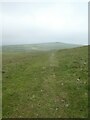
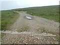
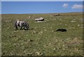
The above images may not be of the site on this page, they are loaded from Geograph.
Please Submit an Image of this site or go out and take one for us!
Click here to see more info for this site
Nearby sites
Key: Red: member's photo, Blue: 3rd party photo, Yellow: other image, Green: no photo - please go there and take one, Grey: site destroyed
Download sites to:
KML (Google Earth)
GPX (GPS waypoints)
CSV (Garmin/Navman)
CSV (Excel)
To unlock full downloads you need to sign up as a Contributory Member. Otherwise downloads are limited to 50 sites.
Turn off the page maps and other distractions
Nearby sites listing. In the following links * = Image available
608m NNE 16° Sourton Tors Cairn* Cairn (SX5460389438)
768m NNE 18° Sourton Tors Stone Circle* Stone Circle (SX54688958)
776m ENE 66° Corn Ridge Stone Ring Cairn Circle* Ring Cairn (SX5513889153)
799m ENE 69° Cornridge SE* Stone Circle (SX5517589119)
849m ENE 69° Corn Ridge Rock* Ring Cairn (SX5521989145)
927m ENE 72° Branscombe's Loaf* Ring Cairn (SX55318912)
1.4km S 184° Little Links Tor* Stone Row / Alignment (SX5428587463)
1.5km SSW 199° Great Nodden* Cist (SX5387487416)
1.8km NW 323° Sourton Green Saxon Cross* Ancient Cross (SX534903)
2.4km SSE 167° Great Links Tor Cairn* Cairn (SX5491686496)
2.5km NE 42° Homerton Hill North* Cist (SX56139065)
3.1km NE 47° Longstone Hill* Standing Stone (Menhir) (SX56729089)
3.2km E 88° Fordsland Ledge Chambered cairn* Chambered Cairn (SX57588888)
3.2km NE 43° Longstone Hill cairn* Cairn (SX56709113)
3.2km W 274° Bridestowe Holy Well Holy Well or Sacred Spring (SX512892)
3.6km E 83° High Willhays kerb cairn* Round Cairn (SX58038922)
3.6km E 79° High Willhays North Ring Cairn (SX58028944)
3.8km ENE 68° Yes Tor cairns* Barrow Cemetery (SX57959020)
4.0km S 179° Doe Tor* Cist (SX54388485)
4.0km NE 47° Black Down West Cairn (SX57469153)
4.7km S 187° White Hill North East* Cairn (SX5371384190)
5.0km S 189° White Hill North Cairn Field Ring Cairn (SX53528395)
5.0km WSW 253° Burley Wood Hillfort Hillfort (SX49548754)
5.4km SSW 194° White Hill South* Ring Cairn (SX5294283680)
5.5km S 176° Ger Tor Cairn (SX54658338)
View more nearby sites and additional images


 We would like to know more about this location. Please feel free to add a brief description and any relevant information in your own language.
 Wir möchten mehr über diese Stätte erfahren. Bitte zögern Sie nicht, eine kurze Beschreibung und relevante Informationen in Deutsch hinzuzufügen.
 Nous aimerions en savoir encore un peu sur les lieux. S'il vous plaît n'hesitez pas à ajouter une courte description et tous les renseignements pertinents dans votre propre langue.
 Quisieramos informarnos un poco más de las lugares. No dude en añadir una breve descripción y otros datos relevantes en su propio idioma.