

<< Text Pages >> Cloghboola More circle - Stone Circle in Ireland (Republic of) in Co. Cork
Submitted by Tom_Bullock on Tuesday, 08 October 2002 Page Views: 4401
Neolithic and Bronze AgeSite Name: Cloghboola More circle Alternative Name: CloghbollaCountry: Ireland (Republic of)
NOTE: This site is 2.9 km away from the location you searched for.
County: Co. Cork Type: Stone Circle
Nearest Town: Millstreet
Map Ref: W27588691
Discovery Map Number: D79
Latitude: 52.029978N Longitude: 9.055895W
Condition:
| 5 | Perfect |
| 4 | Almost Perfect |
| 3 | Reasonable but with some damage |
| 2 | Ruined but still recognisable as an ancient site |
| 1 | Pretty much destroyed, possibly visible as crop marks |
| 0 | No data. |
| -1 | Completely destroyed |
| 5 | Superb |
| 4 | Good |
| 3 | Ordinary |
| 2 | Not Good |
| 1 | Awful |
| 0 | No data. |
| 5 | Can be driven to, probably with disabled access |
| 4 | Short walk on a footpath |
| 3 | Requiring a bit more of a walk |
| 2 | A long walk |
| 1 | In the middle of nowhere, a nightmare to find |
| 0 | No data. |
| 5 | co-ordinates taken by GPS or official recorded co-ordinates |
| 4 | co-ordinates scaled from a detailed map |
| 3 | co-ordinates scaled from a bad map |
| 2 | co-ordinates of the nearest village |
| 1 | co-ordinates of the nearest town |
| 0 | no data |
Internal Links:
External Links:
Five-stone circle in Cork
Circle diameter: 9 feet, Number of stones: None
A Stone Circle is noted on the OS Map, but the incomplete circle was destroyed in 1984. The main axis was aligned N-S, and the stones were up to 4-feet in length.
You may be viewing yesterday's version of this page. To see the most up to date information please register for a free account.
Do not use the above information on other web sites or publications without permission of the contributor.
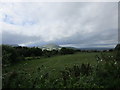
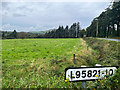
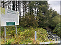
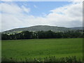
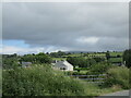
Nearby Images from Geograph Britain and Ireland:
©2018(licence)
©2023(licence)
©2023(licence)
©2021(licence)
©2021(licence)
The above images may not be of the site on this page, they are loaded from Geograph.
Please Submit an Image of this site or go out and take one for us!
Click here to see more info for this site
Nearby sites
Click here to view sites on an interactive map of the areaKey: Red: member's photo, Blue: 3rd party photo, Yellow: other image, Green: no photo - please go there and take one, Grey: site destroyed
Download sites to:
KML (Google Earth)
GPX (GPS waypoints)
CSV (Garmin/Navman)
CSV (Excel)
To unlock full downloads you need to sign up as a Contributory Member. Otherwise downloads are limited to 50 sites.
Turn off the page maps and other distractions
Nearby sites listing. In the following links * = Image available
402m NNE 17° Cloghboola More row Stone Row / Alignment
707m ESE 105° Knocknakilla NW Stone Row / Alignment
2.0km E 84° Lackdotia stone Standing Stone (Menhir)
2.2km SSW 198° Caherdowney Ringfort (cashel)* Stone Fort or Dun
2.3km SE 145° Knocknakilla Standing Stone* Standing Stone (Menhir) (W28858504)
2.4km SE 140° Knocknakilla Modern Dolmen* Modern Stone Circle etc (W29108508)
2.4km SSW 205° Caherdowney west ringfort (cashel)* Stone Fort or Dun
2.5km SW 227° Ballyvouskill cairn* Cairn
2.8km SSE 161° Glantane East NE* Stone Row / Alignment (W2847684240)
2.9km SW 227° Ballyvouskill circle* Stone Circle (W25418496)
2.9km SSE 165° Glantane East Stone Circle* Stone Circle (W2829784056)
3.3km SE 145° Knocknakilla* Stone Circle (W294842)
3.4km ESE 118° Cloghboola Beg Stone Row / Alignment (W30538526)
3.4km WNW 298° Kilmeedy - eastern stone circle* Stone Circle
3.4km ESE 118° Cloghboola Beg* Stone Circle (W3054185260)
3.4km ENE 78° Tullig Stone Circle Stone Circle (W30958760)
3.5km S 173° Glantane SW Stone Circle* Stone Circle (W27988344)
3.6km WNW 291° Unidentified (W242882)* Standing Stone (Menhir) (W2423088228)
3.6km WSW 249° Comeenatrush Lake Log Boat* Ancient Village or Settlement
3.8km SSE 150° Carraig an Ime (north east) wedge tomb* Wedge Tomb
3.9km S 175° Glantane East Southwest Stone Row* Stone Row / Alignment (W2787183068)
3.9km WNW 288° Kilmeedy W* Stone Circle (W23888814)
3.9km S 177° Glantane East Wedge Tomb* Wedge Tomb (W277830)
4.0km SSW 208° Caherdowney Wedge Tomb* Wedge Tomb
4.0km SE 139° Carriganimmy hut site* Ancient Village or Settlement
View more nearby sites and additional images


 We would like to know more about this location. Please feel free to add a brief description and any relevant information in your own language.
 Wir möchten mehr über diese Stätte erfahren. Bitte zögern Sie nicht, eine kurze Beschreibung und relevante Informationen in Deutsch hinzuzufügen.
 Nous aimerions en savoir encore un peu sur les lieux. S'il vous plaît n'hesitez pas à ajouter une courte description et tous les renseignements pertinents dans votre propre langue.
 Quisieramos informarnos un poco más de las lugares. No dude en añadir una breve descripción y otros datos relevantes en su propio idioma.