


<< Our Photo Pages >> Gold well - Holy Well or Sacred Spring in England in Kent
Submitted by HOLYWELL on Tuesday, 29 August 2006 Page Views: 7411
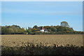
Springs and Holy WellsSite Name: Gold well Alternative Name: The Golden WellCountry: England
NOTE: This site is 5.0 km away from the location you searched for.
County: Kent Type: Holy Well or Sacred Spring
Nearest Village: Great Chart
Map Ref: TQ96904250
Latitude: 51.147885N Longitude: 0.813795E
Condition:
| 5 | Perfect |
| 4 | Almost Perfect |
| 3 | Reasonable but with some damage |
| 2 | Ruined but still recognisable as an ancient site |
| 1 | Pretty much destroyed, possibly visible as crop marks |
| 0 | No data. |
| -1 | Completely destroyed |
| 5 | Superb |
| 4 | Good |
| 3 | Ordinary |
| 2 | Not Good |
| 1 | Awful |
| 0 | No data. |
| 5 | Can be driven to, probably with disabled access |
| 4 | Short walk on a footpath |
| 3 | Requiring a bit more of a walk |
| 2 | A long walk |
| 1 | In the middle of nowhere, a nightmare to find |
| 0 | No data. |
| 5 | co-ordinates taken by GPS or official recorded co-ordinates |
| 4 | co-ordinates scaled from a detailed map |
| 3 | co-ordinates scaled from a bad map |
| 2 | co-ordinates of the nearest village |
| 1 | co-ordinates of the nearest town |
| 0 | no data |
Internal Links:
External Links:
")
Local antiquarian Igglesden (1901-1946) records a tradition of a curative spring, called The Golden Well which he considers a feeder of the Medway, arising beneath the cellar of a house.
He notes that the house:
‘Takes its name from a golden well, that lies under the cellar, and there used to be a legend the effect that the water possessed curative powers over the certain diseases.’
It arises at the base of the rag stone cellar wall, into a circular stone lined well shaft close to a dryer!. This although appearing to be only a foot or so deep, was once deeper, but filled when the present house was erected over the cellar. Recent analysis shows it was not potable, yet it is remarkable clear. Interestingly, the owner, Mr. Peter Green, told me of a tradition of a tunnel which lead from the cellar to the edge of Romney Marsh, or rather the sea. Such traditions are commonly associated with holy wells. He thought ge came across the tunnel whilst building a wall nearby.
However, the origin of the well is not clear cut. Wallenberg (1934), conversely, believes that the Manor's name derives from the Goldwell family. The explanations are not exclusive. The family may have obtained the name from being guardians of the well. Goldwell may derive from golden votive offerings given to the spring, or the discovery of a hidden hoard from the Reformation, a common myth embroiled around such sites. Perhaps, the owner may excavate the well and discover the truth?
Access to the Golden Well is difficult as the well lies in the private cellar of Goldwell Manor, and I thank the owner for access.
You may be viewing yesterday's version of this page. To see the most up to date information please register for a free account.
Do not use the above information on other web sites or publications without permission of the contributor.
Nearby Images from Geograph Britain and Ireland:
©2009(licence)
©2007(licence)
©2007(licence)
©2023(licence)
©2020(licence)
The above images may not be of the site on this page, they are loaded from Geograph.
Please Submit an Image of this site or go out and take one for us!
Click here to see more info for this site
Nearby sites
Key: Red: member's photo, Blue: 3rd party photo, Yellow: other image, Green: no photo - please go there and take one, Grey: site destroyed
Download sites to:
KML (Google Earth)
GPX (GPS waypoints)
CSV (Garmin/Navman)
CSV (Excel)
To unlock full downloads you need to sign up as a Contributory Member. Otherwise downloads are limited to 50 sites.
Turn off the page maps and other distractions
Nearby sites listing. In the following links * = Image available
2.3km NNE 32° Lady well (Hothfield) Holy Well or Sacred Spring (TQ98054452)
5.9km NNE 28° Pilgrims Way 6 Ancient Trackway (TQ995478)
6.1km NE 39° Lady Well ( East well ) Holy Well or Sacred Spring (TR006474)
6.1km NE 50° Duke's Spring* Holy Well or Sacred Spring (TR015466)
6.6km NE 43° Pilgrims Way 7 Ancient Trackway (TR013475)
6.9km NE 48° Plantagenet's Well* Holy Well or Sacred Spring (TR019473)
8.4km NNE 26° The Lees Denehole Ancient Mine, Quarry or other Industry (TR003502)
8.6km ENE 64° Pilgrims Way 8 Ancient Trackway (TR045466)
9.5km NE 44° Jackets Field Long Barrow* Long Barrow (TR03304961)
9.8km ENE 72° St. Eustace's Well* Holy Well or Sacred Spring (TR0617045889)
10.1km NE 42° Kings Wood Mound* Misc. Earthwork (TR034502)
10.2km SE 135° Bilsington Priory Holy Well Holy Well or Sacred Spring (TR04433565)
10.8km NE 43° Kings Wood Barrow* Round Barrow(s) (TR04005060)
10.9km ENE 68° The Junipers Tumulus* Round Barrow(s) (TR069470)
11.4km ENE 78° Broad Downs Bowl Barrow* Round Barrow(s) (TR08004520)
12.1km ENE 62° Warren Wood Saucer Barrow Round Barrow(s) (TR07444852)
12.5km SE 128° Aldington Knoll Barrow* Round Barrow(s) (TR07083525)
12.7km S 189° Appledore Round Barrow* Round Barrow(s) (TQ95412993)
13.4km ENE 78° Shrub's Wood Long Barrow* Long Barrow (TR09914587)
14.0km ESE 123° Our Lady's Well (Court-At-Street) Holy Well or Sacred Spring (TR090353)
14.7km ENE 62° Eggringe Wood Bowl Barrow Round Barrow(s) (TR09664979)
15.0km ENE 61° Pennypot Lane Bowl Barrow* Round Barrow(s) (TR09675035)
15.0km ENE 60° Eggringe Wood Western Bowl Barrow* Round Barrow(s) (TR09655041)
15.0km E 96° Stowting Court Barrow Round Barrow(s) (TR11904161)
15.0km ENE 63° Buckholt Farm Barrows Round Barrow(s) (TR10114972)
View more nearby sites and additional images


 We would like to know more about this location. Please feel free to add a brief description and any relevant information in your own language.
 Wir möchten mehr über diese Stätte erfahren. Bitte zögern Sie nicht, eine kurze Beschreibung und relevante Informationen in Deutsch hinzuzufügen.
 Nous aimerions en savoir encore un peu sur les lieux. S'il vous plaît n'hesitez pas à ajouter une courte description et tous les renseignements pertinents dans votre propre langue.
 Quisieramos informarnos un poco más de las lugares. No dude en añadir una breve descripción y otros datos relevantes en su propio idioma.