


<< Our Photo Pages >> St. Katherine's Well (Winchelsea) - Holy Well or Sacred Spring in England in East Sussex
Submitted by DavidCWoods on Monday, 20 February 2006 Page Views: 11950
Springs and Holy WellsSite Name: St. Katherine's Well (Winchelsea) Alternative Name: Queen Elizabeth's WellCountry: England
NOTE: This site is 3.1 km away from the location you searched for.
County: East Sussex Type: Holy Well or Sacred Spring
Nearest Town: Hastings Nearest Village: Winchelsea
Map Ref: TQ90601760
Latitude: 50.926363N Longitude: 0.710742E
Condition:
| 5 | Perfect |
| 4 | Almost Perfect |
| 3 | Reasonable but with some damage |
| 2 | Ruined but still recognisable as an ancient site |
| 1 | Pretty much destroyed, possibly visible as crop marks |
| 0 | No data. |
| -1 | Completely destroyed |
| 5 | Superb |
| 4 | Good |
| 3 | Ordinary |
| 2 | Not Good |
| 1 | Awful |
| 0 | No data. |
| 5 | Can be driven to, probably with disabled access |
| 4 | Short walk on a footpath |
| 3 | Requiring a bit more of a walk |
| 2 | A long walk |
| 1 | In the middle of nowhere, a nightmare to find |
| 0 | No data. |
| 5 | co-ordinates taken by GPS or official recorded co-ordinates |
| 4 | co-ordinates scaled from a detailed map |
| 3 | co-ordinates scaled from a bad map |
| 2 | co-ordinates of the nearest village |
| 1 | co-ordinates of the nearest town |
| 0 | no data |
Internal Links:
External Links:
I have visited· I would like to visit
mateast would like to visit
JRB visited on 6th May 2012 - their rating: Cond: 3 Amb: 2 Access: 4 Visited 6 May 2012. DavidCWoods said it all.
 (PID:19114)")
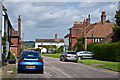
The well is reached by locating the junction of Mill Road and Barrack Square and following the path beside the house named Spring Steps. The muddy track leads eventually to the steps, supposedly leading to the well - in fact they lead to a point about 15 feet away from it, with a scrabble across a muddy cliff needed to reach it.
Bearing in mind that a main road runs along the base of the cliff, I wouldn't recommend trying this in wet weather - it's very slippery!
The well was renamed in honour of the first Queen Elizabeth at the time of her visit in 1573.
You may be viewing yesterday's version of this page. To see the most up to date information please register for a free account.
 (PID:146236)")
Do not use the above information on other web sites or publications without permission of the contributor.
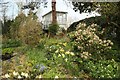
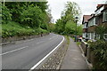
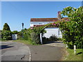
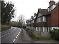
Nearby Images from Geograph Britain and Ireland:
©2018(licence)
©2023(licence)
©2017(licence)
©2015(licence)
©2013(licence)
The above images may not be of the site on this page, they are loaded from Geograph.
Please Submit an Image of this site or go out and take one for us!
Click here to see more info for this site
Nearby sites
Key: Red: member's photo, Blue: 3rd party photo, Yellow: other image, Green: no photo - please go there and take one, Grey: site destroyed
Download sites to:
KML (Google Earth)
GPX (GPS waypoints)
CSV (Garmin/Navman)
CSV (Excel)
To unlock full downloads you need to sign up as a Contributory Member. Otherwise downloads are limited to 50 sites.
Turn off the page maps and other distractions
Nearby sites listing. In the following links * = Image available
705m W 280° St. Leonard's Well (Winchelsea)* Holy Well or Sacred Spring (TQ899177)
3.1km NE 35° Queen's Elizabeth's Well* Holy Well or Sacred Spring (TQ923202)
9.7km ENE 78° Nicker Pits Holy Well or Sacred Spring (TR000200)
10.5km NNE 21° Hogwell Holy Well or Sacred Spring (TQ940275)
10.7km SW 226° East Hill Settlement Ancient Village or Settlement (TQ832099)
11.4km SW 229° St Clements Caves Cave or Rock Shelter (TQ823098)
11.7km SW 228° Hastings Castle* Hillfort (TQ821095)
11.7km SW 234° St. Andrew's Spa Holy Well or Sacred Spring (TQ813104)
13.2km NNE 23° Appledore Round Barrow* Round Barrow(s) (TQ95412993)
16.0km NNW 333° Jacob's Well (Kent) Holy Well or Sacred Spring (TQ82703155)
20.0km WSW 240° Bexhill Museum Museum (TQ736070)
21.9km W 263° Ladyspring* Holy Well or Sacred Spring (TQ689140)
22.0km W 263° Ironspring* Holy Well or Sacred Spring (TQ688141)
22.7km NE 39° Bilsington Priory Holy Well Holy Well or Sacred Spring (TR04433565)
24.1km NE 45° Aldington Knoll Barrow* Round Barrow(s) (TR07083525)
24.7km NW 314° The Lady's Well (Bedgebury) Holy Well or Sacred Spring (TQ72133414)
24.9km NW 314° Lady well (Bedgebury) Holy Well or Sacred Spring (TQ7212534404)
25.5km NE 48° Our Lady's Well (Court-At-Street) Holy Well or Sacred Spring (TR090353)
25.7km NNE 16° Gold well* Holy Well or Sacred Spring (TQ96904250)
27.9km NNE 18° Lady well (Hothfield) Holy Well or Sacred Spring (TQ98054452)
29.2km NW 312° Lady Well (Lamberhurst)* Holy Well or Sacred Spring (TQ682364)
30.6km NE 55° Willow Wood Barrow Round Barrow(s) (TR15023612)
30.7km ENE 58° Holywelle Holy Well or Sacred Spring (TR161349)
31.0km NNE 23° Duke's Spring* Holy Well or Sacred Spring (TR015466)
31.3km W 261° Amberstone Marker Stone (TQ598114)
View more nearby sites and additional images


 We would like to know more about this location. Please feel free to add a brief description and any relevant information in your own language.
 Wir möchten mehr über diese Stätte erfahren. Bitte zögern Sie nicht, eine kurze Beschreibung und relevante Informationen in Deutsch hinzuzufügen.
 Nous aimerions en savoir encore un peu sur les lieux. S'il vous plaît n'hesitez pas à ajouter une courte description et tous les renseignements pertinents dans votre propre langue.
 Quisieramos informarnos un poco más de las lugares. No dude en añadir una breve descripción y otros datos relevantes en su propio idioma.