


<< Text Pages >> Chadwell St Mary - Henge in England in Essex
Submitted by Thorgrim on Sunday, 18 December 2005 Page Views: 6579
Neolithic and Bronze AgeSite Name: Chadwell St MaryCountry: England
NOTE: This site is 3.3 km away from the location you searched for.
County: Essex Type: Henge
Nearest Town: Grays
Map Ref: TQ657790
Latitude: 51.485677N Longitude: 0.385114E
Condition:
| 5 | Perfect |
| 4 | Almost Perfect |
| 3 | Reasonable but with some damage |
| 2 | Ruined but still recognisable as an ancient site |
| 1 | Pretty much destroyed, possibly visible as crop marks |
| 0 | No data. |
| -1 | Completely destroyed |
| 5 | Superb |
| 4 | Good |
| 3 | Ordinary |
| 2 | Not Good |
| 1 | Awful |
| 0 | No data. |
| 5 | Can be driven to, probably with disabled access |
| 4 | Short walk on a footpath |
| 3 | Requiring a bit more of a walk |
| 2 | A long walk |
| 1 | In the middle of nowhere, a nightmare to find |
| 0 | No data. |
| 5 | co-ordinates taken by GPS or official recorded co-ordinates |
| 4 | co-ordinates scaled from a detailed map |
| 3 | co-ordinates scaled from a bad map |
| 2 | co-ordinates of the nearest village |
| 1 | co-ordinates of the nearest town |
| 0 | no data |
Internal Links:
External Links:
Henge in Essex
Visible as a crop mark. Do you have any further information to add?
You may be viewing yesterday's version of this page. To see the most up to date information please register for a free account.
Do not use the above information on other web sites or publications without permission of the contributor.
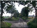
Nearby Images from Geograph Britain and Ireland:
©2019(licence)
©2019(licence)
©2019(licence)
©2006(licence)
©2012(licence)
The above images may not be of the site on this page, they are loaded from Geograph.
Please Submit an Image of this site or go out and take one for us!
Click here to see more info for this site
Nearby sites
Key: Red: member's photo, Blue: 3rd party photo, Yellow: other image, Green: no photo - please go there and take one, Grey: site destroyed
Download sites to:
KML (Google Earth)
GPX (GPS waypoints)
CSV (Garmin/Navman)
CSV (Excel)
To unlock full downloads you need to sign up as a Contributory Member. Otherwise downloads are limited to 50 sites.
Turn off the page maps and other distractions
Nearby sites listing. In the following links * = Image available
2.0km WSW 241° Chadwell* Holy Well or Sacred Spring (TQ6478)
6.6km NNW 328° Church Field (North Ockendon) Cairn (TQ620845)
6.8km SW 225° Bakers Hole Ancient Mine, Quarry or other Industry (TQ610740)
7.0km SE 131° Barrow Hill (Kent)* Round Barrow(s) (TQ711746)
7.3km SW 220° Southfleet Road Ebbsfleet Elephant Butchery Site Not Known (by us) (TQ6117573260)
7.3km SW 235° Swanscombe* Ancient Mine, Quarry or other Industry (TQ598746)
7.6km SSW 213° Spring Head Holy Well or Sacred Spring (TQ61767246)
7.6km WSW 240° The Monks Well Holy Well or Sacred Spring (TQ5918474982)
7.7km SSE 164° Shorne Barrow Round Barrow(s) (TQ68007169)
8.1km NE 53° Corringham Henge (TQ720841)
8.2km S 184° Single Well (Iflield) Holy Well or Sacred Spring (TQ65387081)
8.7km SSE 168° Randall Heath Barrow Round Barrow(s) (TQ67747051)
8.8km SW 224° Lustrating Pool Holy Well or Sacred Spring (TQ598724)
8.9km SSE 162° Randall Wood Barrow Round Barrow(s) (TQ68777069)
8.9km ESE 121° Cliffe Bronze Age Settlement Ancient Village or Settlement (TQ735746)
9.0km NW 314° Seven Springs (North Ockendon) Holy Well or Sacred Spring (TQ590850)
9.1km NW 312° St. Cedd's Well (North Ockendon)* Holy Well or Sacred Spring (TQ587848)
9.4km E 91° Cooling Marshes Mound 1 Ancient Mine, Quarry or other Industry (TQ7511779139)
9.4km S 171° St. Thomas's Well Holy Well or Sacred Spring (TQ67446972)
9.5km E 91° Cooling Marshes Mound 2 Ancient Mine, Quarry or other Industry (TQ7527879124)
9.7km E 91° Cliffe Saltings Mound Ancient Mine, Quarry or other Industry (TQ7545279075)
9.8km S 172° The Mount* Round Barrow(s) (TQ67386934)
9.9km E 91° Cliffe Mound Ancient Mine, Quarry or other Industry (TQ7566379139)
10.5km SSE 166° Cobham Hall Mock Stone circle* Modern Stone Circle etc (TQ685689)
10.6km S 175° Cobham Megalith Burial Chamber or Dolmen (TQ669685)
View more nearby sites and additional images


 We would like to know more about this location. Please feel free to add a brief description and any relevant information in your own language.
 Wir möchten mehr über diese Stätte erfahren. Bitte zögern Sie nicht, eine kurze Beschreibung und relevante Informationen in Deutsch hinzuzufügen.
 Nous aimerions en savoir encore un peu sur les lieux. S'il vous plaît n'hesitez pas à ajouter une courte description et tous les renseignements pertinents dans votre propre langue.
 Quisieramos informarnos un poco más de las lugares. No dude en añadir una breve descripción y otros datos relevantes en su propio idioma.