


<< Text Pages >> Church Hill Standing Stones - Natural Stone / Erratic / Other Natural Feature in England in West Sussex
Submitted by Andy B on Wednesday, 25 May 2022 Page Views: 1584
Date UncertainSite Name: Church Hill Standing StonesCountry: England
NOTE: This site is 0.5 km away from the location you searched for.
County: West Sussex Type: Natural Stone / Erratic / Other Natural Feature
Nearest Town: Brighton
Map Ref: TQ2554506318
Latitude: 50.842776N Longitude: 0.218217W
Condition:
| 5 | Perfect |
| 4 | Almost Perfect |
| 3 | Reasonable but with some damage |
| 2 | Ruined but still recognisable as an ancient site |
| 1 | Pretty much destroyed, possibly visible as crop marks |
| 0 | No data. |
| -1 | Completely destroyed |
| 5 | Superb |
| 4 | Good |
| 3 | Ordinary |
| 2 | Not Good |
| 1 | Awful |
| 0 | No data. |
| 5 | Can be driven to, probably with disabled access |
| 4 | Short walk on a footpath |
| 3 | Requiring a bit more of a walk |
| 2 | A long walk |
| 1 | In the middle of nowhere, a nightmare to find |
| 0 | No data. |
| 5 | co-ordinates taken by GPS or official recorded co-ordinates |
| 4 | co-ordinates scaled from a detailed map |
| 3 | co-ordinates scaled from a bad map |
| 2 | co-ordinates of the nearest village |
| 1 | co-ordinates of the nearest town |
| 0 | no data |
Internal Links:
External Links:
Church Hill in Brighton was reputedly the site of some impressive standing stones, they surrounded the church of St. Nicholas. 19th century sketches (in Brighton Museum) show that at least two stones were upright at the time, an urn containing human bones was found at the base of one stone (which was never recorded for posterity). Two beakers were also found in Church Hill, indicating Neolithic/Iron Age burials. As with the Goldstone (see nearby sites list), building work has destroyed any vestiges of these stones so no-one knows if they were a natural rock deposit used for burial purposes or whether they were erected as a monument to mark a noble burial.
It is also claimed that these stones were the ones used to create the base of the Victoria fountain in Old Steine gardens. So one way or another it is almost assured that some ancient stones were used for this purpose.
Source: Heritage Action
You may be viewing yesterday's version of this page. To see the most up to date information please register for a free account.
Do not use the above information on other web sites or publications without permission of the contributor.
Nearby Images from Geograph Britain and Ireland:
©2012(licence)
©2018(licence)
©2009(licence)
©2008(licence)
©2008(licence)
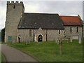
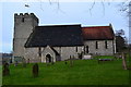
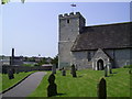
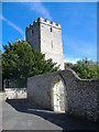
The above images may not be of the site on this page, they are loaded from Geograph.
Please Submit an Image of this site or go out and take one for us!
Click here to see more info for this site
Nearby sites
Key: Red: member's photo, Blue: 3rd party photo, Yellow: other image, Green: no photo - please go there and take one, Grey: site destroyed
Download sites to:
KML (Google Earth)
GPX (GPS waypoints)
CSV (Garmin/Navman)
CSV (Excel)
To unlock full downloads you need to sign up as a Contributory Member. Otherwise downloads are limited to 50 sites.
Turn off the page maps and other distractions
Nearby sites listing. In the following links * = Image available
1.5km SE 138° St. Leonards Church Sarsens Natural Stone / Erratic / Other Natural Feature (TQ26560524)
1.8km WNW 294° Rest And Be Thankful Marker Stone (TQ239070)
3.1km ESE 121° Hove Museum and Art Gallery* Museum (TQ282048)
3.1km E 97° The Goldstone* Natural Stone / Erratic / Other Natural Feature (TQ2868306021)
3.2km NW 308° Thunders Barrow Misc. Earthwork (TQ230082)
3.2km NW 305° Thunders Barrow Field System Misc. Earthwork (TQ229081)
3.2km NNW 328° Tenant Hill Tumulus Round Barrow(s) (TQ238090)
3.3km NW 308° Thundersbarrow Hill Hillfort (TQ229083)
3.3km NNW 343° Tenant Hill Fields System Misc. Earthwork (TQ245095)
3.7km N 356° Adder Bottom Tumulus Round Barrow(s) (TQ252100)
3.9km N 350° Fulking Hill Tumulus 2 Round Barrow(s) (TQ24771011)
4.1km ESE 109° Hove Barrow* Round Barrow(s) (TQ2948105096)
4.5km N 352° Fulking Hill Tumulus 1* Round Barrow(s) (TQ248108)
4.8km N 6° Devil's Dyke (West Sussex)* Hillfort (TQ2597311088)
5.0km NNW 341° Edburton Hill Motte and Bailey* Artificial Mound (TQ23771102)
5.2km NNW 337° Edburton Hill Tumulus* Round Barrow(s) (TQ23381100)
5.9km NNE 16° North Hill Tumuli Barrow Cemetery (TQ270120)
6.0km ESE 111° Brighton Museum and Art Gallery* Museum (TQ312043)
6.2km W 275° Our Lady's Well (Lancing) Holy Well or Sacred Spring (TQ193067)
6.8km E 79° Hollingbury* Hillfort (TQ322078)
7.6km ESE 103° Whitehawk* Causewayed Enclosure (TQ33030477)
7.7km W 274° Lancing Down Romano-Celtic Temple* Ancient Temple (TQ17850670)
7.9km NNE 23° Wolstonbury* Ancient Village or Settlement (TQ28401368)
7.9km ENE 63° Rocky Clump* Natural Stone / Erratic / Other Natural Feature (TQ325101)
8.2km ENE 63° Pudding Bag Tumuli Barrow Cemetery (TQ328102)
View more nearby sites and additional images


 We would like to know more about this location. Please feel free to add a brief description and any relevant information in your own language.
 Wir möchten mehr über diese Stätte erfahren. Bitte zögern Sie nicht, eine kurze Beschreibung und relevante Informationen in Deutsch hinzuzufügen.
 Nous aimerions en savoir encore un peu sur les lieux. S'il vous plaît n'hesitez pas à ajouter une courte description et tous les renseignements pertinents dans votre propre langue.
 Quisieramos informarnos un poco más de las lugares. No dude en añadir una breve descripción y otros datos relevantes en su propio idioma.