


<< Our Photo Pages >> Beech Bottom Dyke - Ancient Village or Settlement in England in Hertfordshire
Submitted by vicky on Tuesday, 31 August 2004 Page Views: 14717
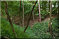
Multi-periodSite Name: Beech Bottom DykeCountry: England
NOTE: This site is 0.6 km away from the location you searched for.
County: Hertfordshire Type: Ancient Village or Settlement
Map Ref: TL155093 Landranger Map Number: 166
Latitude: 51.770469N Longitude: 0.327509W
Condition:
| 5 | Perfect |
| 4 | Almost Perfect |
| 3 | Reasonable but with some damage |
| 2 | Ruined but still recognisable as an ancient site |
| 1 | Pretty much destroyed, possibly visible as crop marks |
| 0 | No data. |
| -1 | Completely destroyed |
| 5 | Superb |
| 4 | Good |
| 3 | Ordinary |
| 2 | Not Good |
| 1 | Awful |
| 0 | No data. |
| 5 | Can be driven to, probably with disabled access |
| 4 | Short walk on a footpath |
| 3 | Requiring a bit more of a walk |
| 2 | A long walk |
| 1 | In the middle of nowhere, a nightmare to find |
| 0 | No data. |
| 5 | co-ordinates taken by GPS or official recorded co-ordinates |
| 4 | co-ordinates scaled from a detailed map |
| 3 | co-ordinates scaled from a bad map |
| 2 | co-ordinates of the nearest village |
| 1 | co-ordinates of the nearest town |
| 0 | no data |
Internal Links:
External Links:
")
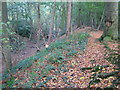
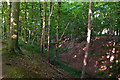
Running behind modern houses in St Albans, this earthwork is thought to have originally joined up with the Devil's Dyke to create a defensive earthwork running from the River Lea to the River Ver.
The site can be seen from across the road from the Ancient Briton pub, although this end is a bit of a dumping ground for the local youth population.
Have you visited this site? Please add a comment below.
You may be viewing yesterday's version of this page. To see the most up to date information please register for a free account.
Do not use the above information on other web sites or publications without permission of the contributor.
Nearby Images from Geograph Britain and Ireland:
©2005(licence)
©2015(licence)
©2007(licence)
©2015(licence)
©2015(licence)
The above images may not be of the site on this page, they are loaded from Geograph.
Please Submit an Image of this site or go out and take one for us!
Click here to see more info for this site
Nearby sites
Key: Red: member's photo, Blue: 3rd party photo, Yellow: other image, Green: no photo - please go there and take one, Grey: site destroyed
Download sites to:
KML (Google Earth)
GPX (GPS waypoints)
CSV (Garmin/Navman)
CSV (Excel)
To unlock full downloads you need to sign up as a Contributory Member. Otherwise downloads are limited to 50 sites.
Turn off the page maps and other distractions
Nearby sites listing. In the following links * = Image available
2.4km SW 223° St Albans Puddingstones* Natural Stone / Erratic / Other Natural Feature (TL139075)
2.7km SSW 200° Holy Well (St. Albans)* Holy Well or Sacred Spring (TL14640670)
2.8km SW 229° Verulamium Puddingstone Natural Stone / Erratic / Other Natural Feature (TL134074)
3.3km WSW 256° Devil's Ditch (Hertfordshire) Ancient Village or Settlement (TL123084)
4.7km SE 136° Tyttenhanger Puddingstones Natural Stone / Erratic / Other Natural Feature (TL189060)
5.1km NE 39° Devil's Dyke (Hertfordshire)* Ancient Village or Settlement (TL186133)
5.6km SW 225° Potterscrouch Puddingstones Natural Stone / Erratic / Other Natural Feature (TL116052)
6.3km WNW 290° The Aubreys* Hillfort (TL095113)
8.3km SW 236° Bedmond Puddingstone Natural Stone / Erratic / Other Natural Feature (TL087045)
8.5km E 89° Mill Green Museum Museum (TL240097)
10.2km NE 49° Welwyn Puddingstone* Natural Stone / Erratic / Other Natural Feature (TL231162)
10.4km NE 51° Welwyn Roman Baths* Ancient Village or Settlement (TL23451602)
11.1km ESE 105° Wildhill Puddingstone Natural Stone / Erratic / Other Natural Feature (TL263067)
11.2km WSW 246° Kings Langley Cursus Cursus (TL0535804425)
12.4km SE 132° Potters Bar Museum Museum (TL2494101262)
12.7km W 280° Great Gaddesden Puddingstone* Natural Stone / Erratic / Other Natural Feature (TL029112)
12.7km W 280° Great Gaddesden church puddingstones* Natural Stone / Erratic / Other Natural Feature (TL02871127)
12.9km NE 55° Perry's Grove Boundary Ditch* Misc. Earthwork (TL25851700)
13.1km ESE 119° Griffin's Hole* Holy Well or Sacred Spring (TL2720403249)
13.5km SW 235° Chipperfield Common Round Barrows* Round Barrow(s) (TL04620126)
13.6km SSW 208° Cassiobury Park barrow* Round Barrow(s) (TQ094971)
13.7km WSW 241° Towerhill (Herts) Puddingstone* Natural Stone / Erratic / Other Natural Feature (TL0363802375)
15.5km S 180° Stanmore common barrows Misc. Earthwork (TQ15869381)
15.9km SW 228° Church Hill puddingstones Natural Stone / Erratic / Other Natural Feature (TQ03899840)
16.5km NNE 31° Six Hills* Round Barrow(s) (TL23742365)
View more nearby sites and additional images


 We would like to know more about this location. Please feel free to add a brief description and any relevant information in your own language.
 Wir möchten mehr über diese Stätte erfahren. Bitte zögern Sie nicht, eine kurze Beschreibung und relevante Informationen in Deutsch hinzuzufügen.
 Nous aimerions en savoir encore un peu sur les lieux. S'il vous plaît n'hesitez pas à ajouter une courte description et tous les renseignements pertinents dans votre propre langue.
 Quisieramos informarnos un poco más de las lugares. No dude en añadir una breve descripción y otros datos relevantes en su propio idioma.