


<< Our Photo Pages >> Gear Hut Circle and Round - Ancient Village or Settlement in England in Cornwall
Submitted by Bladup on Monday, 14 January 2013 Page Views: 3763
Multi-periodSite Name: Gear Hut Circle and RoundCountry: England
NOTE: This site is 0.6 km away from the location you searched for.
County: Cornwall Type: Ancient Village or Settlement
Map Ref: SW49653484
Latitude: 50.160615N Longitude: 5.506561W
Condition:
| 5 | Perfect |
| 4 | Almost Perfect |
| 3 | Reasonable but with some damage |
| 2 | Ruined but still recognisable as an ancient site |
| 1 | Pretty much destroyed, possibly visible as crop marks |
| 0 | No data. |
| -1 | Completely destroyed |
| 5 | Superb |
| 4 | Good |
| 3 | Ordinary |
| 2 | Not Good |
| 1 | Awful |
| 0 | No data. |
| 5 | Can be driven to, probably with disabled access |
| 4 | Short walk on a footpath |
| 3 | Requiring a bit more of a walk |
| 2 | A long walk |
| 1 | In the middle of nowhere, a nightmare to find |
| 0 | No data. |
| 5 | co-ordinates taken by GPS or official recorded co-ordinates |
| 4 | co-ordinates scaled from a detailed map |
| 3 | co-ordinates scaled from a bad map |
| 2 | co-ordinates of the nearest village |
| 1 | co-ordinates of the nearest town |
| 0 | no data |
Internal Links:
External Links:
I have visited· I would like to visit
Bladup has visited here
")
Pastscape says "At SW49633481 is a Round scheduled 450 yards NW of Lower Chellew Farm and at SW 49653484 is a Hut circle".
You may be viewing yesterday's version of this page. To see the most up to date information please register for a free account.
")
")
")
Do not use the above information on other web sites or publications without permission of the contributor.
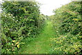
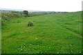
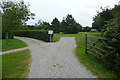
Nearby Images from Geograph Britain and Ireland:
©2011(licence)
©2011(licence)
©2011(licence)

©2008(licence)

©2019(licence)
The above images may not be of the site on this page, they are loaded from Geograph.
Please Submit an Image of this site or go out and take one for us!
Click here to see more info for this site
Nearby sites
Key: Red: member's photo, Blue: 3rd party photo, Yellow: other image, Green: no photo - please go there and take one, Grey: site destroyed
Download sites to:
KML (Google Earth)
GPX (GPS waypoints)
CSV (Garmin/Navman)
CSV (Excel)
To unlock full downloads you need to sign up as a Contributory Member. Otherwise downloads are limited to 50 sites.
Turn off the page maps and other distractions
Nearby sites listing. In the following links * = Image available
1.2km W 275° Castle An Dinas (Penwith)* Hillfort (SW48493500)
1.2km NE 44° Trembethow barrows Barrow Cemetery (SW50513564)
1.4km NNE 29° Brunnion Cross* Ancient Cross (SW50373600)
1.4km ESE 118° St Michael's standing stone* Modern Stone Circle etc (SW509341)
1.5km WNW 303° Noon Digery Enclosure* Ancient Village or Settlement (SW48413573)
1.6km WNW 282° Tonkins Downs* Round Cairn (SW48143523)
1.6km N 10° Cuckoo Rock (Cornwall)* Rock Outcrop (SW50003638)
1.8km ENE 58° Ninnesbridge Barrow Cemetery* Barrow Cemetery (SW51253575)
2.0km W 260° Gulval downs settlement* Ancient Village or Settlement (SW477346)
2.0km SSE 152° Ludgvan Crosses* Ancient Cross (SW50503305)
2.0km SSW 196° Tremenheere Standing Stone* Standing Stone (Menhir) (SW4900032900)
2.1km NNE 21° Cripplesease Settlement* Ancient Village or Settlement (SW505368)
2.2km SE 134° Crowlas holed stone* Holed Stone (SW51133325)
2.2km S 172° Tregarthen hedge stone* Standing Stone (Menhir) (SW4986332625)
2.2km E 99° Tregellas Well* Holy Well or Sacred Spring (SW5183734388)
2.3km N 11° Giew Mine* Standing Stone (Menhir) (SW502371)
2.4km NNE 16° Trink Hill* Round Barrow(s) (SW504371)
2.4km W 272° Chysauster* Ancient Village or Settlement (SW47243502)
2.4km W 267° Chysauster Fogou* Souterrain (Fogou, Earth House) (SW47203483)
2.5km S 185° Tolver Hut site and Outcrop* Rock Outcrop (SW493324)
2.5km NE 53° Trencrom Castle Well* Holy Well or Sacred Spring (SW51723625)
2.5km W 279° Carnaquidden Kerb Cairn* Ring Cairn (SW47163535)
2.5km NE 55° Trencrom* Hillfort (SW51803622)
2.6km E 90° Collurian Well Holy Well or Sacred Spring (SW52243472)
2.7km ESE 111° Tregender Cross* Ancient Cross (SW5212333747)
View more nearby sites and additional images


 We would like to know more about this location. Please feel free to add a brief description and any relevant information in your own language.
 Wir möchten mehr über diese Stätte erfahren. Bitte zögern Sie nicht, eine kurze Beschreibung und relevante Informationen in Deutsch hinzuzufügen.
 Nous aimerions en savoir encore un peu sur les lieux. S'il vous plaît n'hesitez pas à ajouter une courte description et tous les renseignements pertinents dans votre propre langue.
 Quisieramos informarnos un poco más de las lugares. No dude en añadir una breve descripción y otros datos relevantes en su propio idioma.