


<< Text Pages >> Cefn Carnedd - Hillfort in Wales in Powys
Submitted by vicky on Monday, 26 August 2002 Page Views: 12509
Iron Age and Later PrehistorySite Name: Cefn CarneddCountry: Wales
NOTE: This site is 1.3 km away from the location you searched for.
County: Powys Type: Hillfort
Nearest Village: Llandinam
Map Ref: SO016900 Landranger Map Number: 136
Latitude: 52.498995N Longitude: 3.450945W
Condition:
| 5 | Perfect |
| 4 | Almost Perfect |
| 3 | Reasonable but with some damage |
| 2 | Ruined but still recognisable as an ancient site |
| 1 | Pretty much destroyed, possibly visible as crop marks |
| 0 | No data. |
| -1 | Completely destroyed |
| 5 | Superb |
| 4 | Good |
| 3 | Ordinary |
| 2 | Not Good |
| 1 | Awful |
| 0 | No data. |
| 5 | Can be driven to, probably with disabled access |
| 4 | Short walk on a footpath |
| 3 | Requiring a bit more of a walk |
| 2 | A long walk |
| 1 | In the middle of nowhere, a nightmare to find |
| 0 | No data. |
| 5 | co-ordinates taken by GPS or official recorded co-ordinates |
| 4 | co-ordinates scaled from a detailed map |
| 3 | co-ordinates scaled from a bad map |
| 2 | co-ordinates of the nearest village |
| 1 | co-ordinates of the nearest town |
| 0 | no data |
Be the first person to rate this site - see the 'Contribute!' box in the right hand menu.
Internal Links:
External Links:
Hillfort in Powys
Have you visited this site? Please add a comment below.
You may be viewing yesterday's version of this page. To see the most up to date information please register for a free account.
Do not use the above information on other web sites or publications without permission of the contributor.
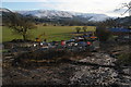
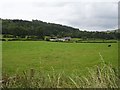
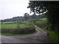
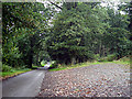
Nearby Images from Geograph Britain and Ireland:
©2013(licence)
©2007(licence)
©2008(licence)
©2008(licence)
©2013(licence)
The above images may not be of the site on this page, they are loaded from Geograph.
Please Submit an Image of this site or go out and take one for us!
Click here to see more info for this site
Nearby sites
Key: Red: member's photo, Blue: 3rd party photo, Yellow: other image, Green: no photo - please go there and take one, Grey: site destroyed
Download sites to:
KML (Google Earth)
GPX (GPS waypoints)
CSV (Garmin/Navman)
CSV (Excel)
To unlock full downloads you need to sign up as a Contributory Member. Otherwise downloads are limited to 50 sites.
Turn off the page maps and other distractions
Nearby sites listing. In the following links * = Image available
814m SE 145° Nant-Yr-Hebog* Ancient Village or Settlement (SO02058932)
2.1km W 274° Pont Ar Daf Cairn Cairn (SN995902)
3.1km W 263° Gaer Bella Hillfort (SN98508969)
6.9km N 357° Clogau Standing Stone* Standing Stone (Menhir) (SO0142096856)
7.0km N 357° Llyn Mawr East* Ring Cairn (SO01369700)
7.1km WNW 297° Esgair y Groes* Standing Stone (Menhir) (SN9532793293)
7.3km NNW 348° Llyn Mawr South* Standing Stone (Menhir) (SO00249714)
7.3km WSW 254° Pen-Y-Castell (Llanidloes Without)* Hillfort (SN94548809)
7.3km N 6° Llyn-y-Tarw* Stone Circle (SO02579726)
7.4km N 4° Llyn-y-Tarw Hut Circle* Ancient Village or Settlement (SO0227597395)
7.8km E 91° Castell-Y-Dail* Ancient Village or Settlement (SO09448972)
8.3km NNW 345° Craig y Llyn Mawr stone circle.* Stone Circle (SN996981)
8.5km NNW 348° Lluest Uchaf* Stone Row / Alignment (SO00049832)
9.1km ENE 77° Newtown Gorsedd Circle* Modern Stone Circle etc (SO1057591808)
9.7km WNW 302° Bryn yr Aran Stone Circle (SN935953)
9.9km WNW 299° Esgair Draenllwyn Stone Row / Alignment (SN93039505)
10.2km N 350° Y Capel* Stone Circle (SH99950005)
10.6km ESE 119° Kerry Ridgeway* Ancient Trackway (SO108846)
11.1km SSE 165° Banc Du (Powys)* Stone Circle (SO042792)
11.2km WNW 299° Careg Lwyd* Stone Row / Alignment (SN91949569)
11.2km WSW 253° Pen y Gaer Llanidloes* Hillfort (SN90828688)
11.2km ESE 115° Two Tumps* Round Barrow(s) (SO11688505)
11.3km WNW 300° Trannon circles* Ring Cairn (SN91899577)
11.3km WNW 301° Trannon Moor* Cairn (SN92049609)
11.4km WNW 300° Twr-Gwyn Mawr* Cairn (SN9181695935)
View more nearby sites and additional images


 We would like to know more about this location. Please feel free to add a brief description and any relevant information in your own language.
 Wir möchten mehr über diese Stätte erfahren. Bitte zögern Sie nicht, eine kurze Beschreibung und relevante Informationen in Deutsch hinzuzufügen.
 Nous aimerions en savoir encore un peu sur les lieux. S'il vous plaît n'hesitez pas à ajouter une courte description et tous les renseignements pertinents dans votre propre langue.
 Quisieramos informarnos un poco más de las lugares. No dude en añadir una breve descripción y otros datos relevantes en su propio idioma.