


<< Our Photo Pages >> Careg Lwyd Standing Stone - Standing Stone (Menhir) in Wales in Powys
Submitted by geoffstickland on Monday, 02 November 2020 Page Views: 440
Neolithic and Bronze AgeSite Name: Careg Lwyd Standing Stone Alternative Name: translation = grey stoneCountry: Wales
NOTE: This site is 1.3 km away from the location you searched for.
County: Powys Type: Standing Stone (Menhir)
Nearest Town: Llanwrtyd Wells Nearest Village: Abergwesyn
Map Ref: SN86925425
Latitude: 52.174882N Longitude: 3.65506W
Condition:
| 5 | Perfect |
| 4 | Almost Perfect |
| 3 | Reasonable but with some damage |
| 2 | Ruined but still recognisable as an ancient site |
| 1 | Pretty much destroyed, possibly visible as crop marks |
| 0 | No data. |
| -1 | Completely destroyed |
| 5 | Superb |
| 4 | Good |
| 3 | Ordinary |
| 2 | Not Good |
| 1 | Awful |
| 0 | No data. |
| 5 | Can be driven to, probably with disabled access |
| 4 | Short walk on a footpath |
| 3 | Requiring a bit more of a walk |
| 2 | A long walk |
| 1 | In the middle of nowhere, a nightmare to find |
| 0 | No data. |
| 5 | co-ordinates taken by GPS or official recorded co-ordinates |
| 4 | co-ordinates scaled from a detailed map |
| 3 | co-ordinates scaled from a bad map |
| 2 | co-ordinates of the nearest village |
| 1 | co-ordinates of the nearest town |
| 0 | no data |
Internal Links:
External Links:
 (PID:219479)")
A single congromerate stone of coarse texture, about 7' in lenght and varying in width from 6' at one end to about 4' at the other Western end and about 3' thick. It may once have been erect but now lies flat on open, marshy meadow. Easily seen from the adjacent bridle way.
Some sites recognise a second stone about 50' to the North West.
You may be viewing yesterday's version of this page. To see the most up to date information please register for a free account.
 (PID:219480)")
Do not use the above information on other web sites or publications without permission of the contributor.
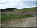
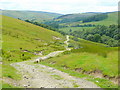
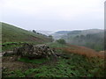
Nearby Images from Geograph Britain and Ireland:
©2012(licence)
©2011(licence)
©2008(licence)
©2011(licence)
©2015(licence)
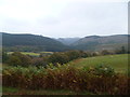
The above images may not be of the site on this page, they are loaded from Geograph.
Please Submit an Image of this site or go out and take one for us!
Click here to see more info for this site
Nearby sites
Key: Red: member's photo, Blue: 3rd party photo, Yellow: other image, Green: no photo - please go there and take one, Grey: site destroyed
Download sites to:
KML (Google Earth)
GPX (GPS waypoints)
CSV (Garmin/Navman)
CSV (Excel)
To unlock full downloads you need to sign up as a Contributory Member. Otherwise downloads are limited to 50 sites.
Turn off the page maps and other distractions
Nearby sites listing. In the following links * = Image available
1.9km SSE 158° Banc Paderau* Ring Cairn (SN8757652484)
2.2km NNW 331° Cefn Craig Gwesyn* Cairn (SN85895619)
2.3km NNE 15° Afon Cammarch* Cairn (SN87565642)
2.3km W 278° Esgair Irfon Cairn* Cairn (SN84645464)
2.3km SW 223° Ffynnon Ddewi (Abergwesyn)* Holy Well or Sacred Spring (SN8529852598)
3.1km SE 125° Ffynnon Ffos-ddu* Holy Well or Sacred Spring (SN894524)
3.4km SE 127° Pen Twr Enclosure* Ancient Village or Settlement (SN89605213)
3.5km ESE 106° Carn Wen cairn* Cairn (SN903532)
4.0km SSW 193° Craig Dinas Fach Hill Fort (possible)* Hillfort (SN85955041)
4.2km E 84° Bryn Round Cairn* Cairn (SN9110554583)
4.2km ENE 78° Hen Clawdd Stones* Standing Stones (SN9106155036)
4.2km N 350° Drygarn Fawr* Cairn (SN86285841)
4.2km ENE 76° Lednant Round Barrow* Cairn (SN91045517)
4.3km E 85° Bryn Ring Cairn* Cairn (SN91195449)
4.3km SSE 157° Pen y Garn Goch* Chambered Tomb (SN885502)
4.5km SSW 192° Cwm Irfon Standing Stone* Standing Stone (Menhir) (SN85844984)
4.6km NW 318° Maesnant Cairn* Cairn (SN83915771)
4.7km SSE 152° Bwlch Mawr Mound (possible barrow)* Barrow Cemetery (SN89045007)
4.8km ENE 60° Darren Standing Stones* Standing Stones (SN91125658)
4.9km N 360° Carreg Yr Ast Cairn* Cairn (SN87005916)
5.0km SE 145° Berth-lwyd pond* Misc. Earthwork (SN8975250083)
5.3km NE 34° Bwlch-y-Ddau-Faen Cairn* Cairn (SN90015859)
5.8km SW 220° Esgair Garn* Cairn (SN83084983)
5.8km SW 214° Cefn Blaencwmhenog Cairn* Cairn (SN8349449500)
5.9km SE 145° Dol Y Garn Round Barrow* Round Barrow(s) (SN902493)
View more nearby sites and additional images


 We would like to know more about this location. Please feel free to add a brief description and any relevant information in your own language.
 Wir möchten mehr über diese Stätte erfahren. Bitte zögern Sie nicht, eine kurze Beschreibung und relevante Informationen in Deutsch hinzuzufügen.
 Nous aimerions en savoir encore un peu sur les lieux. S'il vous plaît n'hesitez pas à ajouter une courte description et tous les renseignements pertinents dans votre propre langue.
 Quisieramos informarnos un poco más de las lugares. No dude en añadir una breve descripción y otros datos relevantes en su propio idioma.