Featured: Explore Scotland (and everywhere else) with our Megalithic Portal iPhone app

Explore Scotland (and everywhere else) with our Megalithic Portal iPhone app

Random Image


Jeffers Mound

The Significance of Monuments

The Significance of Monuments

Who's Online

There are currently, 287 guests and 3 members online.

You are a guest. To join in, please register for free by clicking here

Sponsors

<< Our Photo Pages >> Thynghowe - Artificial Mound in England in Nottinghamshire

Submitted by Flyvapnet on Thursday, 22 June 2017  Page Views: 17431

Multi-periodSite Name: Thynghowe Alternative Name: Hangar Hill
Country: England
NOTE: This site is 2.16 km away from the location you searched for.

County: Nottinghamshire Type: Artificial Mound
Nearest Town: Mansfield  Nearest Village: Market Warsop
Map Ref: SK59936834
Latitude: 53.208756N  Longitude: 1.104133W
Condition:
5Perfect
4Almost Perfect
3Reasonable but with some damage
2Ruined but still recognisable as an ancient site
1Pretty much destroyed, possibly visible as crop marks
0No data.
-1Completely destroyed
2 Ambience:
5Superb
4Good
3Ordinary
2Not Good
1Awful
0No data.
no data Access:
5Can be driven to, probably with disabled access
4Short walk on a footpath
3Requiring a bit more of a walk
2A long walk
1In the middle of nowhere, a nightmare to find
0No data.
2 Accuracy:
5co-ordinates taken by GPS or official recorded co-ordinates
4co-ordinates scaled from a detailed map
3co-ordinates scaled from a bad map
2co-ordinates of the nearest village
1co-ordinates of the nearest town
0no data
5

Internal Links:
External Links:

Thynghowe
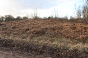
Thynghowe submitted by Blingo_von_Trumpenstein : View of the side of Thynghowe opposite the path. Note the river worn pebbles that seem to be the main material of the mound. Many many quartz pebbles . . . Feb 2011 Enjoy (Vote or comment on this photo)
Thynghowe is a Viking age meeting site in Birklands on the western edge of Sherwood Forest. This site has still to reveal many of its mysteries but it has been an important meeting place for well over a thousand years. It is located on the boundary between three parishes and may once have been an important location on the border of the kingdoms of Northumbria and Mercia.

There is a waymarked Thynghowe Trail through Birklands

Thynghowe and The Forest of Birklands are found between the villages of Warsop, Meden Vale, Budby, Edwinstowe and Kings Clipstone in Nottinghamshire.
There is roadside parking at Warsop Windmill and also near Budby Pumping Station.
Public footpaths link this area of Birklands to Edwinstowe, Budby and Warsop.

More details and how to get involved with the site at the The Friends of Thynghowe pages.

Note: The Friends of Thynghowe and other local groups will be at the Nottinghamshire Local History and Archaeology Festival Sat 8th July, details in our comments
You may be viewing yesterday's version of this page. To see the most up to date information please register for a free account.


Thynghowe
Thynghowe submitted by Blingo_von_Trumpenstein : A view of all 3 boundary stones on/next to Thynghowe Feb 2011 Enjoy (Vote or comment on this photo)

Thynghowe
Thynghowe submitted by Blingo_von_Trumpenstein : Second parish boundary stone on Thynghowe Feb 2011 Enjoy (Vote or comment on this photo)

Thynghowe
Thynghowe submitted by Blingo_von_Trumpenstein : Third parish boundary stone at the side of Thynghowe Feb 2011 Enjoy (Vote or comment on this photo)

Thynghowe
Thynghowe submitted by Blingo_von_Trumpenstein : Fist parish boundary stone on Thynghowe Feb 2011 Enjoy (Vote or comment on this photo)

Thynghowe
Thynghowe submitted by Blingo_von_Trumpenstein : Thynghowe from the side opposite the path. Feb 2011 Enjoy (Vote or comment on this photo)

Thynghowe
Thynghowe submitted by Blingo_von_Trumpenstein : Thynghowe from the path side but nearer. Enjoy

Thynghowe
Thynghowe submitted by Blingo_von_Trumpenstein : Thynghowe from the path. Feb 2011 Enjoy

Thynghowe
Thynghowe submitted by Andy B : Hanger Hill Drive This Bridleway curves around Hanger Hill and straightens out alongside the Jerusalem plantation. Copyright Sally Holmes and licensed for reuse under the Creative Commons Licence.

Thynghowe
Thynghowe submitted by Andy B : The Woodland around Hanger Hill has a range of broad leaf and evergreen trees. There is a recently cleared area of pine trees close to the Hanger Hill Drive bridleway. Copyright Sally Holmes and licensed for reuse under the Creative Commons Licence.

Do not use the above information on other web sites or publications without permission of the contributor.
Click here to see more info for this site

Nearby sites

Click here to view sites on an interactive OS map

Key: Red: member's photo, Blue: 3rd party photo, Yellow: other image, Green: no photo - please go there and take one, Grey: site destroyed

Download sites to:
KML (Google Earth)
GPX (GPS waypoints)
CSV (Garmin/Navman)
CSV (Excel)

To unlock full downloads you need to sign up as a Contributory Member. Otherwise downloads are limited to 50 sites.


Turn off the page maps and other distractions

Nearby sites listing. In the following links * = Image available
 3.4km NE 42° Budby Barrow* Round Barrow(s) (SK62187087)
 6.4km WSW 249° Sookholme Bath* Holy Well or Sacred Spring (SK5466)
 8.2km W 279° Langwith Cave* Cave or Rock Shelter (SK518695)
 8.5km SW 218° The Lady Well (Mansfield) Holy Well or Sacred Spring (SK548616)
 8.7km NW 314° Mother Grundy’s Parlour Cave or Rock Shelter (SK536743)
 8.8km NW 314° Creswell Crags* Cave or Rock Shelter (SK535743)
 8.8km NW 313° Robin Hood’s Cave* Cave or Rock Shelter (SK534742)
 8.8km NW 312° Ossiferous Fissure Cave or Rock Shelter (SK533741)
 8.8km NW 312° Pin Hole Cave Cave or Rock Shelter (SK533741)
 8.8km NW 311° Church Hole* Cave or Rock Shelter (SK532741)
 9.0km W 274° Scarcliffe Shelter 4 Cave or Rock Shelter (SK509688)
 9.1km WNW 292° Whaley Rock Shelter1 Cave or Rock Shelter (SK515717)
 9.5km W 272° Scarcliffe Shelter 3 Cave or Rock Shelter (SK504685)
 9.5km W 272° Scarcliffe Shelter 2 Cave or Rock Shelter (SK504685)
 9.6km WNW 294° Whaley Rock Shelter2 Cave or Rock Shelter (SK511721)
 9.8km W 271° Scarcliffe Shelter 1 Cave or Rock Shelter (SK501684)
 11.2km NW 309° Markland Grips Hillfort* Hillfort (SK511752)
 11.2km NW 308° Markland Grips Cave* Cave or Rock Shelter (SK510751)
 11.5km NW 314° Ash Tree Cave* Cave or Rock Shelter (SK5148576144)
 11.9km SSW 196° Friar Tuck's Well* Holy Well or Sacred Spring (SK568569)
 12.5km S 191° The Druid Stone (Blidworth)* Natural Stone / Erratic / Other Natural Feature (SK577560)
 12.5km E 98° The Duck's Mouth* Holy Well or Sacred Spring (SK724667)
 12.6km S 187° Ashwell (Blidworth) Holy Well or Sacred Spring (SK586558)
 13.1km NNW 328° Thorpe Common Shelter Cave or Rock Shelter (SK529794)
 13.1km E 83° Holy well ( Tuxford ) Holy Well or Sacred Spring (SK7370)
View more nearby sites and additional images

<< Hafodygors Wen

De Sproakstee >>

Please add your thoughts on this site

Lines on the Landscape, Circles from the Sky: Monuments of Neolithic Orkney

Lines on the Landscape, Circles from the Sky: Monuments of Neolithic Orkney

Sponsors

Auto-Translation (Google)

Translate from English into:

"Thynghowe" | Login/Create an Account | 7 News and Comments
  
Go back to top of page    Comments are owned by the poster. We aren't responsible for their content.
Re: Archaeologists to probe Sherwood Forest's 'Thing' by Anonymous on Wednesday, 27 January 2021
Really interesting. I've just been down a Danelaw rabbit hole and have ended up here. Would love to go visit this location some day. Good job on the team that rediscovered the location of this fascinating place and of course Megalithic for the Interesting website. Thanks, Tom Totsi
[ Reply to This ]

Nottinghamshire Local History and Archaeology Festival Sat 8th July by Andy B on Thursday, 22 June 2017
(User Info | Send a Message)
Nottinghamshire Local History and Archaeology Festival Sat 8th July
Saturday 8th July 2017 – Nottinghamshire Local History and Archaeology Festival – 11am to 4pm

Nottingham University Museum, Djanogly Gallery, Rehearsal Hall and Recital Hall, Nottingham Lakeside Arts, University Park, Nottingham NG7 2RD

Free event – Drop in or come along for the whole day

The Friends of Thynghowe write: Once again we will be attending this event with our display – come along and say hello! We will also be giving a brief talk at the start of the day.

Now in its 4th year this hugely successful regional festival and celebration will be displaying the wide and varied work taking place throughout Nottinghamshire by local history and archaeology societies, archaeological units, museums and other regional archaeological organisations.

The festival will include displays, activities, handling of original material and talks.

In anticipation of The Vikings exhibition in November 2017 there will also be a wide variety of related activities to participate in, including Viking hairstyles; Viking crafts; face painting; understanding runes; and re-enactments.

More information at
https://www.lakesidearts.org.uk/whats-on/diary-calendar.html?month=7&year=2017

https://fotevents.wordpress.com/events/
[ Reply to This ]

Re: Archaeologists to probe Sherwood Forest's 'Thing' by Anonymous on Wednesday, 20 April 2016
Been on the excavation here last weekend - very interesting and several interesting things were learnt :)
[ Reply to This ]

Thynghowe - a special spot . . . by Blingo_von_Trumpenstein on Tuesday, 15 February 2011
(User Info | Send a Message)
Visited Feb 2011 and immediately certain it is a special spot. I could not stop grinning. The setting is very suitable for speaking to a large group of people (maybe warriors). I would like to see the geophysical survey to get a real feel for it without trees and dense bracken. The large amount of quartz pebbles was most interesting - see my new pics
I would have to recommend walking all the way through Sherwood Forest from the visitor centre car park (1.7 miles ish) as you will pass the Major Oak and about 100 other massive ancient oaks en route - breathtaking. One Love
Bling_von_T
[ Reply to This ]

Re: 20th and 22nd January 2011 - Discover Viking Age Sherwood Forest by Andy B on Thursday, 30 December 2010
(User Info | Send a Message)
A Mysterious mound in Notts that was once thought to mark the boundary of two Anglo-Saxon kingdoms is to be investigated by historians, the Forestry Commission has said.

Known as Thynghowe, the hillock was only discovered three years ago in the Birklands area of Sherwood Forest by former teacher Lynda Mallet and her husband Stuart Reddish.

Coldrum found this report from This is Nottingham in April 2008
[ Reply to This ]

20th and 22nd January 2011 - Discover Viking Age Sherwood Forest by Andy B on Thursday, 30 December 2010
(User Info | Send a Message)
Hanger Hill or ThynghoweThe rescheduled topographical survey of the hill of Thynghowe funded by the County Council's 'Local Improvement Scheme' will take place between January 18th and 22nd. Nottinghamshire County Council’s Community Archaeology Team should be joined by members of the University College London Assembly Sites Project who are planning a magnetometry survey (more details of this project via our Links page). We hope that these surveys will provide evidence relating to Thynghowe’s use as a Danelaw ‘Thing’ (assembly site) and also the mysterious ancient stones in the area.

You are welcome to join us on Thursday 20th or Saturday 22nd January to meet the archaeologists and find out what has been revealed.

As the site is a considerable distance from public roads we plan to arrange access for vehicles at prearranged times so booking is essential. If you do not have your own transport contact us as we may be able to help. Sessions should start at 9:30 and 13:30 for a tour of the site and an opportunity to find out more about the surveying.

Members of the Friends of Thynghowe group will also be able to participate in the surveying on other days

More details at
http://www.thynghowe.org.uk/News.html

[ Reply to This ]

Archaeologists to probe Sherwood Forest's 'Thing' by Andy B on Thursday, 30 December 2010
(User Info | Send a Message)
A team of experts hope to shed new light on one of Nottinghamshire's most mysterious ancient monuments.

A 'Thing', or open-air meeting place where Vikings gathered to discuss the law, was discovered in the Birklands, Sherwood Forest, five years ago.

In January 2011 experts plan to survey the hill and see if they can detect signs of buried archaeology and the extent of the site.

The site was found by three local historians after a treasure hunt.

It started after husband and wife team Lynda Mallett and Stuart Reddish, along with their friend John Wood, came into possession of a 200 year old document.

It described a walk around part of Sherwood Forest which marked an ancient boundary.

They searched for the boundary on the landscape and found a place called Hanger Hill on which stood three stones.

The historians, from Rainworth, researched further and found that the same place was called Thynghowe on a 1609 map.

This was significant.

"A 'thyng' is the name of a Viking assembly site while a 'howe' is possibly a Bronze Age burial ground," said Lynda.

Lynda and Stuart then formed The Friends of Thynghowe and invited members from the three local historical societies to join them.

Over the last five years they have researched the site, establishing its importance.

http://news.bbc.co.uk/local/nottingham/hi/people_and_places/history/newsid_9155000/9155982.stm

with thanks to Flyvapnet and Coldrum who originally alerted us to this site in 2008
[ Reply to This ]

Your Name: Anonymous [ Register Now ]
Subject:


Add your comment or contribution to this page. Spam or offensive posts are deleted immediately, don't even bother

<<< What is five plus one as a number? (Please type the answer to this question in the little box on the left)
You can also embed videos and other things. For Youtube please copy and paste the 'embed code'.
For Google Street View please include Street View in the text.
Create a web link like this: <a href="https://www.megalithic.co.uk">This is a link</a>  

Allowed HTML is:
<p> <b> <i> <a> <img> <em> <br> <strong> <blockquote> <tt> <li> <ol> <ul> <object> <param> <embed> <iframe>

We would like to know more about this location. Please feel free to add a brief description and any relevant information in your own language.
Wir möchten mehr über diese Stätte erfahren. Bitte zögern Sie nicht, eine kurze Beschreibung und relevante Informationen in Deutsch hinzuzufügen.
Nous aimerions en savoir encore un peu sur les lieux. S'il vous plaît n'hesitez pas à ajouter une courte description et tous les renseignements pertinents dans votre propre langue.
Quisieramos informarnos un poco más de las lugares. No dude en añadir una breve descripción y otros datos relevantes en su propio idioma.