


<< Our Photo Pages >> Healing Spring - Holy Well or Sacred Spring in England in Nottinghamshire
Submitted by HOLYWELL on Monday, 24 January 2011 Page Views: 6757
Springs and Holy WellsSite Name: Healing Spring Alternative Name: Druid's WellCountry: England
NOTE: This site is 4.0 km away from the location you searched for.
County: Nottinghamshire Type: Holy Well or Sacred Spring
Nearest Town: Nottingham Nearest Village: Bramcote
Map Ref: SK494390
Latitude: 52.946120N Longitude: 1.266277W
Condition:
| 5 | Perfect |
| 4 | Almost Perfect |
| 3 | Reasonable but with some damage |
| 2 | Ruined but still recognisable as an ancient site |
| 1 | Pretty much destroyed, possibly visible as crop marks |
| 0 | No data. |
| -1 | Completely destroyed |
| 5 | Superb |
| 4 | Good |
| 3 | Ordinary |
| 2 | Not Good |
| 1 | Awful |
| 0 | No data. |
| 5 | Can be driven to, probably with disabled access |
| 4 | Short walk on a footpath |
| 3 | Requiring a bit more of a walk |
| 2 | A long walk |
| 1 | In the middle of nowhere, a nightmare to find |
| 0 | No data. |
| 5 | co-ordinates taken by GPS or official recorded co-ordinates |
| 4 | co-ordinates scaled from a detailed map |
| 3 | co-ordinates scaled from a bad map |
| 2 | co-ordinates of the nearest village |
| 1 | co-ordinates of the nearest town |
| 0 | no data |
Internal Links:
External Links:
")
Many people know the Hemlock Stone, but the Healing spring located in a field a small distance to the north of the Hemlock stone is less well known. It is said that the Druids used to wash their hands in it after using this odd stone monument. The site of the spring was near the old colliery and such the water was used by those working there, although it is not clear if this was in regard to its healing qualities.
Old O/S maps clearly locate the well as unusually Healing Spring and despite the area remaining, landscaping after the colliery's closure would appear to have lead to the spring's emasculation. The rough location appears to be at the corner of a small afforested area above the footpath. Water still arises in a boggy area below this path and may indicate where the spring has shifted to but this is difficult to prove.
You may be viewing yesterday's version of this page. To see the most up to date information please register for a free account.
")
")
Do not use the above information on other web sites or publications without permission of the contributor.
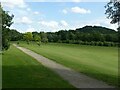
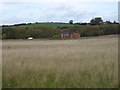
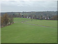
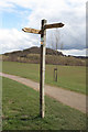
Nearby Images from Geograph Britain and Ireland:
©2021(licence)
©2008(licence)
©2007(licence)
©2008(licence)
©2018(licence)
The above images may not be of the site on this page, they are loaded from Geograph.
Please Submit an Image of this site or go out and take one for us!
Click here to see more info for this site
Nearby sites
Key: Red: member's photo, Blue: 3rd party photo, Yellow: other image, Green: no photo - please go there and take one, Grey: site destroyed
Download sites to:
KML (Google Earth)
GPX (GPS waypoints)
CSV (Garmin/Navman)
CSV (Excel)
To unlock full downloads you need to sign up as a Contributory Member. Otherwise downloads are limited to 50 sites.
Turn off the page maps and other distractions
Nearby sites listing. In the following links * = Image available
649m ESE 122° The Hemlock Stone* Rock Outcrop (SK4995538661)
1.4km SE 134° Crow Hill Standing Stone* Standing Stone (Menhir) (SK50403805)
1.7km S 185° Bob's Rock* Rock Outcrop (SK4927937319)
1.8km SSW 197° Stapleford Cross* Ancient Cross (SK489373)
2.9km NNE 28° Catstone Hill* Natural Stone / Erratic / Other Natural Feature (SK50754156)
5.6km W 267° Hermit's Well (Dale Abbey) Holy Well or Sacred Spring (SK43783861)
5.7km SSE 163° Conies Farm Stone Circle* Stone Circle (SK5115033599)
6.4km SE 140° Cliffton Woods Well* Holy Well or Sacred Spring (SK5361134124)
6.5km W 262° Dale Hermitage* Cave or Rock Shelter (SK4338)
6.5km ESE 119° Clifton Pile Settlements* Ancient Village or Settlement (SK5513735946)
6.6km N 5° Holy Well (Watnall)* Holy Well or Sacred Spring (SK499456)
6.9km ENE 58° Holy Well (Basford) Holy Well or Sacred Spring (SK553427)
7.0km E 88° Rock Chapel of St Mary* Cave or Rock Shelter (SK56433926)
7.5km E 88° Nottingham Castle Museum Museum (SK569394)
8.5km SSW 191° Sawley earthwork* Misc. Earthwork (SK4781130639)
9.0km NE 36° Bull's Well Holy Well or Sacred Spring (SK546464)
9.9km ENE 74° St Ann's Well (Nottingham) Holy Well or Sacred Spring (SK58914191)
10.1km WSW 253° St Werburgh (Spondon)* Ancient Cross (SK39793592)
10.1km N 2° Robin Hood's Well (Beauvale)* Holy Well or Sacred Spring (SK49684915)
10.2km WSW 247° Saxon Holy Well* Holy Well or Sacred Spring (SK4035)
10.4km WNW 282° Morley Moated Mound* Round Barrow(s) (SK392410)
10.6km SSW 194° Lockington Cursus Cursus (SK469287)
11.3km SW 218° Aston Cursus Cursus (SK426300)
12.5km NNE 17° Linby Cross and Well* Ancient Cross (SK5351)
13.0km SW 217° Aston Cursus Cursus (SK417285)
View more nearby sites and additional images


 We would like to know more about this location. Please feel free to add a brief description and any relevant information in your own language.
 Wir möchten mehr über diese Stätte erfahren. Bitte zögern Sie nicht, eine kurze Beschreibung und relevante Informationen in Deutsch hinzuzufügen.
 Nous aimerions en savoir encore un peu sur les lieux. S'il vous plaît n'hesitez pas à ajouter une courte description et tous les renseignements pertinents dans votre propre langue.
 Quisieramos informarnos un poco más de las lugares. No dude en añadir una breve descripción y otros datos relevantes en su propio idioma.