 with our Megalithic Portal iPhone app")

<< Our Photo Pages >> Nine Stones Close - Stone Circle in England in Derbyshire
Submitted by Andy B on Saturday, 15 July 2023 Page Views: 48425
Neolithic and Bronze AgeSite Name: Nine Stones Close Alternative Name: The Grey Ladies, Nine Stone CloseCountry: England County: Derbyshire Type: Stone Circle
Nearest Town: Bakewell Nearest Village: Birchover
Map Ref: SK2253762643 Landranger Map Number: 119
Latitude: 53.160440N Longitude: 1.664394W
Condition:
| 5 | Perfect |
| 4 | Almost Perfect |
| 3 | Reasonable but with some damage |
| 2 | Ruined but still recognisable as an ancient site |
| 1 | Pretty much destroyed, possibly visible as crop marks |
| 0 | No data. |
| -1 | Completely destroyed |
| 5 | Superb |
| 4 | Good |
| 3 | Ordinary |
| 2 | Not Good |
| 1 | Awful |
| 0 | No data. |
| 5 | Can be driven to, probably with disabled access |
| 4 | Short walk on a footpath |
| 3 | Requiring a bit more of a walk |
| 2 | A long walk |
| 1 | In the middle of nowhere, a nightmare to find |
| 0 | No data. |
| 5 | co-ordinates taken by GPS or official recorded co-ordinates |
| 4 | co-ordinates scaled from a detailed map |
| 3 | co-ordinates scaled from a bad map |
| 2 | co-ordinates of the nearest village |
| 1 | co-ordinates of the nearest town |
| 0 | no data |
Internal Links:
External Links:
I have visited· I would like to visit
underhill Mountainharry whese001 coldrum 43559959 would like to visit
TheCaptain visited on 13th Sep 2025 - their rating: Cond: 4 Amb: 4 Access: 4 Proceding towards Bakewell, and decide I have time to go for a walk to Nine Stones Close and Robin Hoods Stride. Its all busy round here with lots of people out walking and climbing. There is plenty of room to park beside the little road from Alport to Elton, leaving a short walk across fields to the circle. Its a lovely place, with its four large stones standing under a tree. I can see that there are two additional large standing stones nearby, one acting as a gatepost to the south which is clearly ancient due to the rivulets. There is also another in the wall up to the north, a couple of fields away, which I do not go and have a proper look at.
Acb90 visited on 1st Jan 2025 - their rating: Cond: 4 Amb: 5 Access: 3
rvbaker2003 visited on 24th Dec 2024 - their rating: Cond: 3 Amb: 4 Access: 4
Couplands visited on 11th Jun 2023 - their rating: Cond: 3 Amb: 4 Access: 4
stretchyboy visited on 21st Jun 2020 - their rating: Cond: 3 Amb: 4 Access: 3 Not far to walk but no footpath there.
elad13 visited on 30th May 2020 - their rating: Cond: 3 Amb: 4 Access: 4 i found what is said to possibly be one of the stones in a wall, I also found another stone in a gateway that looks very similar to the other stones in the circle
Marko visited on 21st Mar 2020 - their rating: Cond: 3 Amb: 5 Access: 4
emerald visited on 1st Jan 2019 - their rating: Cond: 3 Amb: 4 Access: 3
NickyD visited on 1st Oct 2014 - their rating: Cond: 3 Amb: 3 Access: 3
k8marieuk visited on 31st Mar 2013 - their rating: Cond: 4 Amb: 5 Access: 3
lscollinson visited on 6th Jan 2010 - their rating: Cond: 2 Amb: 4 Access: 4 The tallest standing stones in Derbyshire. A stone that was once part of the circle now stands in a nearby stone wall.
BolshieBoris visited on 1st Jan 1984 - their rating: Cond: 3 Amb: 4 Access: 4
shawid visited on 1st Jan 0008 - their rating: Cond: 3 Amb: 4 Access: 4
shawid visited on 1st Jan 0008 - their rating: Cond: 3 Amb: 4 Access: 4
Gorient visited on 1st Jan 0007 - their rating: Cond: 3 Amb: 3 Access: 4
jeniferj visited - their rating: Cond: 4 Amb: 4 Access: 3
Shalaa visited - their rating: Cond: 3 Amb: 4 Access: 3
elad13 visited - their rating: Cond: 2 Amb: 4 Access: 3
mark_a Humbucker Bladup chester1960 rldixon AngieLake nicoladidsbury TimPrevett Catrinm MartinRS Wazza12 have visited here
Average ratings for this site from all visit loggers: Condition: 3.11 Ambience: 4.06 Access: 3.56
")
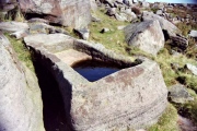
Prior to its re-erection in 1936, the 2.1m (7-foot) stone was measured at 3.5m (11 feet 6 inches) long. Both it and its northern partner are set in concrete. The location of the stones is a pleasant one, and is also known as the ‘Grey Ladies’ , so called because they are supposed to represent ladies who dance at midnight. In the background, to the south-south-west, rise the irregular crags of Robin Hood’s Stride, up from which the major southern Moon sets. This might account for the siting of the circle.
Access: Can be seen from the road from Elton to Alport.
Page originally by Tom Bullock
You may be viewing yesterday's version of this page. To see the most up to date information please register for a free account.
")
")
")
")
")
")
")
")
")
")
")
")
")
")
")
")
")
")
")
")
")
")
")
")
These are just the first 25 photos of Nine Stones Close. If you log in with a free user account you will be able to see our entire collection.
Do not use the above information on other web sites or publications without permission of the contributor.
Click here to see more info for this site
Nearby sites
Key: Red: member's photo, Blue: 3rd party photo, Yellow: other image, Green: no photo - please go there and take one, Grey: site destroyed
Download sites to:
KML (Google Earth)
GPX (GPS waypoints)
CSV (Garmin/Navman)
CSV (Excel)
To unlock full downloads you need to sign up as a Contributory Member. Otherwise downloads are limited to 50 sites.
![]()
![]()
![]()
![]()
Turn off the page maps and other distractions
Nearby sites listing. In the following links * = Image available
197m N 1° Nine Stones Cup Mark (Harthill) Rock Art (SK22546284)
217m N 4° Harthill Cairn* Cairn (SK22556286)
265m S 173° Robin Hoods Settlement* Ancient Village or Settlement (SK22576238)
316m SE 140° Cratcliff Rocks* Hillfort (SK22746240)
376m SSW 195° Robin Hood's Stride* Rock Outcrop (SK22446228)
398m S 190° Robin Hood's Stride* Rock Art (SK22476225)
463m WNW 290° Castle Ring (Derbyshire)* Hillfort (SK221628)
657m SSW 192° Dudwood* Stone Circle (SK224620)
893m SE 131° Rockingstone Farm* Rock Outcrop (SK2322062065)
1.1km ESE 116° Rowtor Rocks* Rock Art (SK23556215)
1.2km ESE 118° St Michael’s Church (Birchover)* Carving (SK23576210)
1.2km ESE 117° The Megalithic Portal Live in the Derbyshire Peak District Natural Stone / Erratic / Other Natural Feature (SK236621)
1.3km E 80° Doll Tor* Stone Circle (SK2383062873)
1.5km ENE 77° Andle Stone (Stanton Moor)* Natural Stone / Erratic / Other Natural Feature (SK2403162993)
1.8km E 85° Stanton Moor Cairn T14* Cairn (SK24306281)
1.8km E 82° Stanton Moor Cairn T13* Round Cairn (SK243629)
1.8km E 86° Cork Stone* Natural Stone / Erratic / Other Natural Feature (SK2434662788)
2.1km E 81° Stanton Moor Cairn T25* Cairn (SK24656297)
2.1km E 86° Stanton Moor Cairn (TBC)* Cairn (SK2467562791)
2.2km NW 323° All Saints Church (Youlgreave)* Carving (SK21206437)
2.2km E 84° Stanton Moor 4* Ring Cairn (SK24716290)
2.3km ENE 78° Stanton Moor Cairn T55* Round Cairn (SK24826313)
2.3km ENE 75° Stanton Moor 3* Stone Circle (SK24806326)
2.4km ENE 73° Stanton Moor Cairn T24* Cairn (SK24806333)
2.4km ENE 62° Stanton Moor Cairn T2* Round Cairn (SK247638)
View more nearby sites and additional images


 We would like to know more about this location. Please feel free to add a brief description and any relevant information in your own language.
 Wir möchten mehr über diese Stätte erfahren. Bitte zögern Sie nicht, eine kurze Beschreibung und relevante Informationen in Deutsch hinzuzufügen.
 Nous aimerions en savoir encore un peu sur les lieux. S'il vous plaît n'hesitez pas à ajouter une courte description et tous les renseignements pertinents dans votre propre langue.
 Quisieramos informarnos un poco más de las lugares. No dude en añadir una breve descripción y otros datos relevantes en su propio idioma.