

<< Our Photo Pages >> Gallt Ffynnon Yr Hydd Enclosure - Ancient Village or Settlement in Wales in Gwynedd
Submitted by TAlanJones on Friday, 02 October 2020 Page Views: 754
Multi-periodSite Name: Gallt Ffynnon Yr Hydd EnclosureCountry: Wales
NOTE: This site is 0.6 km away from the location you searched for.
County: Gwynedd Type: Ancient Village or Settlement
Nearest Town: Llwyngwril
Map Ref: SH615116
Latitude: 52.684335N Longitude: 4.050345W
Condition:
| 5 | Perfect |
| 4 | Almost Perfect |
| 3 | Reasonable but with some damage |
| 2 | Ruined but still recognisable as an ancient site |
| 1 | Pretty much destroyed, possibly visible as crop marks |
| 0 | No data. |
| -1 | Completely destroyed |
| 5 | Superb |
| 4 | Good |
| 3 | Ordinary |
| 2 | Not Good |
| 1 | Awful |
| 0 | No data. |
| 5 | Can be driven to, probably with disabled access |
| 4 | Short walk on a footpath |
| 3 | Requiring a bit more of a walk |
| 2 | A long walk |
| 1 | In the middle of nowhere, a nightmare to find |
| 0 | No data. |
| 5 | co-ordinates taken by GPS or official recorded co-ordinates |
| 4 | co-ordinates scaled from a detailed map |
| 3 | co-ordinates scaled from a bad map |
| 2 | co-ordinates of the nearest village |
| 1 | co-ordinates of the nearest town |
| 0 | no data |
Internal Links:
External Links:
")
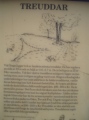
This is the more striking of two stone built enclosures within 500m of each other. This is a landscape that contains many prehistoric and later historical monuments many of which are schedulled. This enclosure occupies the higher ground and has commanding views of the Mawddach Estuary and the resort town of Abermaw (Barmouth).
The enclosure is circular and it has a 45m diameter. it has been raised to the east and north resulting in a level interior with suggestions of huts and pits.
You may be viewing yesterday's version of this page. To see the most up to date information please register for a free account.
")
")
")
")
")
Do not use the above information on other web sites or publications without permission of the contributor.
Click here to see more info for this site
Nearby sites
Key: Red: member's photo, Blue: 3rd party photo, Yellow: other image, Green: no photo - please go there and take one, Grey: site destroyed
Download sites to:
KML (Google Earth)
GPX (GPS waypoints)
CSV (Garmin/Navman)
CSV (Excel)
To unlock full downloads you need to sign up as a Contributory Member. Otherwise downloads are limited to 50 sites.
Turn off the page maps and other distractions
Nearby sites listing. In the following links * = Image available
200m S 178° Hut Enclosure and Early Field System South of Mynydd Graigwen* Ancient Village or Settlement (SH615114)
399m SE 142° Waun Oer* Stone Row / Alignment (SH61741128)
473m ESE 114° Waun-Oer tomb* Chambered Tomb (SH6192711394)
525m S 184° Morfa Stone* Standing Stone (Menhir) (SH6144811077)
698m E 88° Cairn West of Bryn Seward* Cairn (SH622116)
821m ENE 78° Bryn Seward Probable Cairn* Cairn (SH6231011750)
822m ENE 74° Bryn Seward Settlement* Ancient Village or Settlement (SH623118)
845m ENE 77° Bryn Seward Cairn Cemetery* Barrow Cemetery (SH6233011770)
908m E 83° Bryn Seward Cairn 4* Cairn (SH6240711687)
945m E 88° Bryn Seward Cairn 3* Cairn (SH6244811614)
967m E 80° Bryn Seward Cairn 5* Cairn (SH6245911744)
972m ENE 78° Bryn Seward Cairn 2* Cairn (SH6246011770)
974m E 82° Bryn Seward Cairn 6* Cairn (SH6247211700)
994m E 81° Bryn Seward Cairn 7* Cairn (SH6249011722)
1.0km E 94° Bryn Seward Round House and Field System* Ancient Village or Settlement (SH6254111493)
1.1km E 84° Bryn Seward Hut Circle* Ancient Village or Settlement (SH6256411688)
1.1km E 80° Bryn Seward Stone Row* Stone Row / Alignment (SH6258811760)
1.1km E 82° Bryn Seward Cairn 1* Cairn (SH6259711729)
1.1km ENE 78° Bryn Seward Cairn East* Cairn (SH626118)
1.4km ESE 108° Pen y Garn Cairn and Cist* Cairn (SH6284911112)
1.5km SW 221° Cefnfeusydd Farm Cairns* Cairn (SH605105)
1.6km E 89° Hut Circle Settlement SE of Cyfannedd Fawr* Ancient Village or Settlement (SH6313011590)
1.7km E 90° Cyfannedd Fawr erratic* Natural Stone / Erratic / Other Natural Feature (SH63221155)
1.8km E 84° Settlement and Cairn South of Cyfannedd Fawr* Ancient Village or Settlement (SH6331011730)
1.9km SW 225° Gwastadgoed* Standing Stones (SH601103)
View more nearby sites and additional images


 We would like to know more about this location. Please feel free to add a brief description and any relevant information in your own language.
 Wir möchten mehr über diese Stätte erfahren. Bitte zögern Sie nicht, eine kurze Beschreibung und relevante Informationen in Deutsch hinzuzufügen.
 Nous aimerions en savoir encore un peu sur les lieux. S'il vous plaît n'hesitez pas à ajouter une courte description et tous les renseignements pertinents dans votre propre langue.
 Quisieramos informarnos un poco más de las lugares. No dude en añadir una breve descripción y otros datos relevantes en su propio idioma.