


<< Text Pages >> Pen Yr Allt Uchaf Hut Group - Ancient Village or Settlement in Wales in Gwynedd
Submitted by coldrum on Wednesday, 27 January 2010 Page Views: 3728
Multi-periodSite Name: Pen Yr Allt Uchaf Hut GroupCountry: Wales
NOTE: This site is 1.4 km away from the location you searched for.
County: Gwynedd Type: Ancient Village or Settlement
Map Ref: SH4125048911
Latitude: 53.013896N Longitude: 4.367831W
Condition:
| 5 | Perfect |
| 4 | Almost Perfect |
| 3 | Reasonable but with some damage |
| 2 | Ruined but still recognisable as an ancient site |
| 1 | Pretty much destroyed, possibly visible as crop marks |
| 0 | No data. |
| -1 | Completely destroyed |
| 5 | Superb |
| 4 | Good |
| 3 | Ordinary |
| 2 | Not Good |
| 1 | Awful |
| 0 | No data. |
| 5 | Can be driven to, probably with disabled access |
| 4 | Short walk on a footpath |
| 3 | Requiring a bit more of a walk |
| 2 | A long walk |
| 1 | In the middle of nowhere, a nightmare to find |
| 0 | No data. |
| 5 | co-ordinates taken by GPS or official recorded co-ordinates |
| 4 | co-ordinates scaled from a detailed map |
| 3 | co-ordinates scaled from a bad map |
| 2 | co-ordinates of the nearest village |
| 1 | co-ordinates of the nearest town |
| 0 | no data |
Be the first person to rate this site - see the 'Contribute!' box in the right hand menu.
Internal Links:
External Links:
Round Houses in Gwynedd
"Pair of circular, stone-built round houses with stone pile close by, set within a well-preserved system of field terraces which extend to the south, west and north."
Source: Coflein.
You may be viewing yesterday's version of this page. To see the most up to date information please register for a free account.
Do not use the above information on other web sites or publications without permission of the contributor.
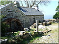
Nearby Images from Geograph Britain and Ireland:
©2010(licence)

©2017(licence)

©2017(licence)

©2019(licence)
©2017(licence)
The above images may not be of the site on this page, they are loaded from Geograph.
Please Submit an Image of this site or go out and take one for us!
Click here to see more info for this site
Nearby sites
Key: Red: member's photo, Blue: 3rd party photo, Yellow: other image, Green: no photo - please go there and take one, Grey: site destroyed
Download sites to:
KML (Google Earth)
GPX (GPS waypoints)
CSV (Garmin/Navman)
CSV (Excel)
To unlock full downloads you need to sign up as a Contributory Member. Otherwise downloads are limited to 50 sites.
Turn off the page maps and other distractions
Nearby sites listing. In the following links * = Image available
392m N 351° Beuno's Well (Clynnog Fawr)* Holy Well or Sacred Spring (SH412493)
743m NW 318° Bachwen* Burial Chamber or Dolmen (SH40774948)
802m N 9° Church of Saint Beuno (Clynnog Fawr)* Carving (SH414497)
1.6km ENE 58° Pen y Garreg* Ancient Village or Settlement (SH426497)
2.0km ENE 60° Capel Uchaf* Early Christian Sculptured Stone (SH43044987)
2.3km SSW 195° Gyrn Ddu* Cairn (SH40584667)
2.8km NE 37° Penarth* Chambered Tomb (SH42995107)
3.8km SSE 153° Pen-Y-Gaer (Llanaelhaearn)* Hillfort (SH42884550)
4.0km SE 136° Mynachdy Gwyn* Standing Stone (Menhir) (SH4392645910)
4.3km E 84° Graianog Standing Stone* Standing Stone (Menhir) (SH45524918)
4.4km E 80° Graianog Long Mound* Misc. Earthwork (SH45634951)
4.7km NE 47° Craig-y-Dinas (Penygroes)* Hillfort (SH44825198)
4.8km SSW 210° Eglwys St. Aelhaearn Church Llanaelhaearn* Early Christian Sculptured Stone (SH387448)
4.9km SSE 156° Tyddyn Mawr* Standing Stone (Menhir) (SH431444)
5.1km SSW 211° St Aelhaearn's Well* Holy Well or Sacred Spring (SH3842944623)
5.7km SW 220° Carnedd Tre'r Ceiri* Cairn (SH3742544716)
5.8km ESE 122° Hut Circle Settlement NW of Ty'r Dewin* Ancient Village or Settlement (SH4605745702)
5.8km SW 221° Tre'r Ceiri* Hillfort (SH37304460)
6.0km WSW 236° Bwlch yr Eifl Cairn* Cairn (SH36104573)
6.2km NNE 30° Maen Llwyd (Gwynedd)* Standing Stone (Menhir) (SH4449554155)
6.3km SW 227° Yr Eifl cairns* Cairn (SH36494474)
6.5km NE 37° Penbryn Mawr Standing Stone* Standing Stone (Menhir) (SH4537253927)
6.5km NE 34° Plas Newydd Ancient Village or Settlement (SH4507954192)
6.5km S 186° The Glasfryn Stone* Standing Stone (Menhir) (SH4031942450)
6.9km E 86° Carreg Rwbio* Natural Stone / Erratic / Other Natural Feature (SH4818949122)
View more nearby sites and additional images


 We would like to know more about this location. Please feel free to add a brief description and any relevant information in your own language.
 Wir möchten mehr über diese Stätte erfahren. Bitte zögern Sie nicht, eine kurze Beschreibung und relevante Informationen in Deutsch hinzuzufügen.
 Nous aimerions en savoir encore un peu sur les lieux. S'il vous plaît n'hesitez pas à ajouter une courte description et tous les renseignements pertinents dans votre propre langue.
 Quisieramos informarnos un poco más de las lugares. No dude en añadir una breve descripción y otros datos relevantes en su propio idioma.