


<< Text Pages >> St Peter's Well (York Minster) - Holy Well or Sacred Spring in England in Yorkshire (North)
Submitted by Anne T on Tuesday, 09 January 2018 Page Views: 1530
Springs and Holy WellsSite Name: St Peter's Well (York Minster) Alternative Name: Holy Well (York Minster)Country: England County: Yorkshire (North) Type: Holy Well or Sacred Spring
Nearest Town: York
Map Ref: SE60385219
Latitude: 53.962277N Longitude: 1.0812W
Condition:
| 5 | Perfect |
| 4 | Almost Perfect |
| 3 | Reasonable but with some damage |
| 2 | Ruined but still recognisable as an ancient site |
| 1 | Pretty much destroyed, possibly visible as crop marks |
| 0 | No data. |
| -1 | Completely destroyed |
| 5 | Superb |
| 4 | Good |
| 3 | Ordinary |
| 2 | Not Good |
| 1 | Awful |
| 0 | No data. |
| 5 | Can be driven to, probably with disabled access |
| 4 | Short walk on a footpath |
| 3 | Requiring a bit more of a walk |
| 2 | A long walk |
| 1 | In the middle of nowhere, a nightmare to find |
| 0 | No data. |
| 5 | co-ordinates taken by GPS or official recorded co-ordinates |
| 4 | co-ordinates scaled from a detailed map |
| 3 | co-ordinates scaled from a bad map |
| 2 | co-ordinates of the nearest village |
| 1 | co-ordinates of the nearest town |
| 0 | no data |
Be the first person to rate this site - see the 'Contribute!' box in the right hand menu.
Internal Links:
External Links:
Holy Well or Sacred Spring in Yorkshire (North)
The Northern Antiquarian (TNA) tells us about this well, now in the undercroft of York Minster but from which access has been closed off - see their entry for St. Peter’s Well, York Minster, North Yorkshire.
The TNA page includes an old photograph and an old sketch of the well, descriptions from 19th, 20th and 21st century reference materials and local folklore. TNA adds: "The well was even included in Murray’s Handbook to Yorkshire (1892) as being 'in the southwest corner of the Minster.' William Smith (1923) included the site in his fine survey, telling his readers that, 'The water is excellent in quality, which in measure, so chemists say, is due to the lime washed into it by the rain from the walls of the Minster. The water has for centuries been used for baptisms, and is so used today. The well has now for some years been covered with a pump'."
Note: Have you obtained access to this well? Do you have any photographs, information or illustrations to contribute?
You may be viewing yesterday's version of this page. To see the most up to date information please register for a free account.
Do not use the above information on other web sites or publications without permission of the contributor.
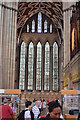
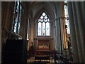
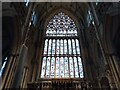
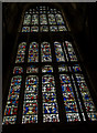
Nearby Images from Geograph Britain and Ireland:
©2011(licence)
©2021(licence)
©2021(licence)
©2014(licence)
©2014(licence)
The above images may not be of the site on this page, they are loaded from Geograph.
Please Submit an Image of this site or go out and take one for us!
Click here to see more info for this site
Nearby sites
Key: Red: member's photo, Blue: 3rd party photo, Yellow: other image, Green: no photo - please go there and take one, Grey: site destroyed
Download sites to:
KML (Google Earth)
GPX (GPS waypoints)
CSV (Garmin/Navman)
CSV (Excel)
To unlock full downloads you need to sign up as a Contributory Member. Otherwise downloads are limited to 50 sites.
Turn off the page maps and other distractions
Nearby sites listing. In the following links * = Image available
59m W 261° York Minster* Museum (SE6032252180)
479m W 272° Yorkshire Museum* Museum (SE599522)
496m S 190° York Roman remains* Ancient Village or Settlement (SE603517)
548m S 174° Jorvik Viking Centre Museum (SE6044451645)
814m SSW 209° St Mary Bishophill Junior* Ancient Cross (SE5999751471)
938m NW 305° The Burton Stone Ancient Cross (SE5960252718)
1.5km S 173° Pikeing Well Holy Well or Sacred Spring (SE6057650665)
1.6km SE 140° Lamel Hill Round Barrow(s) (SE6144450947)
2.1km SSE 167° Fulford Cross* Ancient Cross (SE6086750131)
2.2km SE 126° Siwards How Round Barrow(s) (SE6218450899)
2.3km SW 220° The Hob Stone* Sculptured Stone (SE5891450417)
6.6km E 87° Dunnington Village Cross Ancient Cross (SE6703052591)
6.7km ENE 73° Holtby Timber Circle (SE668543)
11.2km E 87° Catton Cursus (SE716530)
11.7km E 85° Catton Cursus (SE721534)
12.9km W 263° St Helen's Church (Bilton-in-Ainsty)* Ancient Cross (SE476504)
14.8km SW 222° St John the Baptist (Kirkby Wharfe) Ancient Cross (SE50604107)
15.0km SSE 165° Danes Hills (Riccall) Barrow Cemetery (SE6440837723)
16.1km WSW 244° Newton Kyme Henge Henge (SE45934499)
16.5km WSW 248° St Helen's Well (Boston Spa)* Holy Well or Sacred Spring (SE45134583)
17.7km WNW 298° Little Ouseburn Barrow Round Barrow(s) (SE445602)
19.8km N 7° City Of Troy* Turf Maze (SE6252871886)
20.2km SW 219° Saxton Church Ancient Cross (SE478364)
20.4km NE 35° St Ann's Well (Castle Howard)* Holy Well or Sacred Spring (SE71786918)
21.0km WNW 303° Duel Cross Hill (Grafton) Cairn (SE426634)
View more nearby sites and additional images


 We would like to know more about this location. Please feel free to add a brief description and any relevant information in your own language.
 Wir möchten mehr über diese Stätte erfahren. Bitte zögern Sie nicht, eine kurze Beschreibung und relevante Informationen in Deutsch hinzuzufügen.
 Nous aimerions en savoir encore un peu sur les lieux. S'il vous plaît n'hesitez pas à ajouter une courte description et tous les renseignements pertinents dans votre propre langue.
 Quisieramos informarnos un poco más de las lugares. No dude en añadir una breve descripción y otros datos relevantes en su propio idioma.