


<< Text Pages >> Dill Scout - Standing Stone (Menhir) in England in Yorkshire (West)
Submitted by DavidShepherd on Friday, 27 October 2006 Page Views: 5041
Neolithic and Bronze AgeSite Name: Dill ScoutCountry: England
NOTE: This site is 1.7 km away from the location you searched for.
County: Yorkshire (West) Type: Standing Stone (Menhir)
Map Ref: SD97702806
Latitude: 53.748906N Longitude: 2.036357W
Condition:
| 5 | Perfect |
| 4 | Almost Perfect |
| 3 | Reasonable but with some damage |
| 2 | Ruined but still recognisable as an ancient site |
| 1 | Pretty much destroyed, possibly visible as crop marks |
| 0 | No data. |
| -1 | Completely destroyed |
| 5 | Superb |
| 4 | Good |
| 3 | Ordinary |
| 2 | Not Good |
| 1 | Awful |
| 0 | No data. |
| 5 | Can be driven to, probably with disabled access |
| 4 | Short walk on a footpath |
| 3 | Requiring a bit more of a walk |
| 2 | A long walk |
| 1 | In the middle of nowhere, a nightmare to find |
| 0 | No data. |
| 5 | co-ordinates taken by GPS or official recorded co-ordinates |
| 4 | co-ordinates scaled from a detailed map |
| 3 | co-ordinates scaled from a bad map |
| 2 | co-ordinates of the nearest village |
| 1 | co-ordinates of the nearest town |
| 0 | no data |
Be the first person to rate this site - see the 'Contribute!' box in the right hand menu.
Internal Links:
External Links:
Standing Stone (Menhir) in Yorkshire (West)
Dimensions: 100 cm high, 100 cm long, and 50 cm thick.
Elevation: 260 m. Declination is 10.2/-6.1 (?), meaning that if it is a marker, it may have local reference.
More information on these stones may be found in Dr. David Shepherd's paper Standing for What? Standing Stones in the South Pennines. This stone is ref 13 in the article.
You may be viewing yesterday's version of this page. To see the most up to date information please register for a free account.
Do not use the above information on other web sites or publications without permission of the contributor.
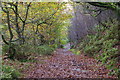
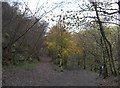
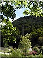
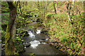
Nearby Images from Geograph Britain and Ireland:
©2006(licence)
©2008(licence)
©2011(licence)
©2007(licence)
©2008(licence)
The above images may not be of the site on this page, they are loaded from Geograph.
Please Submit an Image of this site or go out and take one for us!
Click here to see more info for this site
Nearby sites
Key: Red: member's photo, Blue: 3rd party photo, Yellow: other image, Green: no photo - please go there and take one, Grey: site destroyed
Download sites to:
KML (Google Earth)
GPX (GPS waypoints)
CSV (Garmin/Navman)
CSV (Excel)
To unlock full downloads you need to sign up as a Contributory Member. Otherwise downloads are limited to 50 sites.
Turn off the page maps and other distractions
Nearby sites listing. In the following links * = Image available
999m NE 42° Dawson City field* Standing Stone (Menhir) (SD9837428800)
2.2km NNE 16° Turn Hill Rock Art (SD9828830147)
2.4km S 174° Edge End Moor* Standing Stones (SD97962572)
2.5km WSW 243° Staups Moor Standing Stones (SD95452692)
2.6km WNW 301° New Edge Chalybeate (Colden)* Holy Well or Sacred Spring (SD9544729403)
2.7km NW 322° Pailer End Slade* Standing Stone (Menhir) (SD96053019)
2.8km SW 217° Eastwood Old Hall* Rock Art (SD9602425866)
3.2km NW 312° Standing Stone Hill (Heptonstall)* Standing Stone (Menhir) (SD9535430190)
3.3km E 100° Mount Skip (Hebden Bridge) Cairn (SE00952748)
3.7km E 100° Wicken Hill* Misc. Earthwork (SE0133527390)
3.7km NW 323° King Common Rough* Standing Stone (Menhir) (SD95443102)
3.7km NW 326° Graining Water Standing Stones (SD95593115)
3.8km NW 321° Black Scout* Rock Art (SD9530431001)
3.9km S 186° Stoodley Pike Circle (Mankinholes) Ring Cairn (SD97302420)
4.0km E 83° Greenwood Stone (Midgley Moor)* Marker Stone (SE0165228514)
4.0km NE 53° High Brown Knoll* Rock Art (SE0089930463)
4.0km WNW 303° Reap's Cross (Heptonstall Moor) Ancient Cross (SD9435830268)
4.1km NW 324° Ridge Rough* Rock Art (SD9530831358)
4.1km NE 41° Clattering Edge* Rock Art (SE0036731145)
4.1km SW 232° The Frying Pan 2* Cairn (SD9445425507)
4.2km NW 323° Ridge Rough* Standing Stones (SD95153140)
4.2km E 86° Miller's Grave* Cairn (SE0191328369)
4.3km SW 232° The Frying Pan 1* Cairn (SD9433425426)
4.3km E 95° Churn Milk Joan (Midgley Moor)* Standing Stone (Menhir) (SE0197327691)
4.3km ENE 63° Shore End Top Standing Stone (Menhir) (SE01533002)
View more nearby sites and additional images


 We would like to know more about this location. Please feel free to add a brief description and any relevant information in your own language.
 Wir möchten mehr über diese Stätte erfahren. Bitte zögern Sie nicht, eine kurze Beschreibung und relevante Informationen in Deutsch hinzuzufügen.
 Nous aimerions en savoir encore un peu sur les lieux. S'il vous plaît n'hesitez pas à ajouter une courte description et tous les renseignements pertinents dans votre propre langue.
 Quisieramos informarnos un poco más de las lugares. No dude en añadir una breve descripción y otros datos relevantes en su propio idioma.