


<< Text Pages >> Blake Hill 4 - Rock Art in England in County Durham
Submitted by Anne T on Wednesday, 09 May 2018 Page Views: 1191
Rock ArtSite Name: Blake Hill 4 Alternative Name: ERA-1739; SAM 32092; SMR/HER D10318Country: England
NOTE: This site is 1.7 km away from the location you searched for.
County: County Durham Type: Rock Art
Nearest Town: Middleton-in-Teesdale Nearest Village: Hury / Hunderthwaite
Map Ref: NY9372020115
Latitude: 54.576206N Longitude: 2.098663W
Condition:
| 5 | Perfect |
| 4 | Almost Perfect |
| 3 | Reasonable but with some damage |
| 2 | Ruined but still recognisable as an ancient site |
| 1 | Pretty much destroyed, possibly visible as crop marks |
| 0 | No data. |
| -1 | Completely destroyed |
| 5 | Superb |
| 4 | Good |
| 3 | Ordinary |
| 2 | Not Good |
| 1 | Awful |
| 0 | No data. |
| 5 | Can be driven to, probably with disabled access |
| 4 | Short walk on a footpath |
| 3 | Requiring a bit more of a walk |
| 2 | A long walk |
| 1 | In the middle of nowhere, a nightmare to find |
| 0 | No data. |
| 5 | co-ordinates taken by GPS or official recorded co-ordinates |
| 4 | co-ordinates scaled from a detailed map |
| 3 | co-ordinates scaled from a bad map |
| 2 | co-ordinates of the nearest village |
| 1 | co-ordinates of the nearest town |
| 0 | no data |
Be the first person to rate this site - see the 'Contribute!' box in the right hand menu.
Internal Links:
External Links:
Rock Art in County Durham
This rock art panel is recorded by NADRAP as having three cup like depressions at its western end, which may have been naturally formed.
For more information see England's Rock Art entry for ERA-1739 Blake Hill 4, which includes NADRAP's notes, photographs, a sketch of the rock and its motifs, plus photogrammetry.
It is not recorded if this rock art panel is on Open Access or private land; land usage given is 'unmanaged grassland'.
Note: Have you seen this rock art panel? Do you have any photographs or information to add?
You may be viewing yesterday's version of this page. To see the most up to date information please register for a free account.
Do not use the above information on other web sites or publications without permission of the contributor.
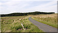
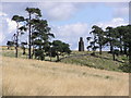
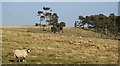
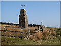
Nearby Images from Geograph Britain and Ireland:
©2012(licence)
©2006(licence)
©2015(licence)
©2015(licence)
©2008(licence)
The above images may not be of the site on this page, they are loaded from Geograph.
Please Submit an Image of this site or go out and take one for us!
Click here to see more info for this site
Nearby sites
Key: Red: member's photo, Blue: 3rd party photo, Yellow: other image, Green: no photo - please go there and take one, Grey: site destroyed
Download sites to:
KML (Google Earth)
GPX (GPS waypoints)
CSV (Garmin/Navman)
CSV (Excel)
To unlock full downloads you need to sign up as a Contributory Member. Otherwise downloads are limited to 50 sites.
Turn off the page maps and other distractions
Nearby sites listing. In the following links * = Image available
12m NNE 14° Blake Hill 3 Rock Art (NY9372320127)
21m NNE 19° Blake Hill 1 Rock Art (NY9372720135)
22m NE 36° Blake Hill 2 Rock Art (NY9373320133)
33m NNE 18° Blake Hill 5 Rock Art (NY9373020146)
422m E 98° Hillgill Plantation Rock Art (NY9413920057)
1.2km ESE 103° Hunderthwaite Moor 1 Rock Art (NY9485719854)
1.3km E 85° Howgill Grange 11 & 12 Rock Art (NY9506020240)
1.3km E 84° Howgill Grange 13* Rock Art (NY9506120244)
1.5km E 85° Howgill Grange 9* Rock Art (NY9517320235)
1.5km E 83° Howgill Grange 10* Rock Art (NY9518520280)
1.6km E 87° Howgill Grange 8* Rock Art (NY9527320193)
1.7km E 80° Howgill Grange 3* Rock Art (NY9536120410)
1.7km E 85° Howgill Grange 4* Rock Art (NY9541820248)
1.7km E 81° Howgill Grange 2* Rock Art (NY9540820366)
1.7km E 80° Howgill Grange 1.* Rock Art (NY9544620413)
1.8km E 88° Howgill Grange 7* Rock Art (NY9549820167)
1.8km E 88° Howgill Grange 6* Rock Art (NY9553220161)
1.8km E 89° Howgill Grange 5* Rock Art (NY9554320142)
1.9km SE 144° Blackton Reservoir 1* Rock Art (NY9484518555)
2.6km ENE 71° Romaldkirk Moor 3 Rock Art (NY9614820923)
2.8km ENE 70° Romaldkirk Moor 1 Rock Art (NY9632621055)
2.8km ENE 70° Romaldkirk Moor 2 Rock Art (NY9640021100)
3.0km SE 142° Goldsborough Rigg 10* Rock Art (NY9559417708)
3.1km SE 141° Goldsborough Rigg 9* Rock Art (NY9567617682)
3.1km SE 141° Goldsborough Rigg 11 Rock Art (NY9567517681)
View more nearby sites and additional images


 We would like to know more about this location. Please feel free to add a brief description and any relevant information in your own language.
 Wir möchten mehr über diese Stätte erfahren. Bitte zögern Sie nicht, eine kurze Beschreibung und relevante Informationen in Deutsch hinzuzufügen.
 Nous aimerions en savoir encore un peu sur les lieux. S'il vous plaît n'hesitez pas à ajouter une courte description et tous les renseignements pertinents dans votre propre langue.
 Quisieramos informarnos un poco más de las lugares. No dude en añadir una breve descripción y otros datos relevantes en su propio idioma.