


<< Our Photo Pages >> Little Langdale Cup-Marked Stone - Rock Art in England
Submitted by Adamibbo789 on Monday, 05 July 2021 Page Views: 741
Rock ArtSite Name: Little Langdale Cup-Marked StoneCountry: England
NOTE: This site is 0.8 km away from the location you searched for.
Type: Rock Art
Nearest Village: Little Langdale
Map Ref: NY317038
Latitude: 54.425024N Longitude: 3.054208W
Condition:
| 5 | Perfect |
| 4 | Almost Perfect |
| 3 | Reasonable but with some damage |
| 2 | Ruined but still recognisable as an ancient site |
| 1 | Pretty much destroyed, possibly visible as crop marks |
| 0 | No data. |
| -1 | Completely destroyed |
| 5 | Superb |
| 4 | Good |
| 3 | Ordinary |
| 2 | Not Good |
| 1 | Awful |
| 0 | No data. |
| 5 | Can be driven to, probably with disabled access |
| 4 | Short walk on a footpath |
| 3 | Requiring a bit more of a walk |
| 2 | A long walk |
| 1 | In the middle of nowhere, a nightmare to find |
| 0 | No data. |
| 5 | co-ordinates taken by GPS or official recorded co-ordinates |
| 4 | co-ordinates scaled from a detailed map |
| 3 | co-ordinates scaled from a bad map |
| 2 | co-ordinates of the nearest village |
| 1 | co-ordinates of the nearest town |
| 0 | no data |
Be the first person to rate this site - see the 'Contribute!' box in the right hand menu.
Internal Links:
External Links:
")
On private land, but very visible from the nearby footpath.
The National Trust states: "Approximately 12 small cup marks set into the smoothed surface of a now upright stone which is currently set into a relict field boundary. Probably not in its original position."
You may be viewing yesterday's version of this page. To see the most up to date information please register for a free account.
")
Do not use the above information on other web sites or publications without permission of the contributor.
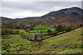
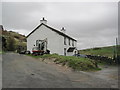
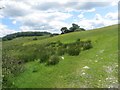
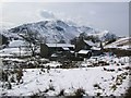
Nearby Images from Geograph Britain and Ireland:
![NY3103 : Track from Dale End to Elterwater [1] by Michael Dibb](https://s2.geograph.org.uk/geophotos/06/21/00/6210098_f0be1aeb_120x120.jpg)
©2019(licence)
©2010(licence)
©2012(licence)
©2016(licence)
©2008(licence)
The above images may not be of the site on this page, they are loaded from Geograph.
Please Submit an Image of this site or go out and take one for us!
Click here to see more info for this site
Nearby sites
Key: Red: member's photo, Blue: 3rd party photo, Yellow: other image, Green: no photo - please go there and take one, Grey: site destroyed
Download sites to:
KML (Google Earth)
GPX (GPS waypoints)
CSV (Garmin/Navman)
CSV (Excel)
To unlock full downloads you need to sign up as a Contributory Member. Otherwise downloads are limited to 50 sites.
Turn off the page maps and other distractions
Nearby sites listing. In the following links * = Image available
2.0km WSW 254° Castle Howe (Little Langdale)* Hillfort (NY29730328)
2.1km N 351° Copt Howe* Rock Art (NY31400583)
3.0km S 181° Holmes Fell and Uskdale Gap* Cairn (NY316008)
3.5km WNW 300° Great Langdale* Rock Art (NY28650560)
4.2km NNE 23° Allan Bank Cup Marked Stone* Rock Art (NY334076)
4.5km NNE 27° Grasmere Cup-Marked Rocks* Rock Art (NY33850778)
5.5km NW 308° Langdale Axe Factory* Ancient Mine, Quarry or other Industry (NY274072)
5.6km E 93° Ambleside Roman Fort* Ancient Village or Settlement (NY37260339)
5.7km ENE 65° Rydal Hall Cup Marks Rock Art (NY369061)
6.0km E 79° The Armitt* Museum (NY376048)
6.2km NNW 348° Grasmere - Far Easedale* Natural Stone / Erratic / Other Natural Feature (NY305099)
6.4km NNE 18° Mêni Arthur Natural Stone / Erratic / Other Natural Feature (NY338099)
7.6km SW 215° Old Man of Coniston and Goat Hawes* Cairn (SD272977)
7.6km SW 231° Round Cairn at Raven Nest Howe, Seathwaite Tarn Ring Cairn (SD257991)
7.7km SSW 201° Heathwaite How* Stone Circle (SD2876396672)
7.8km SSW 204° Banishead Stone Circle* Stone Circle (SD2846796700)
8.0km N 6° Dunmail Raise* Round Cairn (NY32721170)
8.2km SW 233° Ring Cairn, Tarn Brow, Seathwaite Tarn Ring Cairn (SD250990)
8.3km SW 228° Ring Cairn at Woody Crag, Seathwaite Tarn Ring Cairn (SD254984)
8.5km SSW 206° Little Arrow* Stone Circle (SD278962)
9.0km SSW 210° Torver Beck Homestead* Ancient Village or Settlement (SD271961)
9.0km SW 230° Ring Cairn, Lead Pike, Seathwaite Tarn Ring Cairn (SD247981)
9.0km SW 231° Lead Pike, Seathwaite* Ring Cairn (SD246982)
9.1km SW 230° Ring Bank Enclosure, Lead Pike, Seathwaite Tarn Ring Cairn (SD246981)
9.4km SE 145° St Helen's Well (Thorpe Hesley) Holy Well or Sacred Spring (SD370960)
View more nearby sites and additional images


 We would like to know more about this location. Please feel free to add a brief description and any relevant information in your own language.
 Wir möchten mehr über diese Stätte erfahren. Bitte zögern Sie nicht, eine kurze Beschreibung und relevante Informationen in Deutsch hinzuzufügen.
 Nous aimerions en savoir encore un peu sur les lieux. S'il vous plaît n'hesitez pas à ajouter une courte description et tous les renseignements pertinents dans votre propre langue.
 Quisieramos informarnos un poco más de las lugares. No dude en añadir una breve descripción y otros datos relevantes en su propio idioma.