

, Aubrey Burl")
<< Our Photo Pages >> Culnoag - Rock Art in Scotland in Dumfries and Galloway
Submitted by SolarMegalith on Monday, 26 September 2016 Page Views: 1830
Rock ArtSite Name: CulnoagCountry: Scotland
NOTE: This site is 0.9 km away from the location you searched for.
County: Dumfries and Galloway Type: Rock Art
Nearest Village: Sorbie
Map Ref: NX41744693
Latitude: 54.792219N Longitude: 4.463031W
Condition:
| 5 | Perfect |
| 4 | Almost Perfect |
| 3 | Reasonable but with some damage |
| 2 | Ruined but still recognisable as an ancient site |
| 1 | Pretty much destroyed, possibly visible as crop marks |
| 0 | No data. |
| -1 | Completely destroyed |
| 5 | Superb |
| 4 | Good |
| 3 | Ordinary |
| 2 | Not Good |
| 1 | Awful |
| 0 | No data. |
| 5 | Can be driven to, probably with disabled access |
| 4 | Short walk on a footpath |
| 3 | Requiring a bit more of a walk |
| 2 | A long walk |
| 1 | In the middle of nowhere, a nightmare to find |
| 0 | No data. |
| 5 | co-ordinates taken by GPS or official recorded co-ordinates |
| 4 | co-ordinates scaled from a detailed map |
| 3 | co-ordinates scaled from a bad map |
| 2 | co-ordinates of the nearest village |
| 1 | co-ordinates of the nearest town |
| 0 | no data |
Internal Links:
External Links:
I have visited· I would like to visit
SolarMegalith visited on 22nd Sep 2016 - their rating: Cond: 4 Amb: 3 Access: 4
")
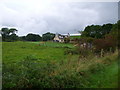
This cup-and-ring marked rock surface is located between Doonhill and Culnoag farms. It is partly turf-covered, the motifs consist of nine cup-and-ring marks with up to six rings and +12 cup-marks.
Reference:
Morris, R. The Prehistoric Rock Art of Galloway and Isle of Man. Poole: Blandford Press (p. 91).
For more information also see Canmore ID 63209.
You may be viewing yesterday's version of this page. To see the most up to date information please register for a free account.
")
")
")
Do not use the above information on other web sites or publications without permission of the contributor.
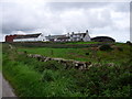
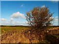
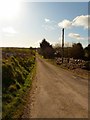
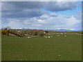
Nearby Images from Geograph Britain and Ireland:
©2007(licence)
©2012(licence)
©2012(licence)
©2008(licence)
©2007(licence)
The above images may not be of the site on this page, they are loaded from Geograph.
Please Submit an Image of this site or go out and take one for us!
Click here to see more info for this site
Nearby sites
Key: Red: member's photo, Blue: 3rd party photo, Yellow: other image, Green: no photo - please go there and take one, Grey: site destroyed
Download sites to:
KML (Google Earth)
GPX (GPS waypoints)
CSV (Garmin/Navman)
CSV (Excel)
To unlock full downloads you need to sign up as a Contributory Member. Otherwise downloads are limited to 50 sites.
Turn off the page maps and other distractions
Nearby sites listing. In the following links * = Image available
379m WNW 295° Doon Hill Ancient Village or Settlement (NX414471)
1.1km W 262° Dowalton Crannogs* Crannog (NX40614681)
1.6km NE 35° Claunch Cup and Ring 2 Rock Art (NX427482)
1.9km NE 35° Claunch Cup and Ring 1* Rock Art (NX42904845)
1.9km NE 39° Claunch Stone Standing Stone (Menhir) (NX430484)
2.1km WNW 284° Miller's Cairn Crannog (NX397475)
3.3km SSW 206° White Loch. Crannog (NX40174404)
3.7km WNW 287° Longcastle School House* Standing Stone (Menhir) (NX3824948105)
4.3km ESE 105° Broughton Mains* Rock Art (NX45814565)
4.4km NNE 20° North Balfern Cup and Rings* Rock Art (NX43375098)
4.5km NNE 24° Ring Hill* Hillfort (NX43725095)
4.6km N 4° St. Kennera's Cross* Ancient Cross (NX42195150)
5.9km WSW 246° Drumtroddan Cup and Ring Markings* Rock Art (NX36264474)
5.9km WSW 241° Drumtroddan Stone Row* Stone Row / Alignment (NX36454430)
6.3km NNW 332° Barvernochan Standing Stone* Standing Stone (Menhir) (NX38975255)
6.3km SW 221° Blairbuy 3* Rock Art (NX37464233)
6.6km SW 233° Lady Well (Monreith Mains) Holy Well or Sacred Spring (NX36314315)
6.6km SW 218° Fell of Barhullion* Hillfort (NX37454188)
6.6km SW 217° Blairbuy 5* Rock Art (NX37594175)
6.6km SE 143° St Kiaran's Well (Chapelheron) Holy Well or Sacred Spring (NX456415)
6.7km SW 226° Blairbuy 6* Rock Art (NX36714243)
6.9km SW 236° White Loch of Myrton* Crannog (NX35854328)
6.9km SW 232° Black Loch of Myrton Settlement* Crannog (NX3610442835)
7.0km SW 223° Blairbuy 4 Rock Art (NX368420)
7.1km SSE 168° Rispain Camp* Ancient Village or Settlement (NX4293039930)
View more nearby sites and additional images


 We would like to know more about this location. Please feel free to add a brief description and any relevant information in your own language.
 Wir möchten mehr über diese Stätte erfahren. Bitte zögern Sie nicht, eine kurze Beschreibung und relevante Informationen in Deutsch hinzuzufügen.
 Nous aimerions en savoir encore un peu sur les lieux. S'il vous plaît n'hesitez pas à ajouter une courte description et tous les renseignements pertinents dans votre propre langue.
 Quisieramos informarnos un poco más de las lugares. No dude en añadir una breve descripción y otros datos relevantes en su propio idioma.