


<< Text Pages >> Broom Ridge - Round Barrow(s) in England in Northumberland
Submitted by vicky on Monday, 24 March 2003 Page Views: 4943
Neolithic and Bronze AgeSite Name: Broom RidgeCountry: England
NOTE: This site is 1.6 km away from the location you searched for.
County: Northumberland Type: Round Barrow(s)
Map Ref: NT925393 Landranger Map Number: 74
Latitude: 55.647182N Longitude: 2.12073W
Condition:
| 5 | Perfect |
| 4 | Almost Perfect |
| 3 | Reasonable but with some damage |
| 2 | Ruined but still recognisable as an ancient site |
| 1 | Pretty much destroyed, possibly visible as crop marks |
| 0 | No data. |
| -1 | Completely destroyed |
| 5 | Superb |
| 4 | Good |
| 3 | Ordinary |
| 2 | Not Good |
| 1 | Awful |
| 0 | No data. |
| 5 | Can be driven to, probably with disabled access |
| 4 | Short walk on a footpath |
| 3 | Requiring a bit more of a walk |
| 2 | A long walk |
| 1 | In the middle of nowhere, a nightmare to find |
| 0 | No data. |
| 5 | co-ordinates taken by GPS or official recorded co-ordinates |
| 4 | co-ordinates scaled from a detailed map |
| 3 | co-ordinates scaled from a bad map |
| 2 | co-ordinates of the nearest village |
| 1 | co-ordinates of the nearest town |
| 0 | no data |
Internal Links:
External Links:
Round Barrow in Northumberland
Have you visited this site? Please add a comment below.
You may be viewing yesterday's version of this page. To see the most up to date information please register for a free account.
")
")
Do not use the above information on other web sites or publications without permission of the contributor.
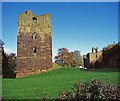
Nearby Images from Geograph Britain and Ireland:
©2005(licence)

©2025(licence)

©2020(licence)

©2017(licence)

©2025(licence)
The above images may not be of the site on this page, they are loaded from Geograph.
Please Submit an Image of this site or go out and take one for us!
Click here to see more info for this site
Nearby sites
Key: Red: member's photo, Blue: 3rd party photo, Yellow: other image, Green: no photo - please go there and take one, Grey: site destroyed
Download sites to:
KML (Google Earth)
GPX (GPS waypoints)
CSV (Garmin/Navman)
CSV (Excel)
To unlock full downloads you need to sign up as a Contributory Member. Otherwise downloads are limited to 50 sites.
Turn off the page maps and other distractions
Nearby sites listing. In the following links * = Image available
300m N 360° Etal Fort Hillfort (NT925396)
528m NNE 29° St Mary's Well (New Etal)* Holy Well or Sacred Spring (NT92763976)
2.4km SE 145° Ford Westfield a & b Rock Art (NT9390037300)
3.8km S 172° Milfield North* Henge (NT930355)
4.0km SW 227° Branxton Hill Settlement Hillfort (NT896366)
4.1km ESE 109° Blackchesters* Hillfort (NT96383793)
4.2km WSW 258° The King's Stone (Coldstream)* Standing Stone (Menhir) (NT88423845)
4.2km S 182° Flodden Camp Hillfort (NT92373510)
4.4km N 7° Duddo Five Stones* Stone Circle (NT9305743705)
4.6km SSE 169° Milfield North Timber Circle (NT934348)
4.7km S 170° Whitton Hill Timber Circle (NT933347)
4.8km S 169° Milfield South Henge (NT934346)
4.8km ESE 118° Broomridge 4 Rock Art (NT9678237048)
4.9km ESE 117° Broomridge 3* Rock Art (NT9687637023)
5.0km ESE 116° Broom Ridge Barrow* Round Barrow(s) (NT970371)
5.1km ESE 116° Broomridge 2* Rock Art (NT9704237046)
5.1km ENE 72° Watch Law Farm Rock Art (NT9733040850)
5.2km NE 55° Lickar Moor Rock Art (NT9680042300)
5.3km ESE 114° Broomridge 1* Rock Art (NT9729837110)
5.5km ESE 121° Fordwood Camp Hillfort (NT972365)
5.6km NW 319° Twizel Standing Stone* Standing Stone (Menhir) (NT88804349)
5.6km S 170° Threefords North Neolithic House* Ancient Village or Settlement (NT9350033800)
5.6km ESE 114° Goatscrag a Rock Art (NT9766437040)
5.6km SSE 163° Maelmin Anglo-Saxon Royal Settlement. Ancient Village or Settlement (NT941339)
5.7km ESE 114° Goatscrag Rock Shelter* Cave or Rock Shelter (NT9771237019)
View more nearby sites and additional images


 We would like to know more about this location. Please feel free to add a brief description and any relevant information in your own language.
 Wir möchten mehr über diese Stätte erfahren. Bitte zögern Sie nicht, eine kurze Beschreibung und relevante Informationen in Deutsch hinzuzufügen.
 Nous aimerions en savoir encore un peu sur les lieux. S'il vous plaît n'hesitez pas à ajouter une courte description et tous les renseignements pertinents dans votre propre langue.
 Quisieramos informarnos un poco más de las lugares. No dude en añadir una breve descripción y otros datos relevantes en su propio idioma.