


<< Our Photo Pages >> Crichton’s Cairn - Cairn in Scotland in East Dunbartonshire
Submitted by Antonine on Monday, 22 May 2023 Page Views: 1168
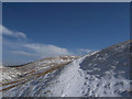
Neolithic and Bronze AgeSite Name: Crichton’s CairnCountry: Scotland
NOTE: This site is 2.0 km away from the location you searched for.
County: East Dunbartonshire Type: Cairn
Nearest Town: Lennoxtown Nearest Village: Clachan of Campsie
Map Ref: NS62607997
Latitude: 55.992950N Longitude: 4.204375W
Condition:
| 5 | Perfect |
| 4 | Almost Perfect |
| 3 | Reasonable but with some damage |
| 2 | Ruined but still recognisable as an ancient site |
| 1 | Pretty much destroyed, possibly visible as crop marks |
| 0 | No data. |
| -1 | Completely destroyed |
| 5 | Superb |
| 4 | Good |
| 3 | Ordinary |
| 2 | Not Good |
| 1 | Awful |
| 0 | No data. |
| 5 | Can be driven to, probably with disabled access |
| 4 | Short walk on a footpath |
| 3 | Requiring a bit more of a walk |
| 2 | A long walk |
| 1 | In the middle of nowhere, a nightmare to find |
| 0 | No data. |
| 5 | co-ordinates taken by GPS or official recorded co-ordinates |
| 4 | co-ordinates scaled from a detailed map |
| 3 | co-ordinates scaled from a bad map |
| 2 | co-ordinates of the nearest village |
| 1 | co-ordinates of the nearest town |
| 0 | no data |
Be the first person to rate this site - see the 'Contribute!' box in the right hand menu.
Internal Links:
External Links:
")
There are several theories of how the cairn got its name. The most likely is that it was named after James Crichton who became the Parish Minister in 1623, and who studied his sermons at the summit.
You may be viewing yesterday's version of this page. To see the most up to date information please register for a free account.
")
Do not use the above information on other web sites or publications without permission of the contributor.
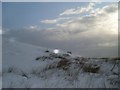
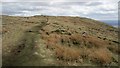
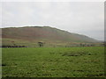
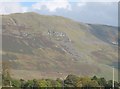
Nearby Images from Geograph Britain and Ireland:
©2010(licence)
©2013(licence)
©2018(licence)
©2009(licence)
©2007(licence)
The above images may not be of the site on this page, they are loaded from Geograph.
Please Submit an Image of this site or go out and take one for us!
Click here to see more info for this site
Nearby sites
Key: Red: member's photo, Blue: 3rd party photo, Yellow: other image, Green: no photo - please go there and take one, Grey: site destroyed
Download sites to:
KML (Google Earth)
GPX (GPS waypoints)
CSV (Garmin/Navman)
CSV (Excel)
To unlock full downloads you need to sign up as a Contributory Member. Otherwise downloads are limited to 50 sites.
Turn off the page maps and other distractions
Nearby sites listing. In the following links * = Image available
5.0km NE 36° Waterhead* Standing Stones (NS6570583932)
5.3km SW 227° Craigmaddie Muir* Chambered Cairn (NS58597646)
5.6km SW 230° Auld Wives Lift* Natural Stone / Erratic / Other Natural Feature (NS5818576458)
5.6km SW 230° North Blochairn 3* Rock Art (NS58187646)
5.7km W 262° Broadgate Farm (Strathblane)* Standing Stone (Menhir) (NS5692979402)
5.8km SW 228° North Blochairn 2 Rock Art (NS58147623)
5.8km W 262° Broadgate 2 Cairn (NS568793)
5.9km SW 229° North Blochairn 1 Rock Art (NS58087623)
5.9km W 262° Broadgate (Strathblane) Chambered Cairn (NS56747934)
6.1km SW 227° Craigmaddie Muir 2 (Baldernock) Cairn (NS5876)
6.2km W 263° Strathblane Churchyard* Standing Stone (Menhir) (NS5638779375)
6.3km SW 222° Blochairn 1 Cairn Cairn (NS582754)
6.4km WSW 245° Loch Ardinning (Mugdock) Rock Art (NS567775)
6.5km SSE 156° Kirkintilloch Roman Fort Not Known (by us) (NS65117396)
6.8km SSE 163° Easter Cadder Roman Camp Not Known (by us) (NS64397344)
7.0km S 169° Glasgow Bridge Roman Fortlet Ancient Village or Settlement (NS63727307)
7.3km WSW 241° Middleton Row Stone Row / Alignment (NS561766)
7.3km SE 132° Auchendavy Fort Promontory Fort / Cliff Castle (NS67887489)
7.5km S 185° Cadder Roman Fort Ancient Village or Settlement (NS61697250)
7.5km WNW 300° Earl’s Seat Cairn* Cairn (NS562840)
7.9km NNW 346° Knockraich (Fintry)* Standing Stone (Menhir) (NS60898774)
8.2km WSW 248° Echo Stone (Mugdock) Natural Stone / Erratic / Other Natural Feature (NS54937710)
8.4km SSW 198° Wilderness Plantation Roman Fort Not Known (by us) (NS59757208)
8.5km ESE 120° Twechar Roman Camp Not Known (by us) (NS69837543)
8.7km NE 34° Todholes (Fintry Hills) Cairn (NS67748702)
View more nearby sites and additional images


 We would like to know more about this location. Please feel free to add a brief description and any relevant information in your own language.
 Wir möchten mehr über diese Stätte erfahren. Bitte zögern Sie nicht, eine kurze Beschreibung und relevante Informationen in Deutsch hinzuzufügen.
 Nous aimerions en savoir encore un peu sur les lieux. S'il vous plaît n'hesitez pas à ajouter une courte description et tous les renseignements pertinents dans votre propre langue.
 Quisieramos informarnos un poco más de las lugares. No dude en añadir una breve descripción y otros datos relevantes en su propio idioma.