


<< Text Pages >> Dun Gotter - Hillfort in Scotland in Renfrewshire
Submitted by AstroGeologist on Thursday, 23 May 2019 Page Views: 692
Iron Age and Later PrehistorySite Name: Dun Gotter Alternative Name: Castle Hill, Gotter Linn, South GibbalstonCountry: Scotland
NOTE: This site is 1.8 km away from the location you searched for.
County: Renfrewshire Type: Hillfort
Nearest Town: Port Glasgow Nearest Village: Quarrier's Village
Map Ref: NS3458666033
Latitude: 55.859020N Longitude: 4.644463W
Condition:
| 5 | Perfect |
| 4 | Almost Perfect |
| 3 | Reasonable but with some damage |
| 2 | Ruined but still recognisable as an ancient site |
| 1 | Pretty much destroyed, possibly visible as crop marks |
| 0 | No data. |
| -1 | Completely destroyed |
| 5 | Superb |
| 4 | Good |
| 3 | Ordinary |
| 2 | Not Good |
| 1 | Awful |
| 0 | No data. |
| 5 | Can be driven to, probably with disabled access |
| 4 | Short walk on a footpath |
| 3 | Requiring a bit more of a walk |
| 2 | A long walk |
| 1 | In the middle of nowhere, a nightmare to find |
| 0 | No data. |
| 5 | co-ordinates taken by GPS or official recorded co-ordinates |
| 4 | co-ordinates scaled from a detailed map |
| 3 | co-ordinates scaled from a bad map |
| 2 | co-ordinates of the nearest village |
| 1 | co-ordinates of the nearest town |
| 0 | no data |
Internal Links:
External Links:
Hillfort in Renfrewshire
Dun Gotter is located on a rocky promontory overlooking the Gotter Water in the Renfrewshire Countryside.
Situated about 120m above sea level, it has a rough oval shape to it and measures approximately 70m x 50m.
The perimeter is defined on the N, W and S sides by traces of a denuded stone wall running along the edge of the steep natural slopes. When "F. Newall" was investigating the Dun in 1964 the Rampart remains were 3m wide and 30cm high. The entrance is in the middle of the East side and the scarp from the SE continues past the entrance on the inside to form a passage leading up into the interior.
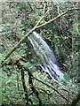
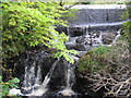
The Dun is now surrounded by trees, and with several waterfalls nearby it is a peaceful place. When cleared of trees the people inside the Dun would have had great views of the land below to the North.
For more information : Canmore ID 42299
You may be viewing yesterday's version of this page. To see the most up to date information please register for a free account.
Do not use the above information on other web sites or publications without permission of the contributor.
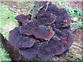
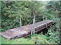
Nearby Images from Geograph Britain and Ireland:
©2007(licence)
©2007(licence)
©2007(licence)

©2007(licence)
©2007(licence)
The above images may not be of the site on this page, they are loaded from Geograph.
Please Submit an Image of this site or go out and take one for us!
Click here to see more info for this site
Nearby sites
Key: Red: member's photo, Blue: 3rd party photo, Yellow: other image, Green: no photo - please go there and take one, Grey: site destroyed
Download sites to:
KML (Google Earth)
GPX (GPS waypoints)
CSV (Garmin/Navman)
CSV (Excel)
To unlock full downloads you need to sign up as a Contributory Member. Otherwise downloads are limited to 50 sites.
Turn off the page maps and other distractions
Nearby sites listing. In the following links * = Image available
2.1km SW 226° Ladymuir Cairn Cairn (NS3299964600)
3.3km W 273° Smeath Hill Cairn Cairn (NS3131566308)
3.9km ESE 119° Lawmarnock Cup Marks Rock Art (NS3794264004)
3.9km E 80° Law Hill Dun Hillfort (NS38506659)
4.0km NE 43° Barlogan Cairn* Cairn (NS37426887)
4.2km S 171° Knockmade Tumulus Barrow Cemetery (NS35126184)
4.3km SE 141° Dun Bower Hillfort (NS3721962579)
4.5km NE 42° Lawfield Cairn* Cairn (NS37736922)
4.7km NW 307° Burnbank Cairn Cairn (NS3095368963)
4.8km NE 51° St Fillan's Seat (Kilallan)* Natural Stone / Erratic / Other Natural Feature (NS38396892)
4.8km E 94° Broom Cist Cist (NS39356552)
4.8km NE 50° St Fillan's Holy Well (Kilallan)* Holy Well or Sacred Spring (NS38406899)
4.9km NE 34° Elphinstone Fort Hillfort (NS37506995)
5.0km SSW 204° Glenward Cairn Cairn (NS32356159)
5.1km N 352° Pennytersal Mounds Artificial Mound (NS3402071145)
5.2km W 275° Dunnairbuck Cairn Cairn (NS2944166642)
5.5km E 84° Houston Tumulus Barrow Cemetery (NS40066640)
5.5km SSE 148° Clochodrick Stone* Natural Stone / Erratic / Other Natural Feature (NS37366127)
5.5km NNW 335° Devol 1 Rock Art (NS324711)
5.5km E 83° Houston South Mound Cairn (NS4010066487)
5.6km ENE 65° Sewn Dun Hillfort (NS39766816)
5.8km N 356° Craigmarloch Fort Hillfort (NS34437185)
5.8km E 86° Back O' Hill Farm Cup Marked Stone Rock Art (NS40456623)
6.2km NNW 347° Cunston Cist Cist (NS33407210)
6.2km NNW 328° Devol 2 Rock Art (NS31547144)
View more nearby sites and additional images


 We would like to know more about this location. Please feel free to add a brief description and any relevant information in your own language.
 Wir möchten mehr über diese Stätte erfahren. Bitte zögern Sie nicht, eine kurze Beschreibung und relevante Informationen in Deutsch hinzuzufügen.
 Nous aimerions en savoir encore un peu sur les lieux. S'il vous plaît n'hesitez pas à ajouter une courte description et tous les renseignements pertinents dans votre propre langue.
 Quisieramos informarnos un poco más de las lugares. No dude en añadir una breve descripción y otros datos relevantes en su propio idioma.