

<< Text Pages >> Sandy Road East - Stone Circle in Scotland in Perth and Kinross
Submitted by Tom_Bullock on Sunday, 14 July 2002 Page Views: 4176
Neolithic and Bronze AgeSite Name: Sandy Road EastCountry: Scotland
NOTE: This site is 1.3 km away from the location you searched for.
County: Perth and Kinross Type: Stone Circle
Map Ref: NO13282646 Landranger Map Number: 53
Latitude: 56.422356N Longitude: 3.407443W
Condition:
| 5 | Perfect |
| 4 | Almost Perfect |
| 3 | Reasonable but with some damage |
| 2 | Ruined but still recognisable as an ancient site |
| 1 | Pretty much destroyed, possibly visible as crop marks |
| 0 | No data. |
| -1 | Completely destroyed |
| 5 | Superb |
| 4 | Good |
| 3 | Ordinary |
| 2 | Not Good |
| 1 | Awful |
| 0 | No data. |
| 5 | Can be driven to, probably with disabled access |
| 4 | Short walk on a footpath |
| 3 | Requiring a bit more of a walk |
| 2 | A long walk |
| 1 | In the middle of nowhere, a nightmare to find |
| 0 | No data. |
| 5 | co-ordinates taken by GPS or official recorded co-ordinates |
| 4 | co-ordinates scaled from a detailed map |
| 3 | co-ordinates scaled from a bad map |
| 2 | co-ordinates of the nearest village |
| 1 | co-ordinates of the nearest town |
| 0 | no data |
Internal Links:
External Links:
Destroyed Stone Circle in Perthshire
Canmore ID 28157
You may be viewing yesterday's version of this page. To see the most up to date information please register for a free account.
Do not use the above information on other web sites or publications without permission of the contributor.
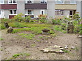
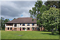
Nearby Images from Geograph Britain and Ireland:
©2021(licence)
©2009(licence)
©2009(licence)
©2009(licence)
©2013(licence)
The above images may not be of the site on this page, they are loaded from Geograph.
Please Submit an Image of this site or go out and take one for us!
Click here to see more info for this site
Nearby sites
Key: Red: member's photo, Blue: 3rd party photo, Yellow: other image, Green: no photo - please go there and take one, Grey: site destroyed
Download sites to:
KML (Google Earth)
GPX (GPS waypoints)
CSV (Garmin/Navman)
CSV (Excel)
To unlock full downloads you need to sign up as a Contributory Member. Otherwise downloads are limited to 50 sites.
Turn off the page maps and other distractions
Nearby sites listing. In the following links * = Image available
6m WNW 300° Sandy Road* Stone Circle (NO1327526463)
1.9km E 95° Murrayshall* Standing Stone (Menhir) (NO1519926265)
2.2km NW 314° Scone Cursus Cursus (NO11712803)
2.3km NW 310° Scone Cursus Cursus (NO11532797)
2.3km SSW 193° Murray Royal Hospital* Standing Stone (Menhir) (NO127242)
2.4km ENE 68° Shianbank NW* Stone Circle (NO15552731)
2.4km ENE 69° Shianbank SE* Stone Circle (NO15562729)
3.0km SSW 206° Inchyra* Class I Pictish Symbol Stone (NO119238)
3.0km SSW 206° Perth Museum and Art Gallery* Museum (NO119238)
3.8km E 97° Arnbathie Fort* Hillfort (NO1703125894)
3.9km SSW 198° South Inch, Perth Standing Stone (Menhir) (NO12002274)
4.0km WNW 296° King's Stone (Perth)* Standing Stone (Menhir) (NO09712828)
4.1km E 86° Shien Hill* Round Cairn (NO1735926678)
4.3km WNW 296° Denmarkfield Farm Standing Stone (Menhir) (NO09402844)
4.4km WNW 288° Broxy Kennels* Hillfort (NO09112788)
4.5km ESE 110° Commonbank* Stone Circle (NO1748824837)
4.5km ESE 110° Commonbank* Stone Row / Alignment (NO17502484)
4.6km N 5° Williamston Stone Circle (NO138310)
4.7km WSW 256° Hunting Tower Cursus (NO087254)
4.7km ESE 111° Commonbank SE Stone Circle (NO177247)
4.8km NNE 12° Tammieteeth* Cairn (NO14403109)
4.9km N 350° Druids Seat* Stone Circle (NO12483132)
5.2km NNW 333° Colen* Stone Circle (NO110311)
5.2km NNE 31° Brownies Knowe Stone Circle (NO16063092)
5.3km N 8° Blackfaulds* Stone Circle (NO14133167)
View more nearby sites and additional images

")
 We would like to know more about this location. Please feel free to add a brief description and any relevant information in your own language.
 Wir möchten mehr über diese Stätte erfahren. Bitte zögern Sie nicht, eine kurze Beschreibung und relevante Informationen in Deutsch hinzuzufügen.
 Nous aimerions en savoir encore un peu sur les lieux. S'il vous plaît n'hesitez pas à ajouter une courte description et tous les renseignements pertinents dans votre propre langue.
 Quisieramos informarnos un poco más de las lugares. No dude en añadir una breve descripción y otros datos relevantes en su propio idioma.