


<< Our Photo Pages >> St Columba's Well (Ardnamurchan) - Holy Well or Sacred Spring in Scotland in Highlands
Submitted by KiwiBetsy on Sunday, 08 October 2006 Page Views: 8821
Springs and Holy WellsSite Name: St Columba's Well (Ardnamurchan)Country: Scotland
NOTE: This site is 2.1 km away from the location you searched for.
County: Highlands Type: Holy Well or Sacred Spring
Nearest Town: Glenborrodale
Map Ref: NM566615
Latitude: 56.681666N Longitude: 5.975624W
Condition:
| 5 | Perfect |
| 4 | Almost Perfect |
| 3 | Reasonable but with some damage |
| 2 | Ruined but still recognisable as an ancient site |
| 1 | Pretty much destroyed, possibly visible as crop marks |
| 0 | No data. |
| -1 | Completely destroyed |
| 5 | Superb |
| 4 | Good |
| 3 | Ordinary |
| 2 | Not Good |
| 1 | Awful |
| 0 | No data. |
| 5 | Can be driven to, probably with disabled access |
| 4 | Short walk on a footpath |
| 3 | Requiring a bit more of a walk |
| 2 | A long walk |
| 1 | In the middle of nowhere, a nightmare to find |
| 0 | No data. |
| 5 | co-ordinates taken by GPS or official recorded co-ordinates |
| 4 | co-ordinates scaled from a detailed map |
| 3 | co-ordinates scaled from a bad map |
| 2 | co-ordinates of the nearest village |
| 1 | co-ordinates of the nearest town |
| 0 | no data |
Internal Links:
External Links:
 (PID:24768)")
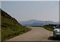
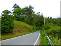
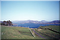
When heading from Glenborrodale to Kilchoan on the B8007, the entrance to Ardslignish Farm is on the left at the top of a sharp rise. Park and walk back down the road a short distance. The well is located in a steep bank beside the road but is unlikely to be spotted from passing cars.
You may be viewing yesterday's version of this page. To see the most up to date information please register for a free account.
 (PID:24769)")
Do not use the above information on other web sites or publications without permission of the contributor.
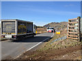
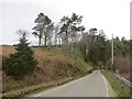
Nearby Images from Geograph Britain and Ireland:
©2015(licence)
©2015(licence)
©2010(licence)
©2017(licence)
©2020(licence)
The above images may not be of the site on this page, they are loaded from Geograph.
Please Submit an Image of this site or go out and take one for us!
Click here to see more info for this site
Nearby sites
Key: Red: member's photo, Blue: 3rd party photo, Yellow: other image, Green: no photo - please go there and take one, Grey: site destroyed
Download sites to:
KML (Google Earth)
GPX (GPS waypoints)
CSV (Garmin/Navman)
CSV (Excel)
To unlock full downloads you need to sign up as a Contributory Member. Otherwise downloads are limited to 50 sites.
Turn off the page maps and other distractions
Nearby sites listing. In the following links * = Image available
668m WNW 293° Camus Nan Geall* Chambered Cairn (NM560618)
8.9km NNW 331° Cladh Chatain Standing Stones (NM52696949)
9.3km WNW 282° Greadal Fhinn* Chambered Cairn (NM47656397)
9.4km SW 225° Dun Urgadul Stone Fort or Dun (NM49475527)
9.5km NNW 345° Cladh Aindreis Chambered Cairn (NM547708)
9.5km ESE 122° Greadal Fhinn Passage Grave (NM644560)
9.5km ESE 122° Rahoy. Passage Grave (NM644560)
9.9km SW 219° Balliscate* Stone Row / Alignment (NM49965413)
11.4km S 185° Ardnacross Cairn* Cairn (NM55025014)
11.7km S 184° An Sean Chaisteal* Broch or Nuraghe (NM55104988)
12.5km S 188° Ardnacross North* Stone Row / Alignment (NM5417949181)
12.6km S 188° Ardnacross Cairns* Cairn (NM54184914)
12.6km S 188° Ardnacross South* Stone Row / Alignment (NM5419049135)
13.8km WSW 248° Glengorm* Stone Row / Alignment (NM43475713)
14.3km WSW 251° Dun Ara* Stone Fort or Dun (NM42725771)
14.4km WSW 245° An Sean Dun Stone Fort or Dun (NM43105624)
14.7km NW 304° Fort at Rubha an Duin Bhain* Promontory Fort / Cliff Castle (NM44857040)
15.4km SSW 196° Ledmore Crannog (NM51514696)
15.5km SW 234° Maol Mor* Stone Row / Alignment (NM4360453056)
15.8km SW 230° Dervaig centre* Stone Row / Alignment (NM43905203)
15.9km SW 229° Priest's Well (Dervaig)* Holy Well or Sacred Spring (NM440518)
15.9km SW 229° Dervaig D Stone Row / Alignment (NM43935189)
15.9km SW 229° Dervaig 3* Standing Stones (NM43935189)
16.1km SW 229° Dervaig SSE* Stone Row / Alignment (NM4385951655)
16.4km SSW 199° Tenga (Mull)* Stone Circle (NM50394631)
View more nearby sites and additional images


 We would like to know more about this location. Please feel free to add a brief description and any relevant information in your own language.
 Wir möchten mehr über diese Stätte erfahren. Bitte zögern Sie nicht, eine kurze Beschreibung und relevante Informationen in Deutsch hinzuzufügen.
 Nous aimerions en savoir encore un peu sur les lieux. S'il vous plaît n'hesitez pas à ajouter une courte description et tous les renseignements pertinents dans votre propre langue.
 Quisieramos informarnos un poco más de las lugares. No dude en añadir una breve descripción y otros datos relevantes en su propio idioma.