


<< Text Pages >> Ulva Standing Stone - Standing Stone (Menhir) in Scotland in Argyll
Submitted by enkidu41 on Sunday, 27 February 2005 Page Views: 6929
Neolithic and Bronze AgeSite Name: Ulva Standing StoneCountry: Scotland
NOTE: This site is 1.686 km away from the location you searched for.
County: Argyll Type: Standing Stone (Menhir)
Map Ref: NM42563926
Latitude: 56.474883N Longitude: 6.182086W
Condition:
| 5 | Perfect |
| 4 | Almost Perfect |
| 3 | Reasonable but with some damage |
| 2 | Ruined but still recognisable as an ancient site |
| 1 | Pretty much destroyed, possibly visible as crop marks |
| 0 | No data. |
| -1 | Completely destroyed |
| 5 | Superb |
| 4 | Good |
| 3 | Ordinary |
| 2 | Not Good |
| 1 | Awful |
| 0 | No data. |
| 5 | Can be driven to, probably with disabled access |
| 4 | Short walk on a footpath |
| 3 | Requiring a bit more of a walk |
| 2 | A long walk |
| 1 | In the middle of nowhere, a nightmare to find |
| 0 | No data. |
| 5 | co-ordinates taken by GPS or official recorded co-ordinates |
| 4 | co-ordinates scaled from a detailed map |
| 3 | co-ordinates scaled from a bad map |
| 2 | co-ordinates of the nearest village |
| 1 | co-ordinates of the nearest town |
| 0 | no data |
Be the first person to rate this site - see the 'Contribute!' box in the right hand menu.
Internal Links:
External Links:
I have visited· I would like to visit
Cyberpanda visited on 1st Jun 2023 - their rating: Cond: 5 Amb: 5 Access: 2 Take the tiny ferry over to the Boathouse cafe, then walk up past the forested area/Ulva house towards Craigaig and Ormaig ruins. Part way along there is a track off to your right and it takes you over a sturdy, tall stile (climb perhaps 2m up and over a deer fence via the wooden steps; the whole thing is like a stepladder). From there follow the narrow path thru the long grass and you’ll reach the standing stone. On a weekday in June (and pre-Banjo/BBC Ulva noise…) I had it to myself, and hung out with the stone sitting in the long grass for ages, thinking about deep time. Lovely place.
Canmore site no. 22024.
You may be viewing yesterday's version of this page. To see the most up to date information please register for a free account.
")
Do not use the above information on other web sites or publications without permission of the contributor.
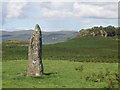
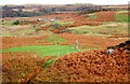
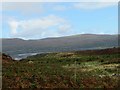
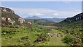
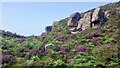
Nearby Images from Geograph Britain and Ireland:
©2010(licence)
©2006(licence)
©2018(licence)
©2021(licence)
©2021(licence)
The above images may not be of the site on this page, they are loaded from Geograph.
Please Submit an Image of this site or go out and take one for us!
Click here to see more info for this site
Nearby sites
Key: Red: member's photo, Blue: 3rd party photo, Yellow: other image, Green: no photo - please go there and take one, Grey: site destroyed
Download sites to:
KML (Google Earth)
GPX (GPS waypoints)
CSV (Garmin/Navman)
CSV (Excel)
To unlock full downloads you need to sign up as a Contributory Member. Otherwise downloads are limited to 50 sites.
Turn off the page maps and other distractions
Nearby sites listing. In the following links * = Image available
2.2km E 101° Meall Min Rock Art (NM447387)
2.3km W 260° Cragaig* Standing Stones (NM40283901)
4.0km SSE 158° Inch Kenneth Stone Standing Stone (Menhir) (NM4385835492)
4.1km N 7° Dun nan Gall* Broch or Nuraghe (NM43344331)
4.1km NNE 18° Dun Choinichean* Stone Fort or Dun (NM44094312)
5.7km W 275° Tigh An Duine Stone Fort or Dun (NM36944013)
6.9km NNW 330° Torr Damh* Cairn (NM39434544)
7.1km NNW 333° Tobar Ninian* Holy Well or Sacred Spring (NM3976545784)
7.1km NW 324° Dun Ban, Tostarie Stone Fort or Dun (NM38694524)
7.2km NNW 329° Tostarie* Standing Stone (Menhir) (NM3918145614)
7.7km NW 318° Dun Aisgain* Stone Fort or Dun (NM37744524)
7.9km ESE 113° Dishig* Standing Stone (Menhir) (NM49693574)
10.5km NE 44° Tenga (Mull)* Stone Circle (NM50394631)
10.6km ENE 74° Kellan Wood Stone Fort or Dun (NM52914163)
10.7km N 359° Torr A'chlachain, Mull* Hillfort (NM42945000)
10.9km N 5° Torr Aint* Hillfort (NM44265005)
11.5km ENE 75° Torr Nam Fiann* Stone Fort or Dun (NM53904157)
11.7km ENE 73° Killichronan* Standing Stone (Menhir) (NM540419)
11.7km E 84° Gruline 2* Standing Stone (Menhir) (NM543397)
11.8km NE 46° Ledmore Crannog (NM51514696)
11.8km N 1° Aintuim Cairn Round Cairn (NM43445103)
11.9km E 85° Gruline 1* Standing Stone (Menhir) (NM54553959)
12.0km E 86° Carn Ban (Mull)* Cairn (NM54653934)
12.3km NW 309° Dun Haunn Stone Fort or Dun (NM33434749)
12.3km NW 324° Creag A' Chaisteal Rock Art (NM35874957)
View more nearby sites and additional images


 We would like to know more about this location. Please feel free to add a brief description and any relevant information in your own language.
 Wir möchten mehr über diese Stätte erfahren. Bitte zögern Sie nicht, eine kurze Beschreibung und relevante Informationen in Deutsch hinzuzufügen.
 Nous aimerions en savoir encore un peu sur les lieux. S'il vous plaît n'hesitez pas à ajouter une courte description et tous les renseignements pertinents dans votre propre langue.
 Quisieramos informarnos un poco más de las lugares. No dude en añadir una breve descripción y otros datos relevantes en su propio idioma.