


<< Text Pages >> Shorelands - Broch or Nuraghe in Scotland in Caithness
Submitted by SolarMegalith on Tuesday, 15 November 2011 Page Views: 1926
Iron Age and Later PrehistorySite Name: ShorelandsCountry: Scotland
NOTE: This site is 1.3 km away from the location you searched for.
County: Caithness Type: Broch or Nuraghe
Nearest Town: Wick
Map Ref: ND36475425
Latitude: 58.471842N Longitude: 3.090858W
Condition:
| 5 | Perfect |
| 4 | Almost Perfect |
| 3 | Reasonable but with some damage |
| 2 | Ruined but still recognisable as an ancient site |
| 1 | Pretty much destroyed, possibly visible as crop marks |
| 0 | No data. |
| -1 | Completely destroyed |
| 5 | Superb |
| 4 | Good |
| 3 | Ordinary |
| 2 | Not Good |
| 1 | Awful |
| 0 | No data. |
| 5 | Can be driven to, probably with disabled access |
| 4 | Short walk on a footpath |
| 3 | Requiring a bit more of a walk |
| 2 | A long walk |
| 1 | In the middle of nowhere, a nightmare to find |
| 0 | No data. |
| 5 | co-ordinates taken by GPS or official recorded co-ordinates |
| 4 | co-ordinates scaled from a detailed map |
| 3 | co-ordinates scaled from a bad map |
| 2 | co-ordinates of the nearest village |
| 1 | co-ordinates of the nearest town |
| 0 | no data |
Internal Links:
External Links:
Broch in Caithness
Possible remains of a broch preserved as a low mound were visible in 1910, but the field survey in 1981 revealed that the mound has almost completely disappeared.
MacKie E.W. 2007. The Roundhouses, Brochs and Wheelhouses of Atlantic Scotland c. 700 BC – AD 500. Part 2 (I). Oxford: Archaeopress (p. 462).
You may be viewing yesterday's version of this page. To see the most up to date information please register for a free account.
Do not use the above information on other web sites or publications without permission of the contributor.
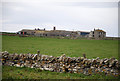
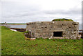
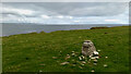
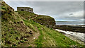
Nearby Images from Geograph Britain and Ireland:
©2011(licence)
©2011(licence)
©2021(licence)
©2021(licence)
©2022(licence)
The above images may not be of the site on this page, they are loaded from Geograph.
Please Submit an Image of this site or go out and take one for us!
Click here to see more info for this site
Nearby sites
Key: Red: member's photo, Blue: 3rd party photo, Yellow: other image, Green: no photo - please go there and take one, Grey: site destroyed
Download sites to:
KML (Google Earth)
GPX (GPS waypoints)
CSV (Garmin/Navman)
CSV (Excel)
To unlock full downloads you need to sign up as a Contributory Member. Otherwise downloads are limited to 50 sites.
Turn off the page maps and other distractions
Nearby sites listing. In the following links * = Image available
1.2km W 269° Ackergill Mains* Standing Stone (Menhir) (ND35285424)
2.8km SSW 212° Kettleburn Broch Broch or Nuraghe (ND34975191)
3.1km SSE 157° The Pap* Broch or Nuraghe (ND37625140)
3.1km SE 143° Papigoe Broch or Nuraghe (ND38285176)
3.2km SE 135° Cairn of Elsay* Broch or Nuraghe (ND38715198)
3.2km SW 218° Fairy Hillock (Milton) Cairn (ND34465173)
3.8km W 272° Norwall Broch* Broch or Nuraghe (ND32665445)
4.7km WNW 298° Skitten Broch or Nuraghe (ND32345655)
5.9km S 191° Cairn of Humster* Broch or Nuraghe (ND35294848)
6.6km WSW 254° Thuster Broch or Nuraghe (ND30045254)
6.9km N 349° Keiss Broch* Broch or Nuraghe (ND35316108)
7.0km N 350° Whitegate Broch* Broch or Nuraghe (ND35416120)
7.2km S 190° Hempriggs Broch* Broch or Nuraghe (ND35114717)
7.4km NNW 347° Kirk Tofts* Broch or Nuraghe (ND34886151)
7.4km S 181° Hempriggs Chambered Cairn* Chambered Cairn (ND36174680)
7.6km SSW 205° Cairnquoy* Broch or Nuraghe (ND33094743)
7.9km SSW 210° Tannach Mains* Broch or Nuraghe (ND32364748)
8.2km W 266° North Bilbster* Standing Stone (Menhir) (ND28295381)
8.8km SSW 196° Thrumster Little Broch* Broch or Nuraghe (ND33844583)
8.9km N 3° Nybster Broch* Broch or Nuraghe (ND37026314)
9.4km N 0° Caithness Broch Centre* Museum (ND367637)
9.4km N 1° Watenan Class I Pictish Symbol Stone (ND36806370)
9.7km SSW 199° Thrumster Mains* Broch or Nuraghe (ND3319545059)
9.9km SSW 195° Gansclet Standing Stone* Standing Stone (Menhir) (ND33824473)
10.0km WNW 292° Gearsay Cairn Broch or Nuraghe (ND27265819)
View more nearby sites and additional images


 We would like to know more about this location. Please feel free to add a brief description and any relevant information in your own language.
 Wir möchten mehr über diese Stätte erfahren. Bitte zögern Sie nicht, eine kurze Beschreibung und relevante Informationen in Deutsch hinzuzufügen.
 Nous aimerions en savoir encore un peu sur les lieux. S'il vous plaît n'hesitez pas à ajouter une courte description et tous les renseignements pertinents dans votre propre langue.
 Quisieramos informarnos un poco más de las lugares. No dude en añadir una breve descripción y otros datos relevantes en su propio idioma.