


<< Our Photo Pages >> Cashelbane - Wedge Tomb in Ireland (Northern) in Co. Derry
Submitted by Anonymous on Monday, 30 September 2002 Page Views: 6008
Neolithic and Bronze AgeSite Name: CashelbaneCountry: Ireland (Northern)
NOTE: This site is 2.3 km away from the location you searched for.
County: Co. Derry Type: Wedge Tomb
Map Ref: C5162001300
Discoverer Map Number: D7
Latitude: 54.856793N Longitude: 7.196994W
Condition:
| 5 | Perfect |
| 4 | Almost Perfect |
| 3 | Reasonable but with some damage |
| 2 | Ruined but still recognisable as an ancient site |
| 1 | Pretty much destroyed, possibly visible as crop marks |
| 0 | No data. |
| -1 | Completely destroyed |
| 5 | Superb |
| 4 | Good |
| 3 | Ordinary |
| 2 | Not Good |
| 1 | Awful |
| 0 | No data. |
| 5 | Can be driven to, probably with disabled access |
| 4 | Short walk on a footpath |
| 3 | Requiring a bit more of a walk |
| 2 | A long walk |
| 1 | In the middle of nowhere, a nightmare to find |
| 0 | No data. |
| 5 | co-ordinates taken by GPS or official recorded co-ordinates |
| 4 | co-ordinates scaled from a detailed map |
| 3 | co-ordinates scaled from a bad map |
| 2 | co-ordinates of the nearest village |
| 1 | co-ordinates of the nearest town |
| 0 | no data |
Internal Links:
External Links:
")
Have you visited this site? Please contribute a description or any thoughts by adding a comment.
You may be viewing yesterday's version of this page. To see the most up to date information please register for a free account.
")
")
Do not use the above information on other web sites or publications without permission of the contributor.
Nearby Images from Geograph Britain and Ireland:

©2007(licence)

©2014(licence)

©2014(licence)
©2007(licence)

©2014(licence)
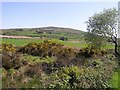
The above images may not be of the site on this page, they are loaded from Geograph.
Please Submit an Image of this site or go out and take one for us!
Click here to see more info for this site
Nearby sites
Click here to view sites on an interactive map of the areaKey: Red: member's photo, Blue: 3rd party photo, Yellow: other image, Green: no photo - please go there and take one, Grey: site destroyed
Download sites to:
KML (Google Earth)
GPX (GPS waypoints)
CSV (Garmin/Navman)
CSV (Excel)
To unlock full downloads you need to sign up as a Contributory Member. Otherwise downloads are limited to 50 sites.
Turn off the page maps and other distractions
Nearby sites listing. In the following links * = Image available
255m SSE 155° Altaghoney* Stone Circle (C5173001070)
3.2km W 262° Loughash Wedge Tomb* Wedge Tomb (C484008)
5.0km SSW 209° Doorat NW, E Stone Circle (H49249688)
5.1km SSW 208° Doorat NW, W Stone Circle (H4930096800)
5.1km SSW 205° Doorat SE Stone Row / Alignment (H495966)
5.8km E 83° Lear Standing Stone* Standing Stone (Menhir) (NV724640)
6.0km W 260° Lisnaragh Irish rath* Stone Fort or Dun (C45690023)
6.1km S 182° Mullaghcarbatagh cairn 2* Cairn (H51499519)
6.2km SW 235° Banagher* Stone Circle (H466977)
6.2km SSW 201° Clogherny standing stone* Standing Stone (Menhir) (H49459548)
6.5km S 179° Mullaghcarbatagh cairn 1* Cairn (H51809477)
6.5km S 180° Mullaghcarbatagh cairn 3* Cairn (H51739476)
6.9km NNE 15° Cregg (Claudy)* Standing Stone (Menhir) (C5331107965)
6.9km WSW 238° Meendamph B* Stone Circle (H458976)
6.9km SSW 201° Butterlope Northern Stone Circle* Stone Circle (H49209484)
6.9km SSW 201° Butterlope standing stone* Standing Stone (Menhir) (H49259481)
6.9km NNW 327° Lackagh* Stone Circle (C4778007050)
6.9km ENE 72° Loughtilube Stone Standing Stone (Menhir) (C5822003480)
7.0km SSW 200° Butterlope Southern Stone Circle Stone Circle (H493947)
7.0km SSW 200° Clogherny Butterlope W Stone Circle (H493947)
7.1km SW 233° Meendamph A Stone Circle (H460970)
7.3km SSW 203° Balix Lower* Court Tomb (H488946)
7.3km SSW 197° Glenga stone circle* Stone Circle (H49509430)
7.4km SSW 203° Clogherny Meenerrigal* Stone Circle (H488945)
7.6km E 85° Tireighter* Wedge Tomb (C592021)
View more nearby sites and additional images


 We would like to know more about this location. Please feel free to add a brief description and any relevant information in your own language.
 Wir möchten mehr über diese Stätte erfahren. Bitte zögern Sie nicht, eine kurze Beschreibung und relevante Informationen in Deutsch hinzuzufügen.
 Nous aimerions en savoir encore un peu sur les lieux. S'il vous plaît n'hesitez pas à ajouter une courte description et tous les renseignements pertinents dans votre propre langue.
 Quisieramos informarnos un poco más de las lugares. No dude en añadir una breve descripción y otros datos relevantes en su propio idioma.