


<< Text Pages >> Ko Kho Khao ancient settlement - Ancient Village or Settlement in Thailand
Submitted by KaiHofmann on Tuesday, 28 February 2017 Page Views: 1327
Multi-periodSite Name: Ko Kho Khao ancient settlement Alternative Name: Ban Thung Tuk Ancient CityCountry: Thailand
NOTE: This site is 7.466 km away from the location you searched for.
Type: Ancient Village or Settlement
Nearest Town: Takua Pa
Latitude: 8.894372N Longitude: 98.279957E
Condition:
| 5 | Perfect |
| 4 | Almost Perfect |
| 3 | Reasonable but with some damage |
| 2 | Ruined but still recognisable as an ancient site |
| 1 | Pretty much destroyed, possibly visible as crop marks |
| 0 | No data. |
| -1 | Completely destroyed |
| 5 | Superb |
| 4 | Good |
| 3 | Ordinary |
| 2 | Not Good |
| 1 | Awful |
| 0 | No data. |
| 5 | Can be driven to, probably with disabled access |
| 4 | Short walk on a footpath |
| 3 | Requiring a bit more of a walk |
| 2 | A long walk |
| 1 | In the middle of nowhere, a nightmare to find |
| 0 | No data. |
| 5 | co-ordinates taken by GPS or official recorded co-ordinates |
| 4 | co-ordinates scaled from a detailed map |
| 3 | co-ordinates scaled from a bad map |
| 2 | co-ordinates of the nearest village |
| 1 | co-ordinates of the nearest town |
| 0 | no data |
Internal Links:
External Links:
Ancient Village or Settlement in Thailand
An ancient Settlement (1st century CE) of the maritime silk route. Some indian inscriptions in tamil language and remains of buildings have been found in the early 20th century.
You may be viewing yesterday's version of this page. To see the most up to date information please register for a free account.
Do not use the above information on other web sites or publications without permission of the contributor.
Nearby Images from Flickr
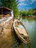
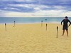
The above images may not be of the site on this page, but were taken nearby. They are loaded from Flickr so please click on them for image credits.
Click here to see more info for this site
Nearby sites
Click here to view sites on an interactive map of the areaKey: Red: member's photo, Blue: 3rd party photo, Yellow: other image, Green: no photo - please go there and take one, Grey: site destroyed
Download sites to:
KML (Google Earth)
GPX (GPS waypoints)
CSV (Garmin/Navman)
CSV (Excel)
To unlock full downloads you need to sign up as a Contributory Member. Otherwise downloads are limited to 50 sites.
Turn off the page maps and other distractions
Nearby sites listing. In the following links * = Image available
42.5km E 91° Wararam Cave* Cave or Rock Shelter
65.5km SSE 158° Khao Khian* Rock Art
68.1km SSE 160° Naga Cave* Rock Art
73.0km SE 142° Tham Phee Hua Toh Rock Art
102.0km S 175° Thalang Museum Museum
103.3km SE 140° Tham Lang Rongrien Cave or Rock Shelter
113.3km ENE 61° Wat Phra Borommathtat Ancient Temple
113.5km ENE 62° Chedi Wat Kaew Ancient Temple
113.7km ENE 61° Wat Long Ancient Temple
174.9km E 90° Khao Ka Shiva Temples* Ancient Temple
191.9km ESE 105° Nakhon Si Thammarat City Wall* Ancient Village or Settlement
193.0km ESE 106° Wat Phra Mahathat* Ancient Temple
193.7km ESE 106° Nakhon Si Thammarat National Museum* Museum
202.4km ENE 72° Grandma and Grandpa Rocks* Natural Stone / Erratic / Other Natural Feature
422.6km SE 146° Lembah Bujang Ancient Village or Settlement
462.5km SSE 148° Cherok Tokun Carving
502.7km NNE 21° Wat Kamphaeng Laeng* Ancient Temple
520.3km SE 145° Lenggong Archaeological Museum* Museum
571.6km SSE 146° Gua Tambun Rock Art
578.1km SE 138° Gua Cha Cave or Rock Shelter
581.0km NNE 19° Phra Pathommachedi* Ancient Temple
581.9km NNE 20° Phra Prathon Chedi* Ancient Temple
592.1km NNE 24° Bangkok National Museum* Museum
607.2km NNE 31° Khok Phanom Di* Ancient Village or Settlement
646.1km SE 132° Bewah Cave Cave or Rock Shelter
View more nearby sites and additional images

")
 We would like to know more about this location. Please feel free to add a brief description and any relevant information in your own language.
 Wir möchten mehr über diese Stätte erfahren. Bitte zögern Sie nicht, eine kurze Beschreibung und relevante Informationen in Deutsch hinzuzufügen.
 Nous aimerions en savoir encore un peu sur les lieux. S'il vous plaît n'hesitez pas à ajouter une courte description et tous les renseignements pertinents dans votre propre langue.
 Quisieramos informarnos un poco más de las lugares. No dude en añadir una breve descripción y otros datos relevantes en su propio idioma.