


<< Our Photo Pages >> Buckhagen Findling - Natural Stone / Erratic / Other Natural Feature in Germany in Schleswig-Holstein, Hamburg
Submitted by holger_rix on Wednesday, 08 December 2010 Page Views: 4198
Natural PlacesSite Name: Buckhagen FindlingCountry: Germany
NOTE: This site is 1.472 km away from the location you searched for.
Land: Schleswig-Holstein, Hamburg Type: Natural Stone / Erratic / Other Natural Feature
Nearest Town: Kappeln Nearest Village: Rabel
Latitude: 54.690309N Longitude: 9.963862E
Condition:
| 5 | Perfect |
| 4 | Almost Perfect |
| 3 | Reasonable but with some damage |
| 2 | Ruined but still recognisable as an ancient site |
| 1 | Pretty much destroyed, possibly visible as crop marks |
| 0 | No data. |
| -1 | Completely destroyed |
| 5 | Superb |
| 4 | Good |
| 3 | Ordinary |
| 2 | Not Good |
| 1 | Awful |
| 0 | No data. |
| 5 | Can be driven to, probably with disabled access |
| 4 | Short walk on a footpath |
| 3 | Requiring a bit more of a walk |
| 2 | A long walk |
| 1 | In the middle of nowhere, a nightmare to find |
| 0 | No data. |
| 5 | co-ordinates taken by GPS or official recorded co-ordinates |
| 4 | co-ordinates scaled from a detailed map |
| 3 | co-ordinates scaled from a bad map |
| 2 | co-ordinates of the nearest village |
| 1 | co-ordinates of the nearest town |
| 0 | no data |
Internal Links:
External Links:
")
Almost 3m high glacial erratic, set up on smaller supports on a field behind the Buckhagen Gut near Kappeln.
The block has been moved here in 1882.
You may be viewing yesterday's version of this page. To see the most up to date information please register for a free account.
")
")
")
")
Do not use the above information on other web sites or publications without permission of the contributor.
Nearby Images from Flickr
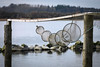
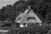
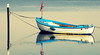
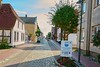
The above images may not be of the site on this page, but were taken nearby. They are loaded from Flickr so please click on them for image credits.
Click here to see more info for this site
Nearby sites
Click here to view sites on an interactive map of the areaKey: Red: member's photo, Blue: 3rd party photo, Yellow: other image, Green: no photo - please go there and take one, Grey: site destroyed
Download sites to:
KML (Google Earth)
GPX (GPS waypoints)
CSV (Garmin/Navman)
CSV (Excel)
To unlock full downloads you need to sign up as a Contributory Member. Otherwise downloads are limited to 50 sites.
Turn off the page maps and other distractions
Nearby sites listing. In the following links * = Image available
4.4km W 270° Drülter Holz* Barrow Cemetery
4.7km N 357° Kronsgaard Dolmen* Burial Chamber or Dolmen
4.9km SSE 150° Olpenitz Huenengrab* Long Barrow
6.9km NW 316° Lehbek Langbett* Long Barrow
7.8km W 265° Gulde Thing Platz [Guly Thing]* Museum
8.5km NW 315° Ohrfeld Riesenbett Long Barrow
9.0km N 351° Nieby Langbett* Long Barrow
9.3km SW 231° Ekenislund* Barrow Cemetery
10.4km W 265° Brarupholz* Barrow Cemetery
11.7km S 169° Damp Steinkreis [Rote Maas]* Stone Circle
12.0km S 170° Damp Huenenbett Long Barrow
12.9km WSW 245° Heilige Quelle Süderbrarup* Holy Well or Sacred Spring
13.6km WSW 247° Thorsberger Moor (Suederbrarup)* Ancient Village or Settlement
13.7km WSW 247° Suederbrarup Grabhuegel Kummerhy* Standing Stones
13.9km NW 312° Steinbergholz ~ Norgaardholz* Barrow Cemetery
13.9km SW 221° Hegeholz Grabhuegelfeld* Barrow Cemetery
14.1km SW 221° Ketelsby Langbett* Long Barrow
16.5km SW 216° Stubbe Langbett 1* Long Barrow
16.7km S 188° Holzdorf Dolmen* Burial Chamber or Dolmen
17.2km NW 309° Philipsthal Langbett* Long Barrow
17.3km S 183° Rotensande Langbett 4* Long Barrow
17.3km S 179° Klein Waabs Huenenbett 2 Long Barrow
17.3km SSW 213° Buestorf Steingrab 3 Long Barrow
17.4km S 179° Klein Waabs Huenenbett 1 Long Barrow
17.4km SSW 213° Buestorf Steingrab 2* Burial Chamber or Dolmen
View more nearby sites and additional images


 We would like to know more about this location. Please feel free to add a brief description and any relevant information in your own language.
 Wir möchten mehr über diese Stätte erfahren. Bitte zögern Sie nicht, eine kurze Beschreibung und relevante Informationen in Deutsch hinzuzufügen.
 Nous aimerions en savoir encore un peu sur les lieux. S'il vous plaît n'hesitez pas à ajouter une courte description et tous les renseignements pertinents dans votre propre langue.
 Quisieramos informarnos un poco más de las lugares. No dude en añadir una breve descripción y otros datos relevantes en su propio idioma.