

<< Text Pages >> Risholm Langdysse med Stenkiste - Long Barrow in Denmark in Nordjylland
Submitted by Fortidsminder on Sunday, 04 July 2010 Page Views: 2000
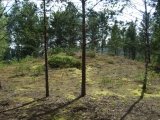
Neolithic and Bronze AgeSite Name: Risholm Langdysse med Stenkiste Alternative Name: Vester Mellerup, SkelhøjCountry: Denmark
NOTE: This site is 4.202 km away from the location you searched for.
County: Nordjylland Type: Long Barrow
Nearest Town: Brønderslev Nearest Village: Jerslev
Latitude: 57.305709N Longitude: 10.043621E
Condition:
| 5 | Perfect |
| 4 | Almost Perfect |
| 3 | Reasonable but with some damage |
| 2 | Ruined but still recognisable as an ancient site |
| 1 | Pretty much destroyed, possibly visible as crop marks |
| 0 | No data. |
| -1 | Completely destroyed |
| 5 | Superb |
| 4 | Good |
| 3 | Ordinary |
| 2 | Not Good |
| 1 | Awful |
| 0 | No data. |
| 5 | Can be driven to, probably with disabled access |
| 4 | Short walk on a footpath |
| 3 | Requiring a bit more of a walk |
| 2 | A long walk |
| 1 | In the middle of nowhere, a nightmare to find |
| 0 | No data. |
| 5 | co-ordinates taken by GPS or official recorded co-ordinates |
| 4 | co-ordinates scaled from a detailed map |
| 3 | co-ordinates scaled from a bad map |
| 2 | co-ordinates of the nearest village |
| 1 | co-ordinates of the nearest town |
| 0 | no data |
Be the first person to rate this site - see the 'Contribute!' box in the right hand menu.
Internal Links:
External Links:
Langdysse med Stenkiste (Oldtid) (Long Barrow with Stone Cist) in Hjørring
More information at www.kulturarv.dk: Danish Sites and Monuments Record: 100106-125
"Fortidsmindedata Copyright Kulturarvsstyrelsen"
You may be viewing yesterday's version of this page. To see the most up to date information please register for a free account.
Do not use the above information on other web sites or publications without permission of the contributor.
Click here to see more info for this site
Nearby sites
Click here to view sites on an interactive map of the areaKey: Red: member's photo, Blue: 3rd party photo, Yellow: other image, Green: no photo - please go there and take one, Grey: site destroyed
Download sites to:
KML (Google Earth)
GPX (GPS waypoints)
CSV (Garmin/Navman)
CSV (Excel)
To unlock full downloads you need to sign up as a Contributory Member. Otherwise downloads are limited to 50 sites.
Turn off the page maps and other distractions
Nearby sites listing. In the following links * = Image available
9.5km ESE 105° Pajhede Skov Rundhøj 4 Round Barrow(s)
9.7km ESE 104° Pajhede Skov Rundhøj 3* Round Barrow(s)
9.8km ESE 104° Pajhede Skov Runddysse* Burial Chamber or Dolmen
9.8km ESE 104° Pajhede Skov Rundhøj 2* Round Barrow(s)
10.2km NNE 28° Tårs Stenkiste Cist
10.5km ESE 102° Torstendal Langdysse Long Barrow
11.0km NNE 33° Tårs Sjørupgård Stenkiste Cist
11.0km E 95° Krogen Stenkiste Cist
11.7km W 270° Filholm Hellekiste Cist
12.2km SSE 149° Klokkerholm Stenkiste* Cist
13.5km E 91° Rampen Langdysse* Long Barrow
17.2km N 351° Hjørring Markedspladsen Stenkiste Cist
17.2km E 84° Ørslev Langdysse Long Barrow
17.4km SE 136° Dronninglund Lange Dejs Langdysse Long Barrow
17.5km ENE 69° Højstrup Vang Runddysse Burial Chamber or Dolmen
18.7km ENE 77° Hørby Langdysse Long Barrow
19.3km SE 143° Dronninglund Runddysse Burial Chamber or Dolmen
19.6km E 92° Stenbakken Jyndovn Runddysse Burial Chamber or Dolmen
20.3km ENE 72° Hørbylund Langdysse Long Barrow
20.6km S 183° Vodskov Stenhøj Langdysse Long Barrow
20.9km NE 44° Tislum Langdysse Long Barrow
21.0km S 185° Vodskov Hammer Langdysse Long Barrow
21.1km NE 43° Højen Langdysse* Long Barrow
21.2km ENE 58° Eget Runddysse Burial Chamber or Dolmen
21.3km S 186° Vodskov Kikkenborg Langdysse Long Barrow
View more nearby sites and additional images


 We would like to know more about this location. Please feel free to add a brief description and any relevant information in your own language.
 Wir möchten mehr über diese Stätte erfahren. Bitte zögern Sie nicht, eine kurze Beschreibung und relevante Informationen in Deutsch hinzuzufügen.
 Nous aimerions en savoir encore un peu sur les lieux. S'il vous plaît n'hesitez pas à ajouter une courte description et tous les renseignements pertinents dans votre propre langue.
 Quisieramos informarnos un poco más de las lugares. No dude en añadir una breve descripción y otros datos relevantes en su propio idioma.