


<< Text Pages >> Erbach Grabhügelgruppe - Barrow Cemetery in Germany in Baden-Wuerttemberg
Submitted by AlexHunger on Tuesday, 13 September 2005 Page Views: 2387
Neolithic and Bronze AgeSite Name: Erbach GrabhügelgruppeCountry: Germany
NOTE: This site is 12.153 km away from the location you searched for.
Land: Baden-Wuerttemberg Type: Barrow Cemetery
Nearest Town: Ulm Nearest Village: Erbach
Latitude: 48.338010N Longitude: 9.862300E
Condition:
| 5 | Perfect |
| 4 | Almost Perfect |
| 3 | Reasonable but with some damage |
| 2 | Ruined but still recognisable as an ancient site |
| 1 | Pretty much destroyed, possibly visible as crop marks |
| 0 | No data. |
| -1 | Completely destroyed |
| 5 | Superb |
| 4 | Good |
| 3 | Ordinary |
| 2 | Not Good |
| 1 | Awful |
| 0 | No data. |
| 5 | Can be driven to, probably with disabled access |
| 4 | Short walk on a footpath |
| 3 | Requiring a bit more of a walk |
| 2 | A long walk |
| 1 | In the middle of nowhere, a nightmare to find |
| 0 | No data. |
| 5 | co-ordinates taken by GPS or official recorded co-ordinates |
| 4 | co-ordinates scaled from a detailed map |
| 3 | co-ordinates scaled from a bad map |
| 2 | co-ordinates of the nearest village |
| 1 | co-ordinates of the nearest town |
| 0 | no data |
Be the first person to rate this site - see the 'Contribute!' box in the right hand menu.
Internal Links:
External Links:
Tumuli in Baden-Württemberg
IMPORTANT NOTE: Site believed to be near this position. Group of heavily eroded and undated tumuli
You may be viewing yesterday's version of this page. To see the most up to date information please register for a free account.
Do not use the above information on other web sites or publications without permission of the contributor.
Nearby Images from Flickr
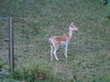
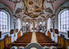


The above images may not be of the site on this page, but were taken nearby. They are loaded from Flickr so please click on them for image credits.
Click here to see more info for this site
Nearby sites
Click here to view sites on an interactive map of the areaKey: Red: member's photo, Blue: 3rd party photo, Yellow: other image, Green: no photo - please go there and take one, Grey: site destroyed
Download sites to:
KML (Google Earth)
GPX (GPS waypoints)
CSV (Garmin/Navman)
CSV (Excel)
To unlock full downloads you need to sign up as a Contributory Member. Otherwise downloads are limited to 50 sites.
Turn off the page maps and other distractions
Nearby sites listing. In the following links * = Image available
131m W 278° Erbach Viereckschanze Ancient Village or Settlement
8.6km NNW 347° Schanzhau Wald Keltische Viereckschanze Ancient Village or Settlement
8.8km NNW 346° Schanzhau Wald Grabhügelgruppe Artificial Mound
8.9km NNW 327° Grosse Grotte Cave or Rock Shelter
9.1km WNW 300° Hohlefels Höhle* Cave or Rock Shelter
9.2km NNE 29° Ehrenstein Ancient Village or Settlement
9.4km NW 315° Geissenklösterle Höhle* Cave or Rock Shelter
9.5km NW 306° Sirgenstein Höhle Cave or Rock Shelter
9.8km NW 320° Brillenhöhle* Cave or Rock Shelter
16.9km NW 309° Sontheimer Höhle Cave or Rock Shelter
23.0km SW 221° Grundsheim Grabhügelgruppe Barrow Cemetery
23.3km WSW 249° Bärenhöhle Cave or Rock Shelter
24.4km NE 35° Fohlenhaus-Höhlen Cave or Rock Shelter
25.6km NW 324° Westerheim Keltische Viereckschanze Ancient Village or Settlement
26.0km NE 47° Museum für Vor-und Frühgeschichte des Lonetales Museum
26.1km WSW 240° Langhau Wald Grabhügelgruppe Barrow Cemetery
26.2km WSW 239° Langhau Wald Keltische Viereckschanze Ancient Village or Settlement
27.6km W 259° Alt-Hayingen Hillfort
27.6km NW 308° Zainingen Grabhügelfeld Barrow Cemetery
29.3km SW 214° Ödenahlen Ancient Village or Settlement
30.0km SW 230° Bussen Vorgeschichtliche Höhensiedlung Hillfort
30.9km SW 214° Grundwiesen Ancient Village or Settlement
31.3km SSW 200° Mittelbiberach Keltische Viereckschanze Ancient Village or Settlement
31.6km NNE 28° Hungerbrunnen* Holy Well or Sacred Spring
32.3km NE 42° Bocksteinhöhle* Cave or Rock Shelter
View more nearby sites and additional images


 We would like to know more about this location. Please feel free to add a brief description and any relevant information in your own language.
 Wir möchten mehr über diese Stätte erfahren. Bitte zögern Sie nicht, eine kurze Beschreibung und relevante Informationen in Deutsch hinzuzufügen.
 Nous aimerions en savoir encore un peu sur les lieux. S'il vous plaît n'hesitez pas à ajouter une courte description et tous les renseignements pertinents dans votre propre langue.
 Quisieramos informarnos un poco más de las lugares. No dude en añadir una breve descripción y otros datos relevantes en su propio idioma.