

<< Text Pages >> Beusterburg Ringwall - Causewayed Enclosure in Germany in Lower Saxony, Bremen
Submitted by SolarMegalith on Wednesday, 04 April 2012 Page Views: 2061
Neolithic and Bronze AgeSite Name: Beusterburg RingwallCountry: Germany
NOTE: This site is 9.388 km away from the location you searched for.
Land: Lower Saxony, Bremen Type: Causewayed Enclosure
Nearest Town: Hildesheim Nearest Village: Betheln
Latitude: 52.133699N Longitude: 9.832048E
Condition:
| 5 | Perfect |
| 4 | Almost Perfect |
| 3 | Reasonable but with some damage |
| 2 | Ruined but still recognisable as an ancient site |
| 1 | Pretty much destroyed, possibly visible as crop marks |
| 0 | No data. |
| -1 | Completely destroyed |
| 5 | Superb |
| 4 | Good |
| 3 | Ordinary |
| 2 | Not Good |
| 1 | Awful |
| 0 | No data. |
| 5 | Can be driven to, probably with disabled access |
| 4 | Short walk on a footpath |
| 3 | Requiring a bit more of a walk |
| 2 | A long walk |
| 1 | In the middle of nowhere, a nightmare to find |
| 0 | No data. |
| 5 | co-ordinates taken by GPS or official recorded co-ordinates |
| 4 | co-ordinates scaled from a detailed map |
| 3 | co-ordinates scaled from a bad map |
| 2 | co-ordinates of the nearest village |
| 1 | co-ordinates of the nearest town |
| 0 | no data |
Internal Links:
External Links:
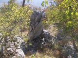
Causewayed Enclosure in Lower Saxony
A Neolithic ringwork in Eddinghausener Wald. The excavations revealed the pottery connected with Michelsberg culture (4400-3500 BC).
Location Map.
You may be viewing yesterday's version of this page. To see the most up to date information please register for a free account.
Do not use the above information on other web sites or publications without permission of the contributor.
Nearby Images from Flickr
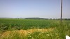

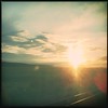
The above images may not be of the site on this page, but were taken nearby. They are loaded from Flickr so please click on them for image credits.
Click here to see more info for this site
Nearby sites
Click here to view sites on an interactive map of the areaKey: Red: member's photo, Blue: 3rd party photo, Yellow: other image, Green: no photo - please go there and take one, Grey: site destroyed
Download sites to:
KML (Google Earth)
GPX (GPS waypoints)
CSV (Garmin/Navman)
CSV (Excel)
To unlock full downloads you need to sign up as a Contributory Member. Otherwise downloads are limited to 50 sites.
Turn off the page maps and other distractions
Nearby sites listing. In the following links * = Image available
1.7km W 265° Grabhügelfeld Osterholz Barrow Cemetery
2.3km E 87° Sorsum Galeriegrab Rock Cut Tomb
7.4km NE 38° Giesener Forst Grabhügelfeld Barrow Cemetery
7.8km ENE 77° Roemer-und Pelizaeus-Museum Hildesheim* Museum
12.6km ENE 76° Glockenstein* Standing Stone (Menhir)
20.0km NW 315° Rästepahl Early Christian Sculptured Stone
22.3km SSE 160° Apenteichquellen* Holy Well or Sacred Spring
23.8km SSW 210° Kelchstein Natural Stone / Erratic / Other Natural Feature
23.9km SSW 209° Rothesteinhoehle Cave or Rock Shelter
24.0km SSW 208° Nasensteinhöhle Cave or Rock Shelter
24.1km SSW 208° Kinderhöhle Cave or Rock Shelter
24.6km NW 319° Gehrden, Suerser Berg* Stone Circle
26.0km N 355° Heiligers Brunnen* Holy Well or Sacred Spring
26.0km N 355° Kopperloch* Holy Well or Sacred Spring
26.2km NW 320° Ringwall Gehrdener Burgberg* Hillfort
26.5km NNW 346° Anderlingen Steinkistengrab (Hannover)* Chambered Tomb
26.5km NNW 346° Niedersächsischen Landesmuseums Hannover* Museum
26.8km ENE 61° Adenstedter Lah Hügelgräber* Barrow Cemetery
27.6km NNW 332° Grabhügelfeld Benther Berg Barrow Cemetery
27.6km NNW 333° Early Metalworking at the Benther Berg Ancient Mine, Quarry or other Industry
28.4km N 3° Urnengräberfeld Misburg* Barrow Cemetery
28.5km ESE 113° Hubertuskapelle* Cave or Rock Shelter
28.7km N 351° Das Rad* Turf Maze
29.1km NE 56° Bueltener Holz Huegelgrabfeld* Barrow Cemetery
30.4km WNW 301° Teufelskanzel Steinblock Natural Stone / Erratic / Other Natural Feature
View more nearby sites and additional images


 We would like to know more about this location. Please feel free to add a brief description and any relevant information in your own language.
 Wir möchten mehr über diese Stätte erfahren. Bitte zögern Sie nicht, eine kurze Beschreibung und relevante Informationen in Deutsch hinzuzufügen.
 Nous aimerions en savoir encore un peu sur les lieux. S'il vous plaît n'hesitez pas à ajouter une courte description et tous les renseignements pertinents dans votre propre langue.
 Quisieramos informarnos un poco más de las lugares. No dude en añadir una breve descripción y otros datos relevantes en su propio idioma.