


<< Our Photo Pages >> Geissenklösterle Höhle - Cave or Rock Shelter in Germany in Baden-Wuerttemberg
Submitted by AlexHunger on Tuesday, 05 June 2012 Page Views: 5872
Natural PlacesSite Name: Geissenklösterle HöhleCountry: Germany Land: Baden-Wuerttemberg Type: Cave or Rock Shelter
Nearest Town: Ulm Nearest Village: Blaubeuren
Latitude: 48.398410N Longitude: 9.772530E
Condition:
| 5 | Perfect |
| 4 | Almost Perfect |
| 3 | Reasonable but with some damage |
| 2 | Ruined but still recognisable as an ancient site |
| 1 | Pretty much destroyed, possibly visible as crop marks |
| 0 | No data. |
| -1 | Completely destroyed |
| 5 | Superb |
| 4 | Good |
| 3 | Ordinary |
| 2 | Not Good |
| 1 | Awful |
| 0 | No data. |
| 5 | Can be driven to, probably with disabled access |
| 4 | Short walk on a footpath |
| 3 | Requiring a bit more of a walk |
| 2 | A long walk |
| 1 | In the middle of nowhere, a nightmare to find |
| 0 | No data. |
| 5 | co-ordinates taken by GPS or official recorded co-ordinates |
| 4 | co-ordinates scaled from a detailed map |
| 3 | co-ordinates scaled from a bad map |
| 2 | co-ordinates of the nearest village |
| 1 | co-ordinates of the nearest town |
| 0 | no data |
Internal Links:
External Links:
I have visited· I would like to visit
Andy B has visited here
")
One of a number of caves where early modern humans in the Aurignacian, between 43,000 and 30,000 years ago left traces of early artwork, including the Vogelherd, Brillenhöhle, Große Grotte, Hohle Fels and Hohlenstein-Stadel caves.
IMPORTANT NOTE: Site believed to be near this position.
Note: Earliest music instruments, from ~42,000BC found in Germany
You may be viewing yesterday's version of this page. To see the most up to date information please register for a free account.
")
")
Do not use the above information on other web sites or publications without permission of the contributor.
Nearby Images from Flickr
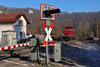
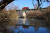

The above images may not be of the site on this page, but were taken nearby. They are loaded from Flickr so please click on them for image credits.
Click here to see more info for this site
Nearby sites
Click here to view sites on an interactive map of the areaKey: Red: member's photo, Blue: 3rd party photo, Yellow: other image, Green: no photo - please go there and take one, Grey: site destroyed
Download sites to:
KML (Google Earth)
GPX (GPS waypoints)
CSV (Garmin/Navman)
CSV (Excel)
To unlock full downloads you need to sign up as a Contributory Member. Otherwise downloads are limited to 50 sites.
Turn off the page maps and other distractions
Nearby sites listing. In the following links * = Image available
874m NNE 26° Brillenhöhle* Cave or Rock Shelter
1.6km SW 223° Sirgenstein Höhle Cave or Rock Shelter
1.9km ENE 69° Grosse Grotte Cave or Rock Shelter
2.5km SSW 210° Hohlefels Höhle* Cave or Rock Shelter
4.8km ENE 68° Schanzhau Wald Grabhügelgruppe Artificial Mound
5.0km ENE 71° Schanzhau Wald Keltische Viereckschanze Ancient Village or Settlement
7.6km WNW 301° Sontheimer Höhle Cave or Rock Shelter
9.3km SE 136° Erbach Viereckschanze Ancient Village or Settlement
9.4km SE 135° Erbach Grabhügelgruppe Barrow Cemetery
11.2km E 83° Ehrenstein Ancient Village or Settlement
16.3km NNW 328° Westerheim Keltische Viereckschanze Ancient Village or Settlement
18.3km NW 304° Zainingen Grabhügelfeld Barrow Cemetery
21.4km SW 225° Bärenhöhle Cave or Rock Shelter
23.7km WSW 239° Alt-Hayingen Hillfort
24.5km ENE 57° Fohlenhaus-Höhlen Cave or Rock Shelter
25.5km SW 219° Langhau Wald Grabhügelgruppe Barrow Cemetery
25.5km SSW 199° Grundsheim Grabhügelgruppe Barrow Cemetery
25.6km SW 218° Langhau Wald Keltische Viereckschanze Ancient Village or Settlement
26.8km WNW 301° Grabenstetten Museum Museum
27.9km ENE 67° Museum für Vor-und Frühgeschichte des Lonetales Museum
28.9km WNW 301° Heidengraben Keltisches Oppidum Ancient Village or Settlement
29.9km W 268° Sternberg Grabhügelgruppe Barrow Cemetery
30.1km NE 45° Hungerbrunnen* Holy Well or Sacred Spring
30.4km WNW 301° Gräberfeld am Burrenhof* Barrow Cemetery
30.7km NW 306° Rekonstruiertes keltisches Zangentor am Heidengraben* Ancient Village or Settlement
View more nearby sites and additional images


 We would like to know more about this location. Please feel free to add a brief description and any relevant information in your own language.
 Wir möchten mehr über diese Stätte erfahren. Bitte zögern Sie nicht, eine kurze Beschreibung und relevante Informationen in Deutsch hinzuzufügen.
 Nous aimerions en savoir encore un peu sur les lieux. S'il vous plaît n'hesitez pas à ajouter une courte description et tous les renseignements pertinents dans votre propre langue.
 Quisieramos informarnos un poco más de las lugares. No dude en añadir una breve descripción y otros datos relevantes en su propio idioma.