 with our Megalithic Portal iPhone app")
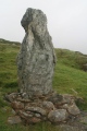

<< Text Pages >> Årø Runddysse 1 - Burial Chamber or Dolmen in Denmark in Syddanmark
Submitted by Fortidsminder on Saturday, 19 June 2010 Page Views: 1528
Neolithic and Bronze AgeSite Name: Årø Runddysse 1 Alternative Name: AarøCountry: Denmark
NOTE: This site is 2.007 km away from the location you searched for.
County: Syddanmark Type: Burial Chamber or Dolmen
Nearest Town: Haderslev Nearest Village: Øsby
Latitude: 55.267861N Longitude: 9.754593E
Condition:
| 5 | Perfect |
| 4 | Almost Perfect |
| 3 | Reasonable but with some damage |
| 2 | Ruined but still recognisable as an ancient site |
| 1 | Pretty much destroyed, possibly visible as crop marks |
| 0 | No data. |
| -1 | Completely destroyed |
| 5 | Superb |
| 4 | Good |
| 3 | Ordinary |
| 2 | Not Good |
| 1 | Awful |
| 0 | No data. |
| 5 | Can be driven to, probably with disabled access |
| 4 | Short walk on a footpath |
| 3 | Requiring a bit more of a walk |
| 2 | A long walk |
| 1 | In the middle of nowhere, a nightmare to find |
| 0 | No data. |
| 5 | co-ordinates taken by GPS or official recorded co-ordinates |
| 4 | co-ordinates scaled from a detailed map |
| 3 | co-ordinates scaled from a bad map |
| 2 | co-ordinates of the nearest village |
| 1 | co-ordinates of the nearest town |
| 0 | no data |
Be the first person to rate this site - see the 'Contribute!' box in the right hand menu.
Internal Links:
External Links:
Megalitgrav (Burial Chamber) in Haderslev
More information at www.kulturarv.dk: Danish Sites and Monuments Record: 200311-174
"Fortidsmindedata Copyright Kulturarvsstyrelsen"
You may be viewing yesterday's version of this page. To see the most up to date information please register for a free account.
Do not use the above information on other web sites or publications without permission of the contributor.
Nearby Images from Flickr


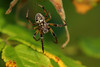
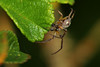
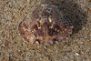
The above images may not be of the site on this page, but were taken nearby. They are loaded from Flickr so please click on them for image credits.
Click here to see more info for this site
Nearby sites
Click here to view sites on an interactive map of the areaKey: Red: member's photo, Blue: 3rd party photo, Yellow: other image, Green: no photo - please go there and take one, Grey: site destroyed
Download sites to:
KML (Google Earth)
GPX (GPS waypoints)
CSV (Garmin/Navman)
CSV (Excel)
To unlock full downloads you need to sign up as a Contributory Member. Otherwise downloads are limited to 50 sites.
Turn off the page maps and other distractions
Nearby sites listing. In the following links * = Image available
98m N 4° Årø Runddysse* Burial Chamber or Dolmen
3.9km W 267° Øsby Anhøj Jættestue* Passage Grave
4.2km SW 219° Øsby Tonneshøj Jættestue* Passage Grave
5.1km NE 46° Bågø Langdysse 1 Long Barrow
5.2km NE 46° Bågø Langdysse 2 Long Barrow
5.8km SW 229° Øsby Flovt Dyssekammer 2* Burial Chamber or Dolmen
6.4km WSW 247° Øsby Flovt Dyssekammer 1* Burial Chamber or Dolmen
10.0km NNW 342° Brandsø Svenskehøj Langdysse Long Barrow
10.0km NNW 340° Brandsø Runddysse* Burial Chamber or Dolmen
10.6km NW 317° Anslet Hage Langdysse Long Barrow
12.4km ESE 110° Sønderby Bjerge Dyssekammer* Burial Chamber or Dolmen
12.6km NE 53° Orelund Skov Runddysse Burial Chamber or Dolmen
14.3km W 261° Starup Runesten* Carving
14.8km ESE 111° Teglskov Runddysse Burial Chamber or Dolmen
15.1km E 86° Gamtofte Tokkehøj Runddysse* Burial Chamber or Dolmen
15.9km ESE 112° Flenstofte Vielandshøj Langdysse* Long Barrow
16.3km W 265° Museum Sønderjylland Archaeology* Museum
16.8km NE 39° Håre Bjerge Stenkiste Cist
17.4km ESE 107° Dreslette Langdysse* Long Barrow
18.5km E 98° Voldtofte Lusehøj* Round Barrow(s)
18.7km ESE 113° Snave Dyssekammer* Burial Chamber or Dolmen
19.1km NNW 327° Grønninghoved Tvillingedyssen* Long Barrow
19.1km NNW 327° Grønninghoved Runddysse 1* Burial Chamber or Dolmen
19.1km N 6° Sparretorn Skov Jættestue Passage Grave
19.2km NNW 327° Grønninghoved Runddysse 2 Burial Chamber or Dolmen
View more nearby sites and additional images


 We would like to know more about this location. Please feel free to add a brief description and any relevant information in your own language.
 Wir möchten mehr über diese Stätte erfahren. Bitte zögern Sie nicht, eine kurze Beschreibung und relevante Informationen in Deutsch hinzuzufügen.
 Nous aimerions en savoir encore un peu sur les lieux. S'il vous plaît n'hesitez pas à ajouter une courte description et tous les renseignements pertinents dans votre propre langue.
 Quisieramos informarnos un poco más de las lugares. No dude en añadir una breve descripción y otros datos relevantes en su propio idioma.